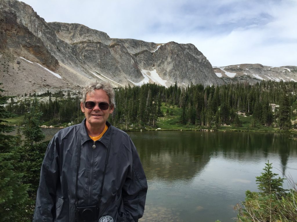
After leaving Pam and John’s house, we realized that it was time to head home. We were a bit tired of being on the road, and we knew that we wanted to visit our kids, my brother and Chuck’s parents before Thanksgiving. An additional incentive was provided by our fridge, which had twice defrosted itself and seemed unable to get really cold (although the freezer compartment has worked perfectly throughout). We decided to see any interesting sights en route, but basically try to be home within the week.
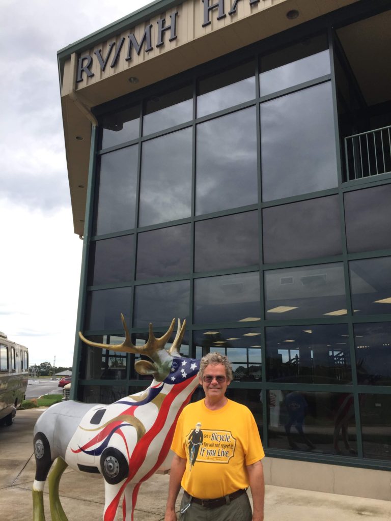
Chuck discovered that our route took us through Elkhart IN, home of the RV and Motor Home Hall of Fame and Museum (RV/MH) Elkhart is known as the RV Manufacturing Capital of the World, as most US RV manufacturers (although not Winnebago) with 80% of RV production are located in or near the city. We got to Elkhart after the museum closed for the day, but since they allow overnight RV parking, we stayed in the lot. The RV parked next to us was a 1974 model that was identical to one we saw in the museum the next day, but we did not meet the owner.
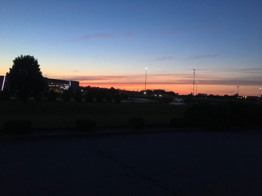
We did not see too many colorful sunsets on this trip, but
the sunset in Elkhart was pretty.
As a place to camp, the parking lot was better than some places we have
been. And the next morning we
toured RV/MH.
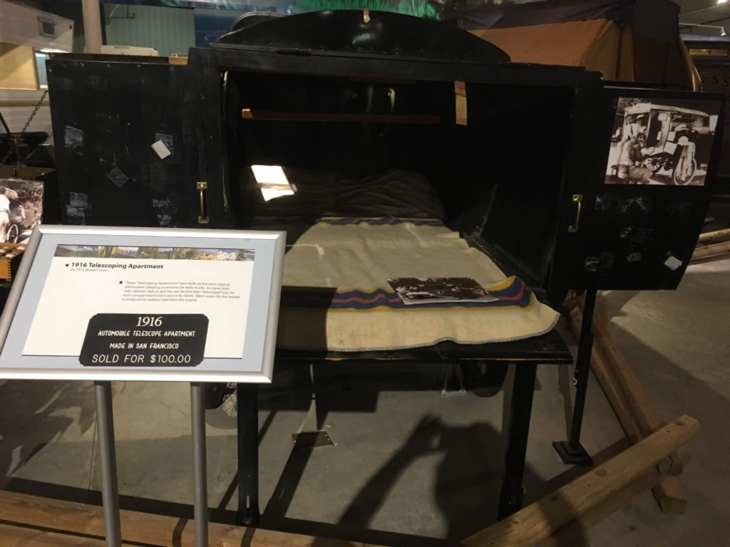
As I mentioned in my Laramie posting, the idea of living in one’s vehicle is pretty old. The Romani (Gypsy) caravan, sheep wagon and private train compartment all had the essential elements: beds, storage and cooking space along with a mode of locomotion. According to RV/MH manufacturing got underway in Elkhart in 1931 when a local businessman Milo Miller constructed a travel trailer so that he could easily take his family with him on business trips.
On his first trip, he was asked to sell that one, and also construct another. Miller started a business constructing travel trailers. Two years later, an entrepreneur, Wilbur Schult saw Miller’s trailers at the Chicago Exposition and purchased the company. The industry expanded from there. Now Elkhart is home not only to RV manufacturers, but also companies that supply RV parts and appliances.
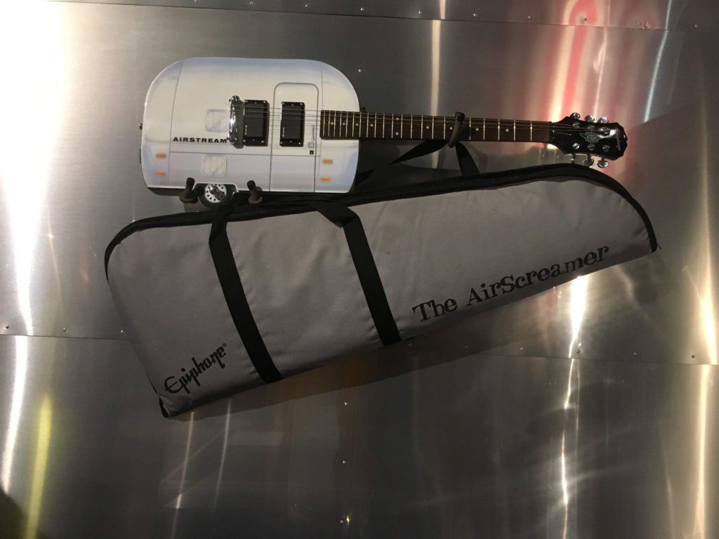
According to Wikipedia, Elkhart is also the Band Instrument Manufacturing Capital of the World. Not bad for a town most of us have never heard of! The Airscreamer Guitar (above) is not exactly a band instrument, but it is an amusing artifact.
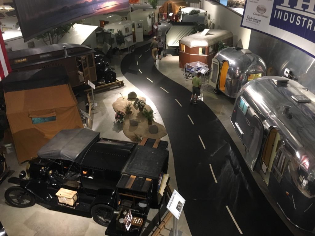
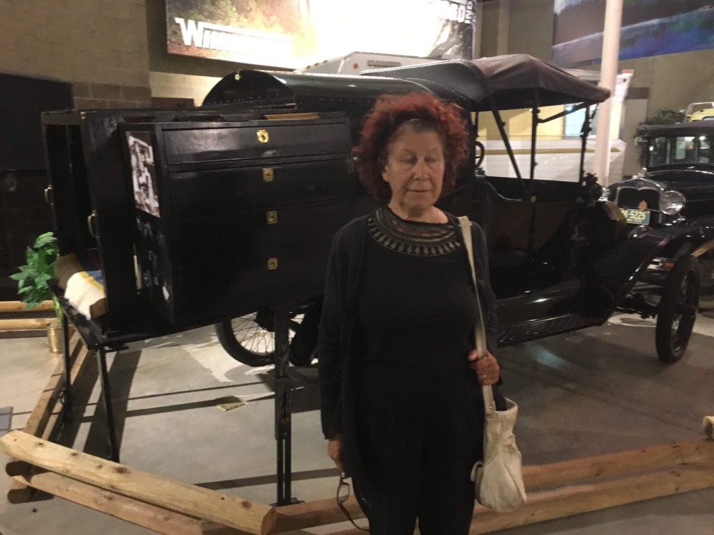
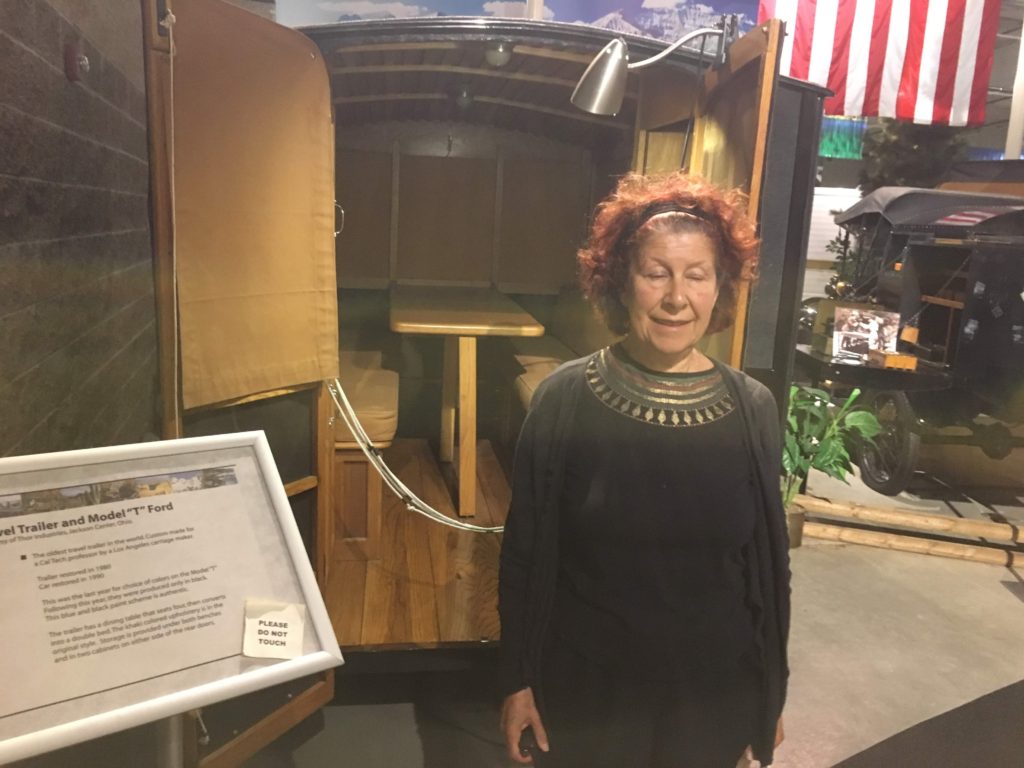
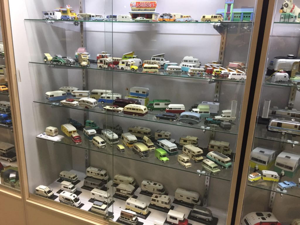
If you are interested in RVs, the RV/MH is pretty cool. There are Model T’s converted to travel vans (bed, storage and outside cooking), the first pop-up tents, early motor homes and early pull trailers including some early Airstreams (the iconic aluminum RVs). And of course there are a couple of display cases of toy RVs.
After the museum, we noted another Travato in the parking lot, but the owners did not seem to be around. However, we must have set out around the same time because we ran into them at our lunch stop. They are frequent posters to the Facebook group, and we got some tips about how to winterize.
Driving along I80 was not fun. Because of the short time between our purchasing the T and leaving on our trip, we did not receive our EZPass which came in the mail after we left home. On this stretch of I80, there are tolls every hundred miles or so, with pull-out lanes if you are paying cash or credit card. Most of these are automatic, although some are manned. We kept getting into automatic lanes for which the mechanism did not work. You cannot back up once you are within a certain distance of the booth, so if the mechanism does not work, you have to hit the call button. Some of these tolls took us 10 – 15 minutes to get through.
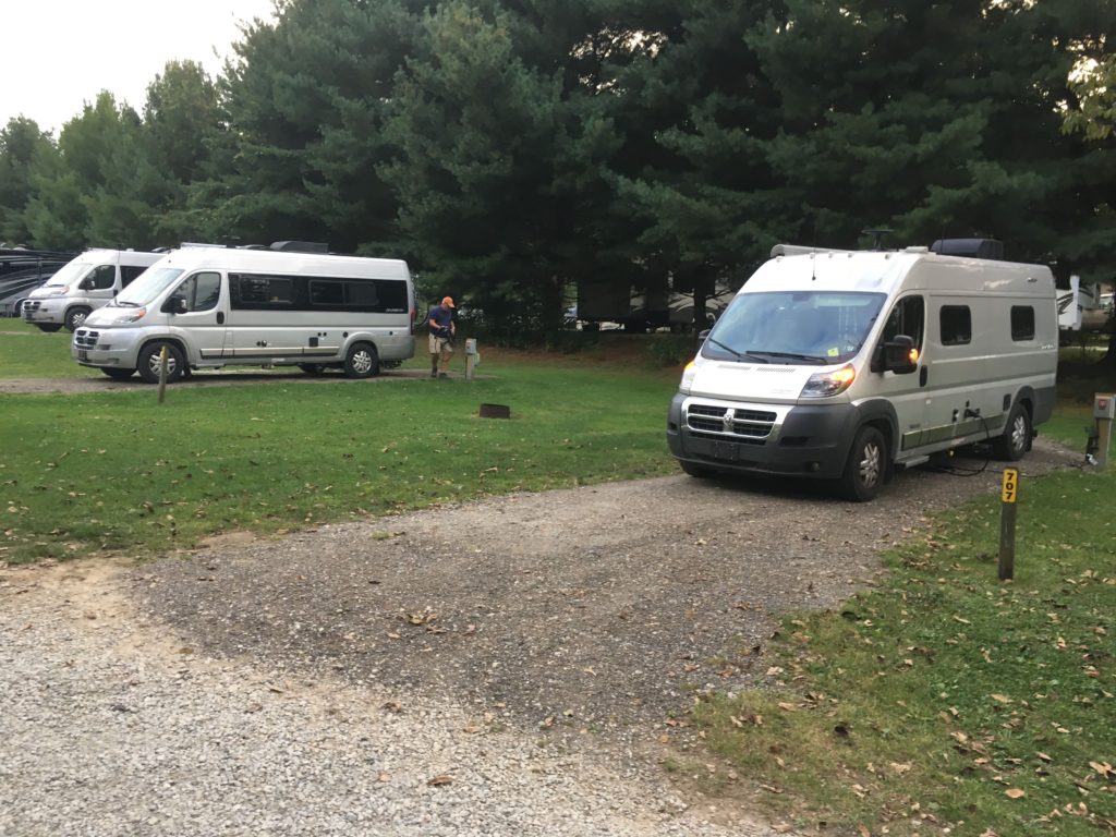
Our last night on the road was spent at the KOA in Streetsboro, OH. We came in after the campground office closed, so we picked out one of the empty campsites from their “night registration” box. Imagine our surprise to find that we were camped next to 2 other Travatos. (We are the van on the right.) And imagine our further surprise to find that on our last night out, we were to meet up again with the first Travato couple we had met on the trip in our first Colorado stop at Blackhawk.
Dan and Judy remembered us because they had told us that
they planned to go to Hershey for the annual Hershey RV show, and we had
invited them to visit us in State College. They were now heading home from the show.
We never did ask what they do (or did) for a living, but Dan
seemed to know a lot of the design staff at Winnebago. They seem to be frequent attendees at
Winnebago and Travato meetups.
They were at the Grand National Meeting in Forest City in July and then
went to Hershey. Dan knows a lot
about the designs and why they are done that way (mostly monetary), and what
changes are planned. It was quite
fun to see them and we spent a lot of time talking.
And then, on Monday Sept. 16, after supper, we arrived home. Everything in the house was as we left it. We unpacked the essentials from the van and marvelled at the amount of room in the house. We also marvelled at the heaps of stuff we were going to have to put away — things that we unpacked from the Vista, things that we thought we were going to use for the Travato but decided were unnecessary, and of course everything in the Travato.
And that is the end of the trip for this year. Who knows when and where the next adventure will be.
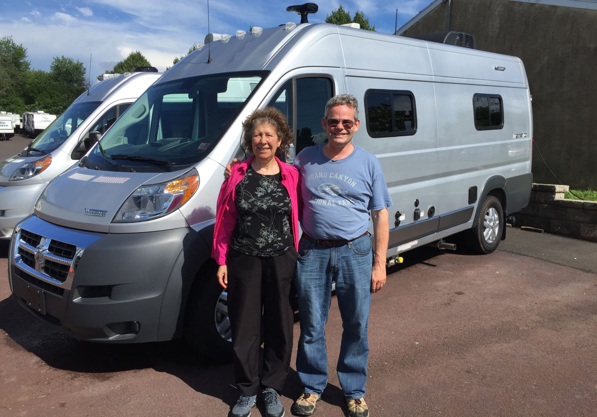
We spent the night in Milton KOA and then headed east to Mukwonago WI for a special treat. Through 23andMe, we have been in touch with Chuck’s father’s half-cousins, a branch of the family we had never met. Pam and her husband John invited us to spend a night at their house and meet other members of that side of the family.
We set up camp (hooked up electric) in Pam and John’s driveway and had lunch with them. We then relaxed in their house (so much room!) for a couple of hours while they attended to some necessary chores. The house is quite unique. It was built by an engineer who had a lot of innovative ideas — although many of the innovative features have since stopped working. However, Pam and John are gearing up to sell their house and current RV and become full-timers in a large 5th wheel RV with a new truck.
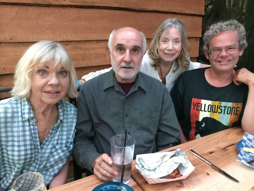
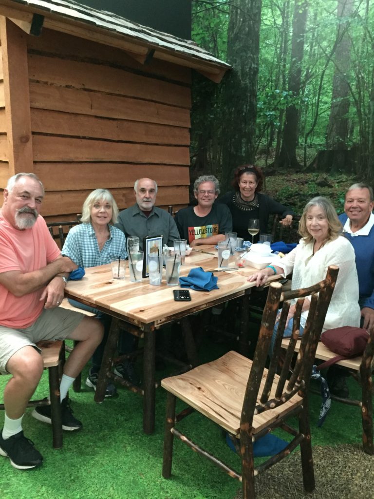
L to R: Pam, Jim, Christine and Chuck
In the afternoon, the family began to show up: Pam’s sister Christine and her husband Ron and their cousin Jim. The rest of the afternoon was spent trying to fill in the gaps in the family history. Apparently one of their aunts had been working on a geneology, so there was some additional information that could be added to the anecdotal stories. This blog is not the place to get into all this.
The entire group
John is also into gadgets and he and Chuck spent some time flying his small drone and looking at drone videos he made of the surrounding areas. His drone is much smaller and more portable than Chuck’s drone but the videos are just as spectacular. Of course they will take it when they start their RV adventure.
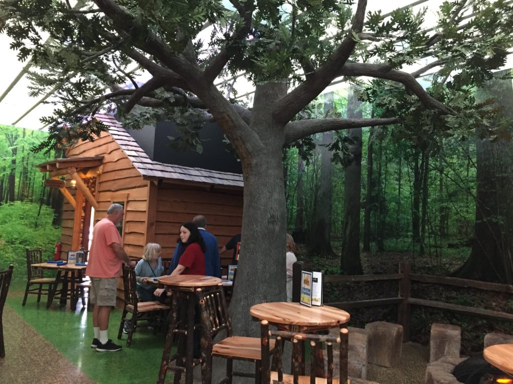
Inside the “Outside Inn”
For dinner we went to the “Outside Inn” a sort-of Rainforest Cafe for the Wisconsin woodlands. The interior is decorated to look like a forest. Diners can sit at a picnic table or around a gas fire on concrete “stumps”. The food is camping food well-seasoned with bacon. In fact, trays of crispy bacon are placed on the table similar to tortilla chips in Mexican restaurants. We tried some Wisconsin delicacies, like deep-fried cheese curds and fish fry with potato pancakes. Unfortunately we did not have room for S’mores for dessert.
In the morning, Pam and John made a delicious breakfast casserole. They had a lot of social activities in the afternoon, so we headed out shortly after breakfast.
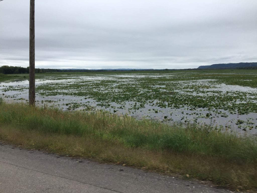
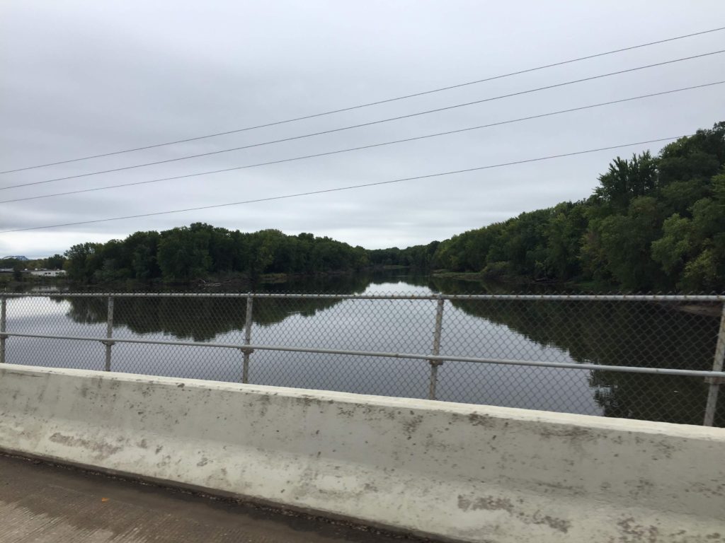
On Sept. 11 we crossed the Mississippi River at La Crosse
and arrived back in the east AKA Wisconsin. The Mississippi here has a lot of wide swampy parts beside
the main channel.
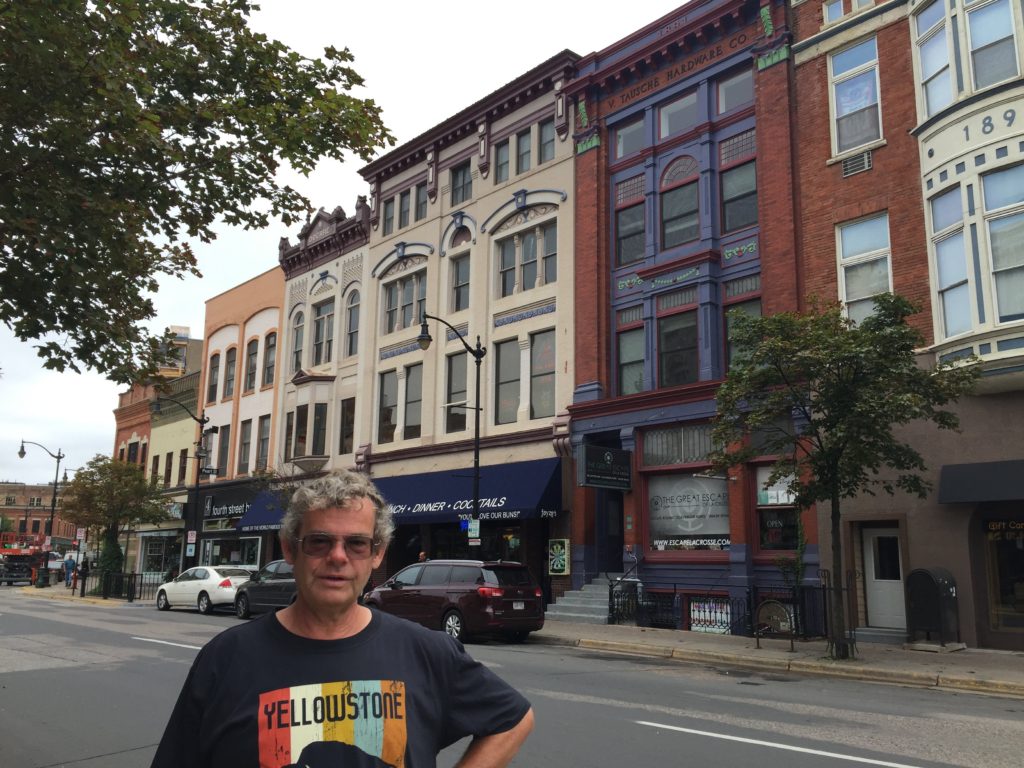
We spent some time exploring downtown La Crosse. The older buildings have great paint
jobs, highlighting the decorative elements. We found a cozy restaurant for lunch.
We then continued on to Token Creek County Park, just
outside Madison to spend the night.
The park was swarming with monarch butterflies.
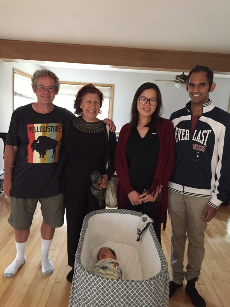
The next day we met friends Garvesh and Trisha for lunch. Lots of recent changes in their lives: new baby, new house and tenure for Garvesh. It is all very exciting and we were glad to catch up with Garvesh after a 2-year hiatus and meet Trisha.
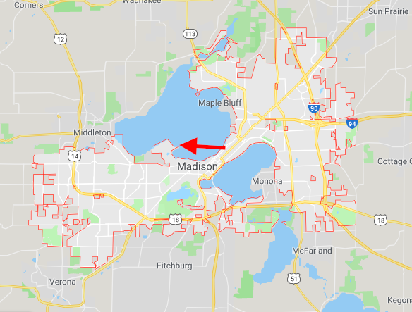
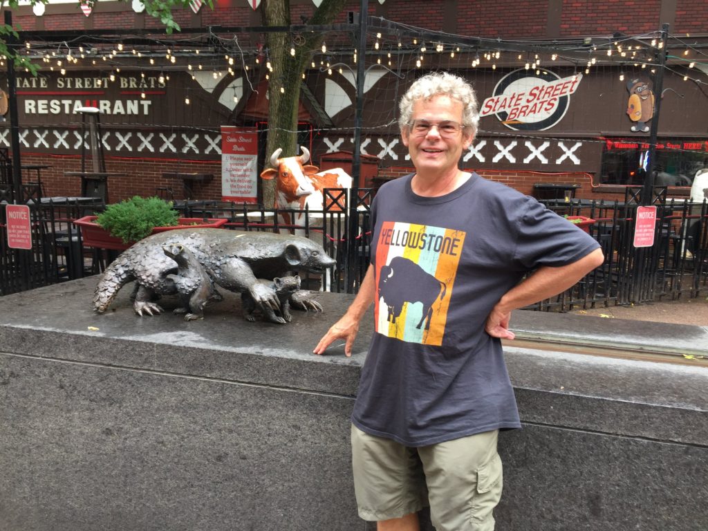
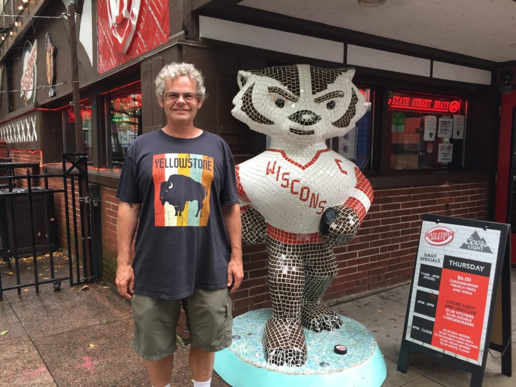
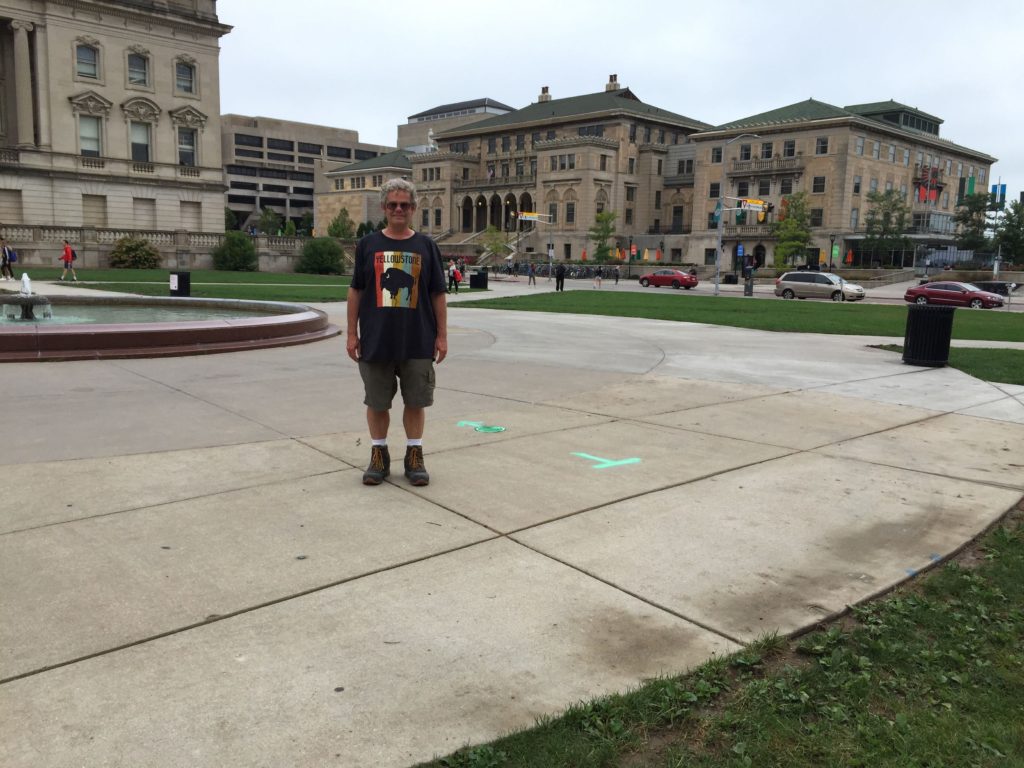
After lunch we meandered around downtown Madison and then went to the U. Wisconsin campus.
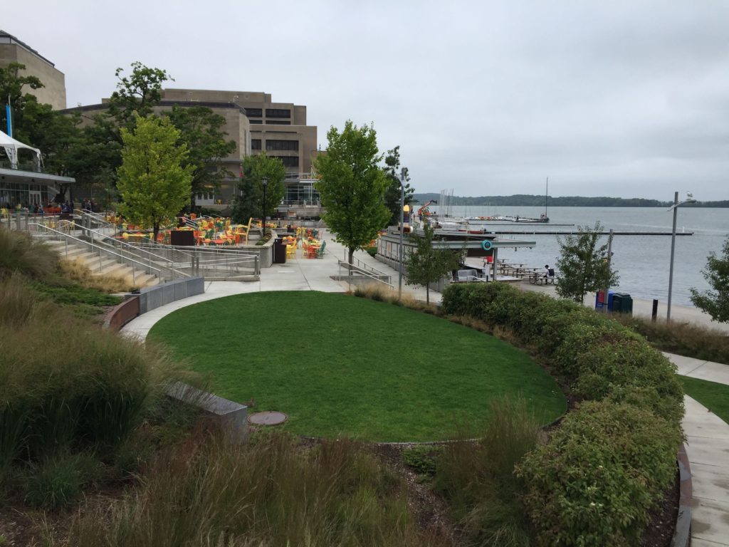
Downtown Madison is squeezed between 2 lakes. The campus borders Lake Mendota and the student center, which has a deck over the lake, rents kayaks and sailboats. It is at the tail of the arrow on the map.
Madison is not exactly a university town, since it is also
the state capitol. But near the
campus, it resembles other university towns – lots of pubs and restaurants and
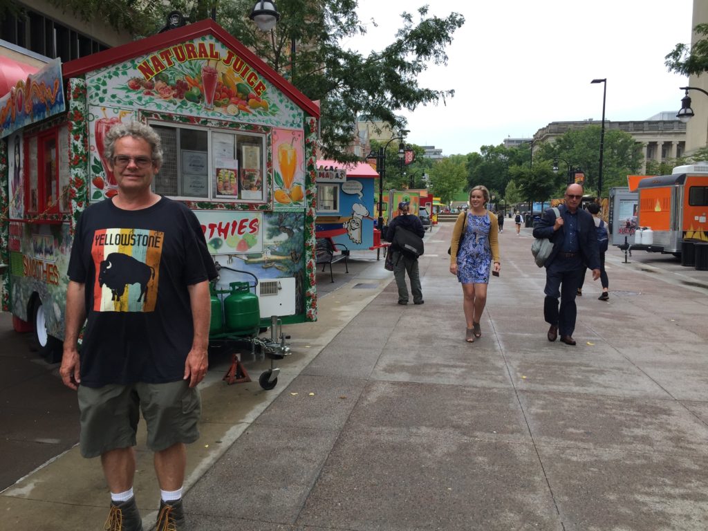
lots of references to the university mascot. As you enter campus there seems to be a permanent “food
truck rodeo” which is a great idea that adds diversity to the culinary
offerings of the campus.
view of HUB and lake
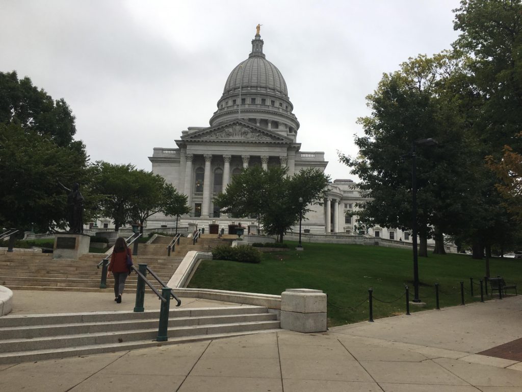
There is a lovely hiking trail that goes through the campus and along the lake. We planned to hike from the student center to Picnic Point (the head of the arrow). However, it is a much longer walk than it looks on the map. We were still quite far from the point when we decided to head back into town and see the State Capitol.
What can I say: nice building; lovely grounds. it seems like the same architect designed every state capitol.
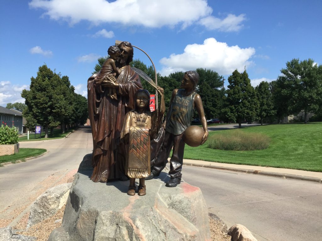
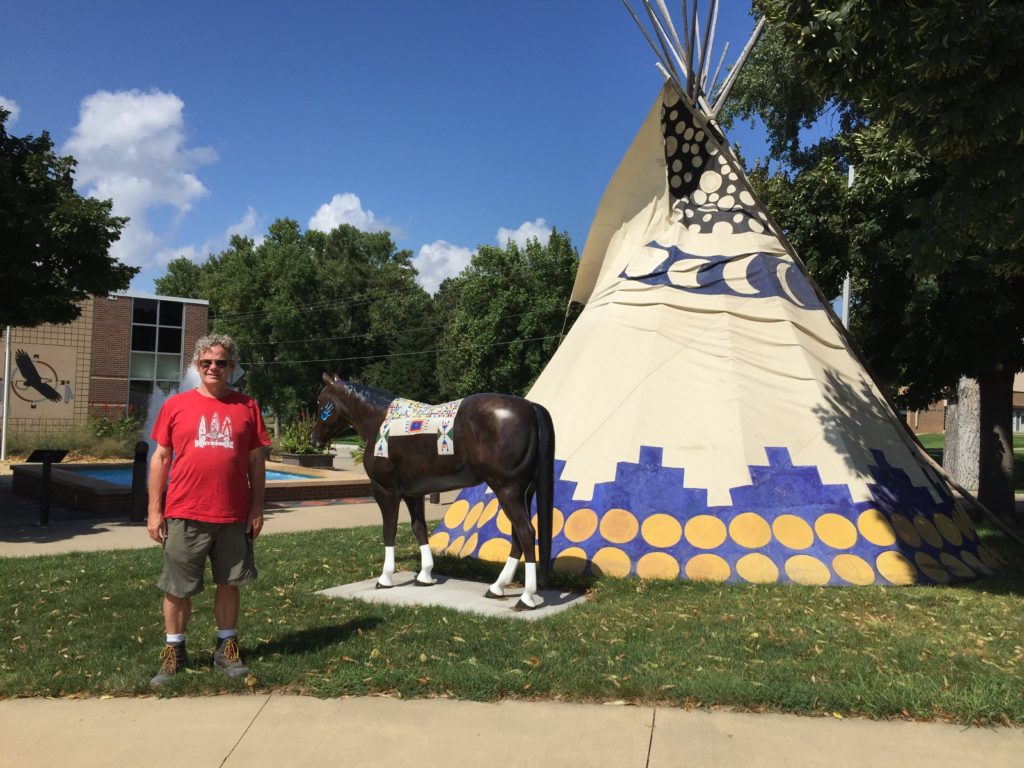
We left Kadoka with no particular sightseeing plans. However, we were attracted by a billboard advertising the Akta Lakota Museum run by St. Joseph’s Indian school in Chamberlain. They had a nice display of quilled, painted and beaded artifacts, and some information about traditional Sioux attitudes towards child-rearing.
Museum entrance
There was also a display of the history of treaties in the area — too depressing really. There was also a section about the history of St. Joseph’s, from the point of view of the folks running it, along with some (not very deep) discussion of the roles of the school in suppressing Lakota culture (up to 1950) and then helping preserve it (after 1950).
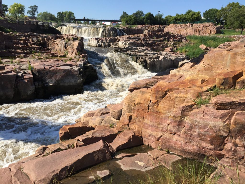
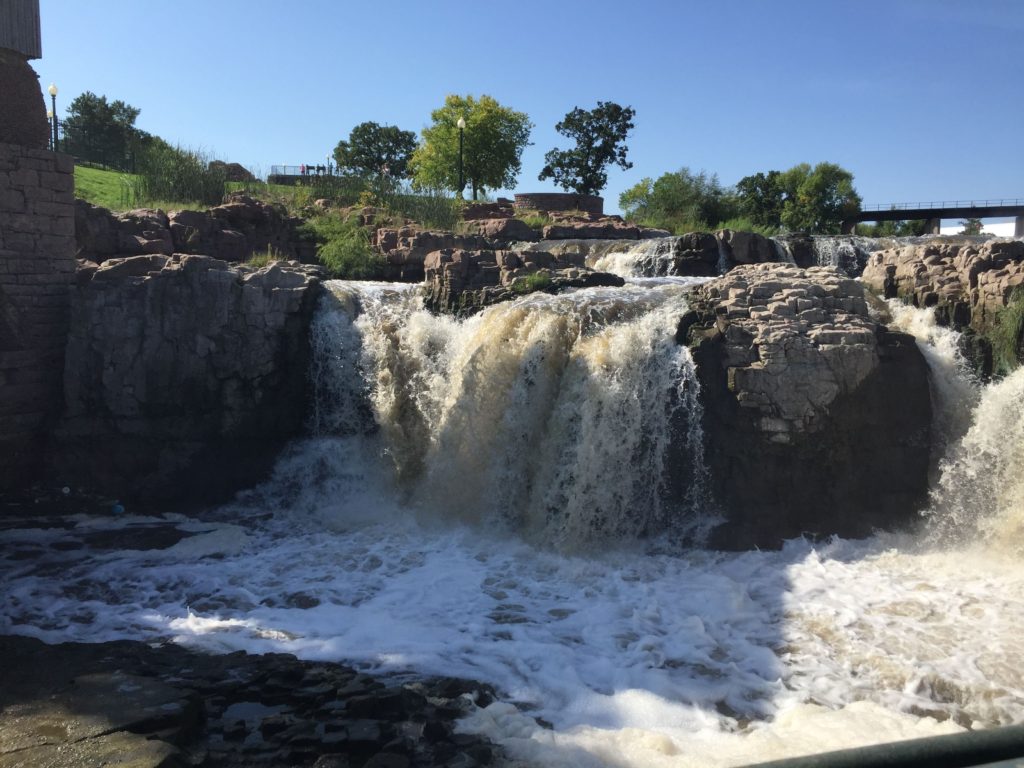
We spent the night at a state recreation area just outside of Sioux Falls, and then went to see the eponymous falls. This is a very pretty set of 2 waterfalls flowing over bright red quartzite. There were 3 falls, but the lower falls were quarried to use the quartzite as building stone (and there are a lot of red quartzite buildings and walls on the site).
The flow of water is impressive — it was a very wet year. However, apparently there was not enough water in a typical year to power the grain milling operation and hydro-electric generator that were build to take advantage of the river. The grain mill went out of business in only 2 years.
Fortunately we left Sioux Falls for Rochester MN before
lunch. Overnight, a serious
tornado struck the city, destroying several buildings, taking out the power and
closing roads until debris could be removed. Although the campground was not directly affected, the road
to the campground crosses the center of the area that was hit.
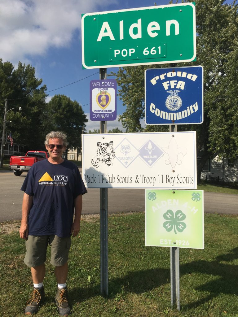
As a child, Chuck’s father lived for 6 months in the small
town of Alden MN. Since it was on
our route, we decided to stop for a snack. Alden has 3 restaurants (which we thought was a lot for a
town this size). Two of them were lunch places and close at 3 p.m. One is a
dinner place and opens at 5. We
got there at 4. No snack for
us. Perhaps that explains our next
stop.
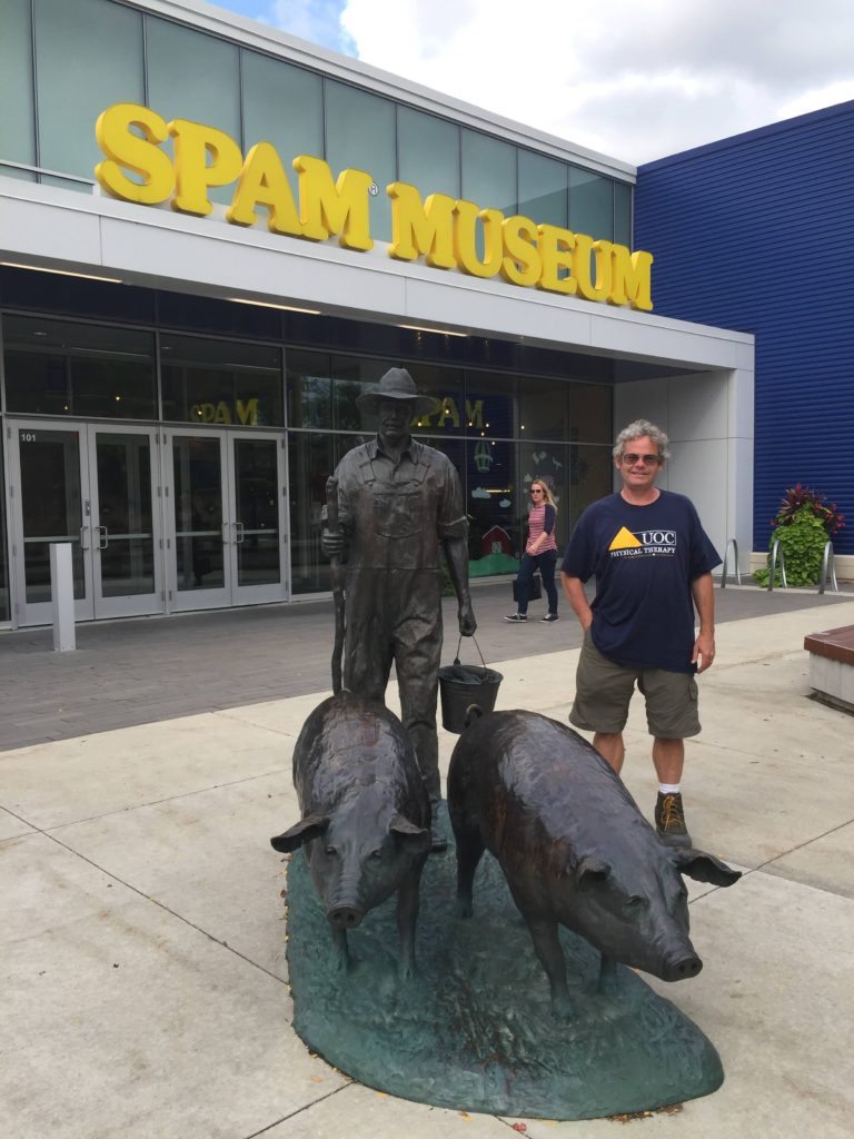
Going by Austin MN, we saw the advertisement for the Spam
Museum (the food). I never tasted
Spam growing up, as it certainly is not kosher. But I do remember eating it in college. In any case, I could not resist.
Spam came into its own during WWII, where it was part of the
rations of the US troops. It is
now extremely popular wherever the troops were stationed, and is a staple in some places, such as
Hawaii. The museum did not offer
free samples, but it did give a history of the Hormel Food Corporation,
information about how Spam is manufactured, a history of the role of Spam in
WWII and a look at Spam internationally.
We spent the night of Sept. 10 just outside Rochester, the
home of the Mayo Clinic.
Overnight, the same storm system that hit Sioux Falls passed over us,
although neither the winds nor the rain were as heavy as predicted. We did not get much sleep, but
otherwise there were no problems.
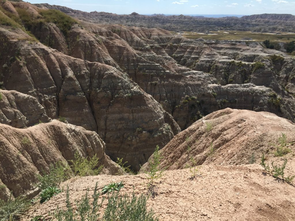
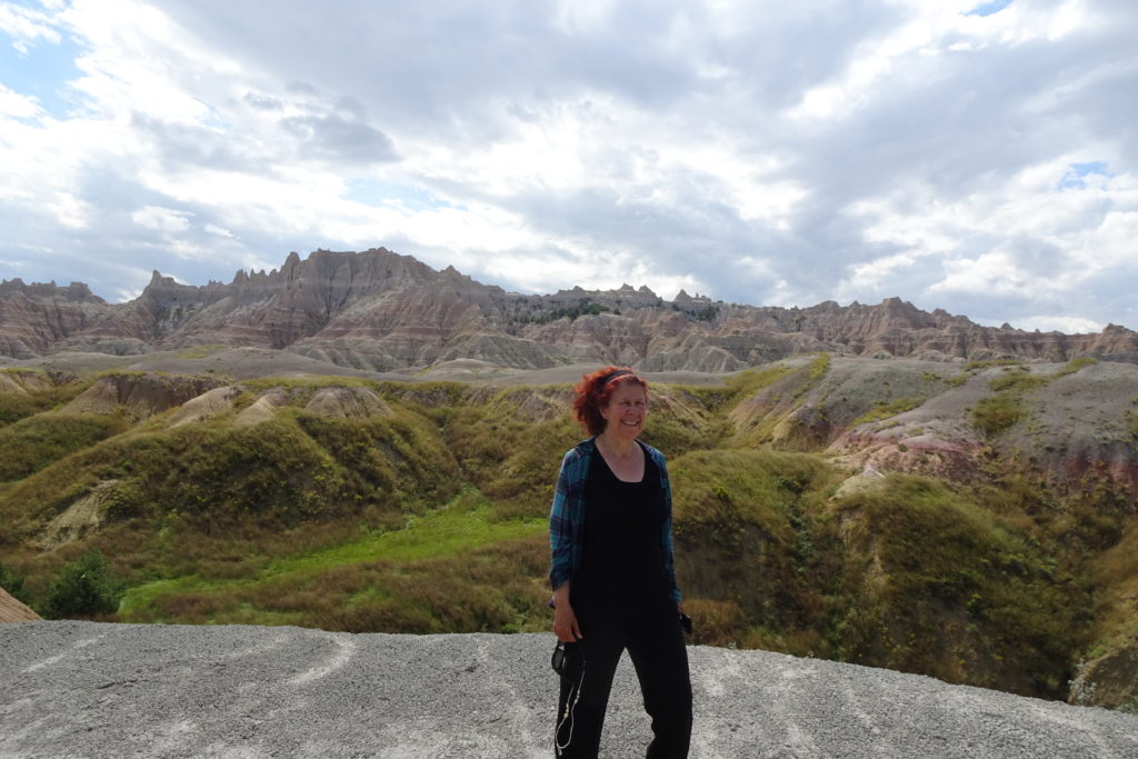
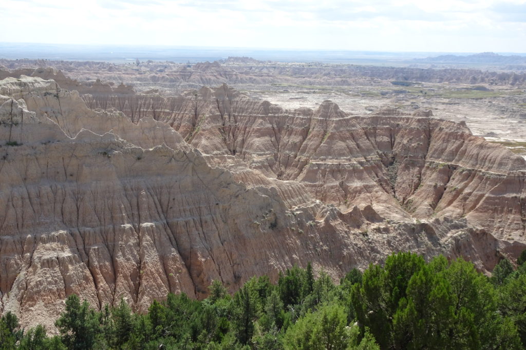
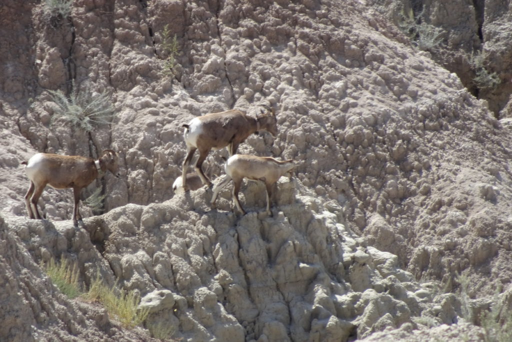
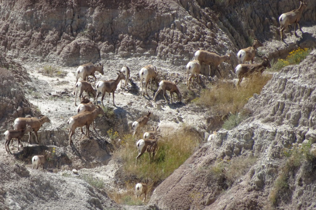
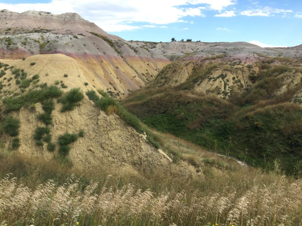
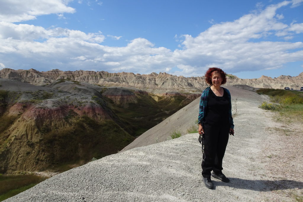
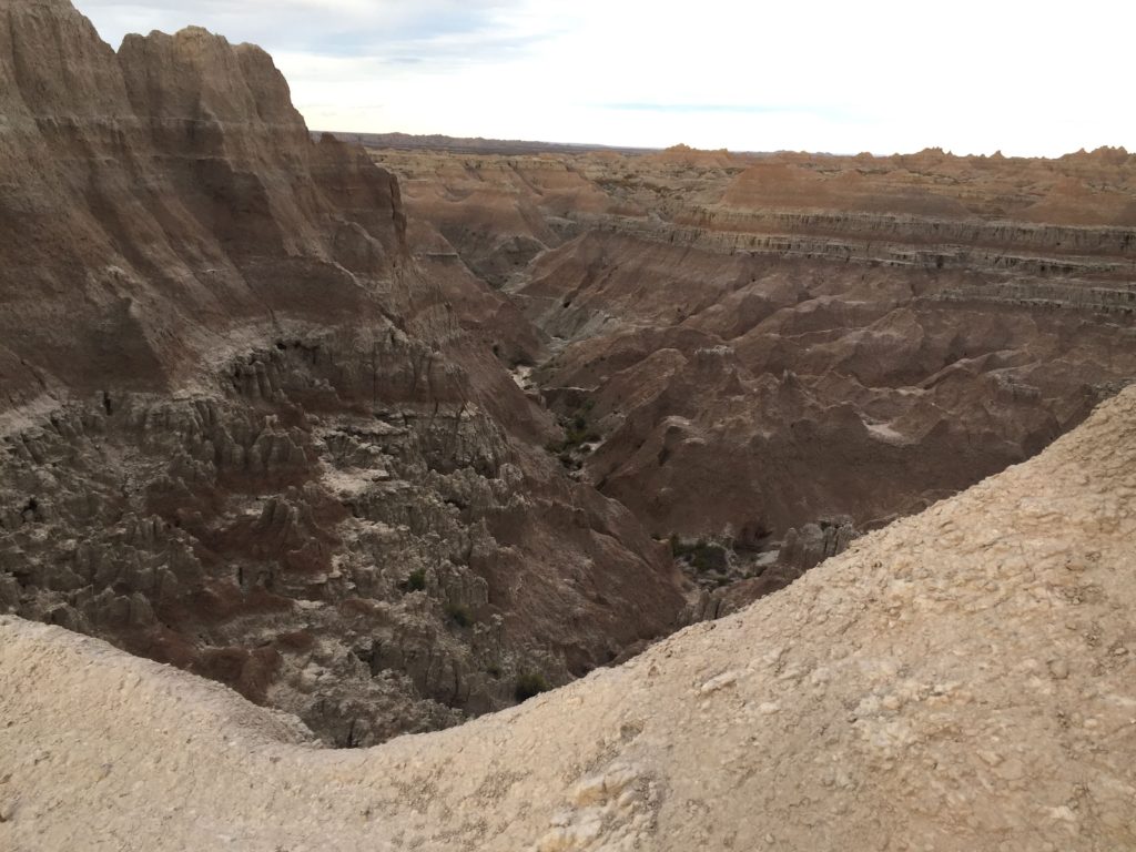
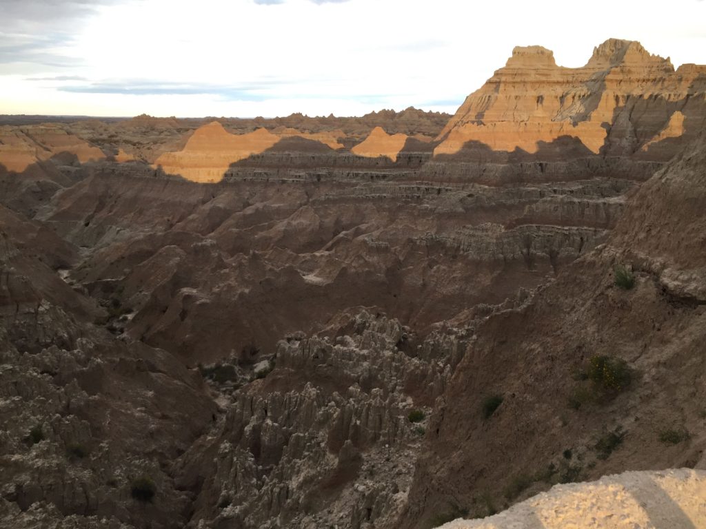
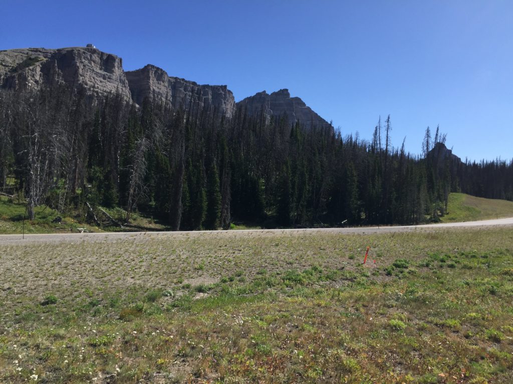
Taking Rte 44 straight (very straight) out of Rapid City you very quickly get to the “Badlands Loop” road. This is a gravel road, in pretty good condition, but corrugated in spots. However, after a tantalizing glimpse of eroded hills, it goes for at least 26 miles through flat prairie. It is not until the last 5 miles or so before it meets the paved road (240) that things begin to get interesting.
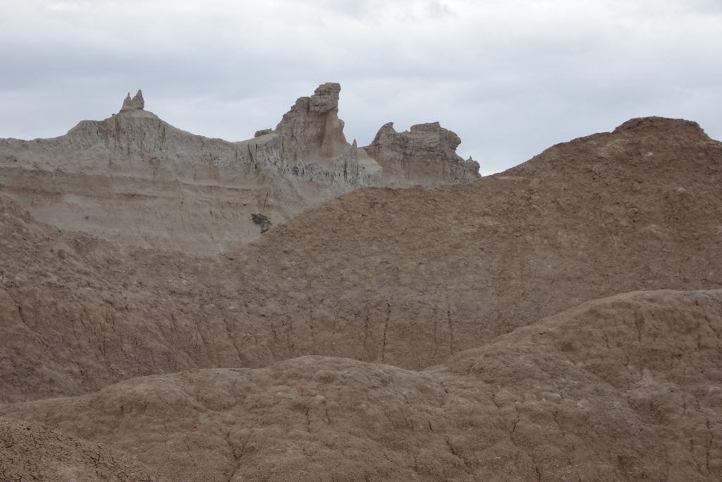
First the scenery becomes very interesting, with colorful,
jagged spires, ridges and gullies.
And then there is the wildlife.
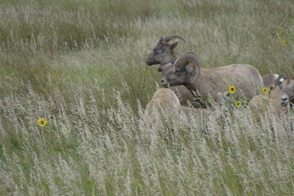
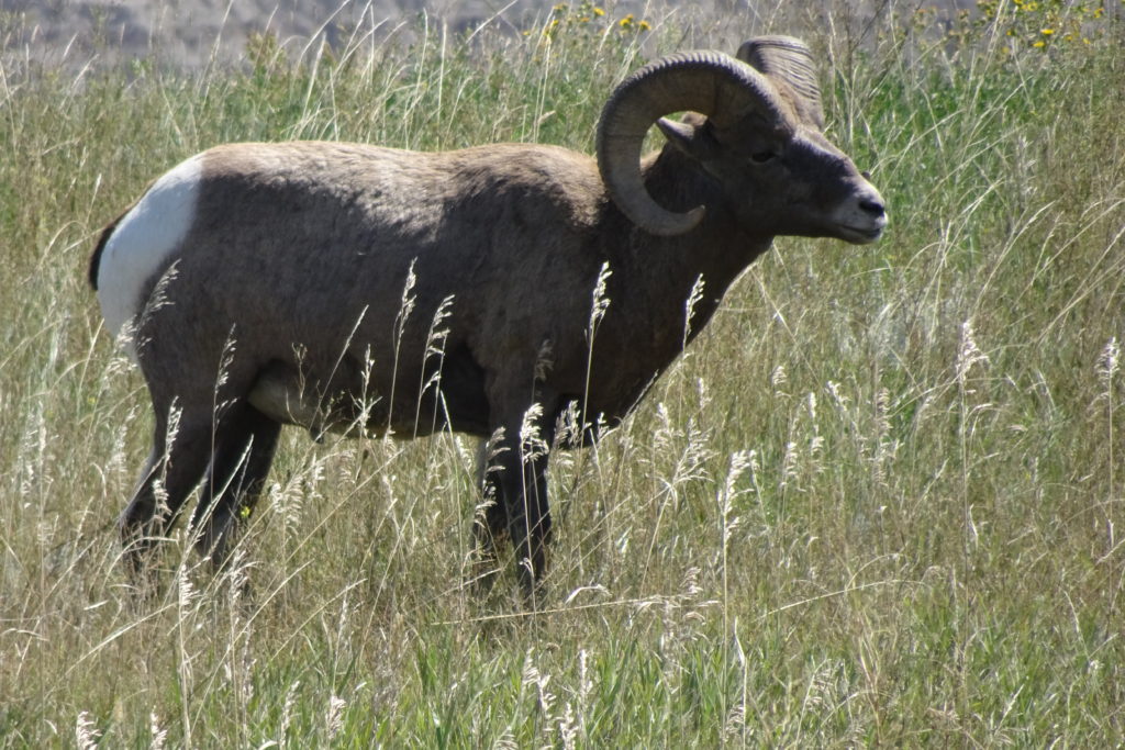
There are a lot of bighorn sheep. Although the park apparently has only about 150 bighorns, we
saw at least 40. There were small
herds amid the erosion features.
But there were also a considerable number of animals, including rams
with impressive horns, grazing by the roadside (and creating the usual animal
viewing traffic jams). There
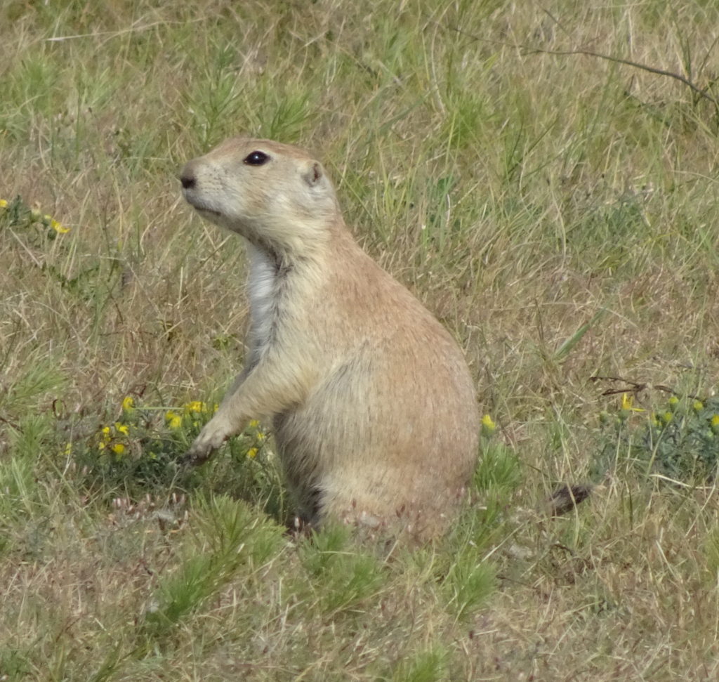
were also a few bison and several prairie dog towns.
Speaking of prairie dogs, the attempt to eradicate them from
the plains also almost eradicated one of their predators, the black-footed
ferret. They were declared extinct
in 1979. However, in 1981 a few
individuals were found on a Wyoming ranch. They were introduced into the Badlands National Park and a
several other sites with protected prairie dog populations, where they are
hanging on despite threats from canine distemper and the plague. We saw prairie dogs but no ferrets.
I enjoyed the many colors of the soil and the interesting
erosion formations.
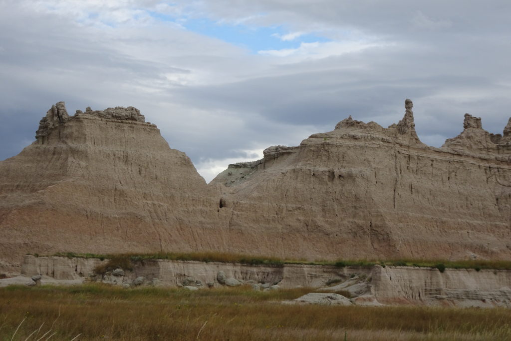
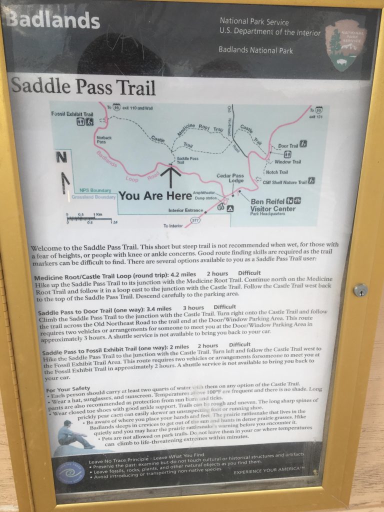
We stopped to try the Saddle Pass Trail. We climbed to the top of the first
ridge. However, the soil here is
very fine and the trail is covered by a mix of dust and fine gravelly particles. The effect is almost as slippery as
climbing on hard packed snow – you can make progress, but each step forward
leads to sliding half a step back.
Up was not too bad; down was treacherous. We carefully made the descent back to the van, dodging
a few raindrops as we went.
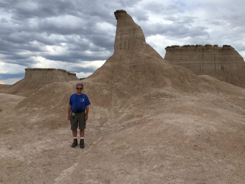
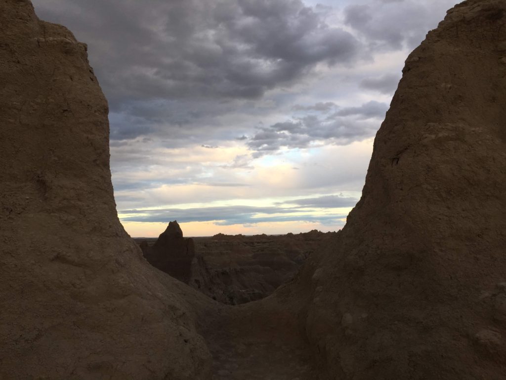
We then went to the Door/Window parking lot, which is the
trailhead for 3 trails, Door, Window and Notch. We are not sure which specific features give the trails
their names, but the parking lot features a ridge with several window-like
features. Looking through the
windows gives quite impressive (spectacular again?) views over the erosion
features.
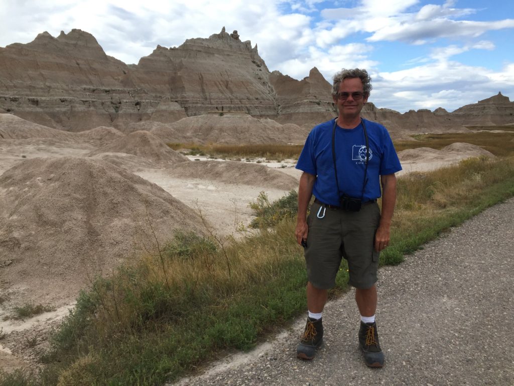
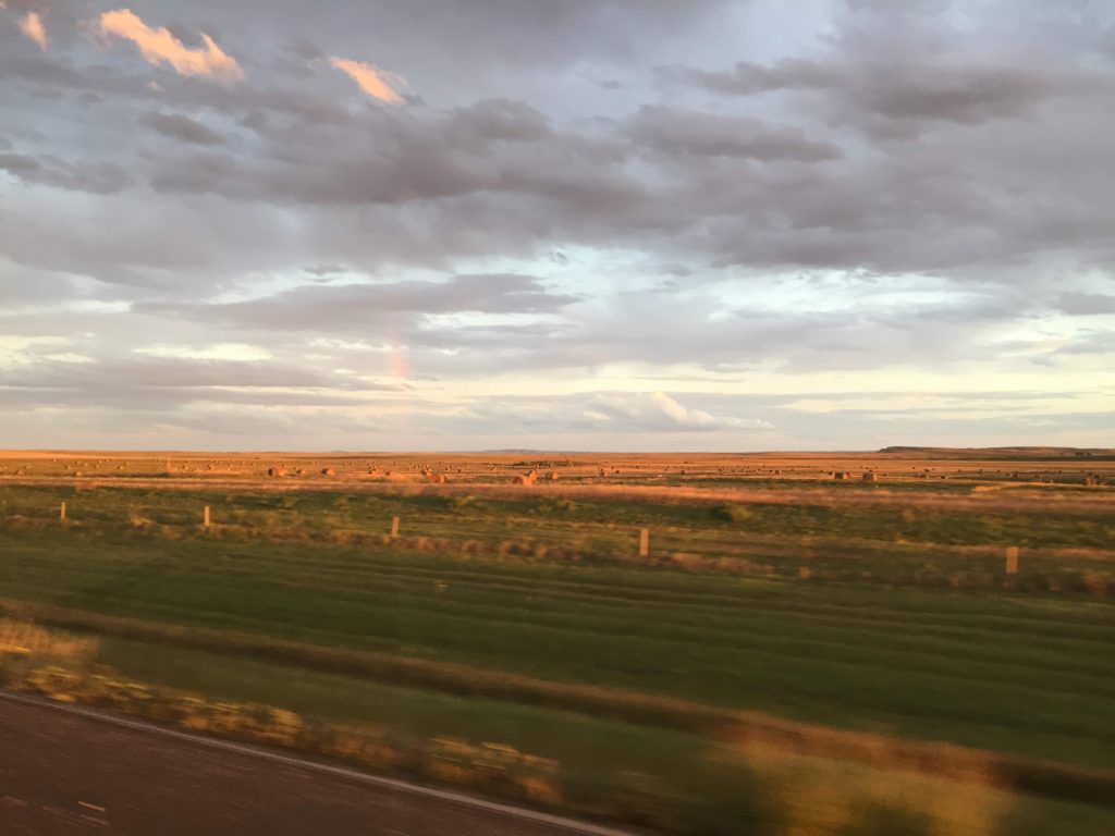
After a hard day of sightseeing in the Badlands, we drove
through iconic SD farmlands to arrive at the Kadoka KOA. It is hay harvesting season, and with
the late afternoon sun, the fields with their huge rolls of hay looked golden.
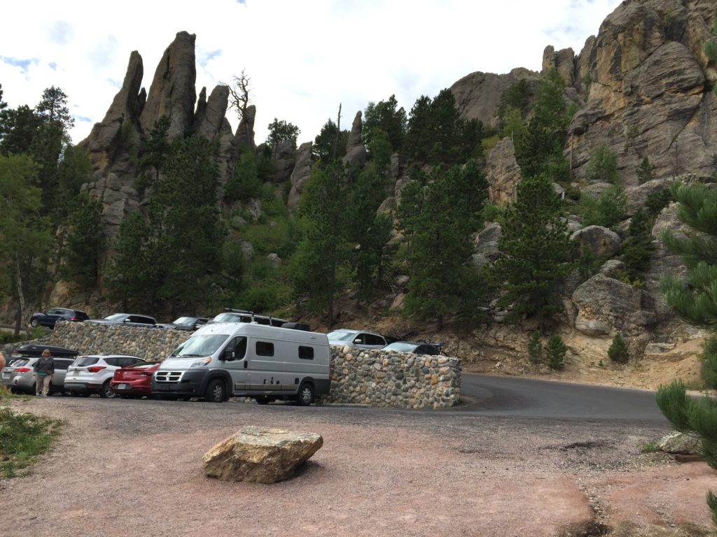
We decided to spend two nights at Kadoka KOA to
regenerate. The campground is
actually fairly far from Kadoka — pretty much the middle of nowhere — and is
on a lake. However, there is no
lake access. According to the
owner, the Army Corps of Engineers have declared the lake dead due to selenium
and nitrate run-off. There is a
thick riparian area of bulrushes and other reeds. The owners were quite friendly and explained to me some of
the complexities of running the campground, which they had purchased only 2
years earlier. Among other ideas,
they would like to rehabilitate the lake.
In any case, it was a fine place to rest up. Among other things, they had a cafe, serving specialty
coffees and pizza. We took
advantage of the latter – delivered hot to the campsite.
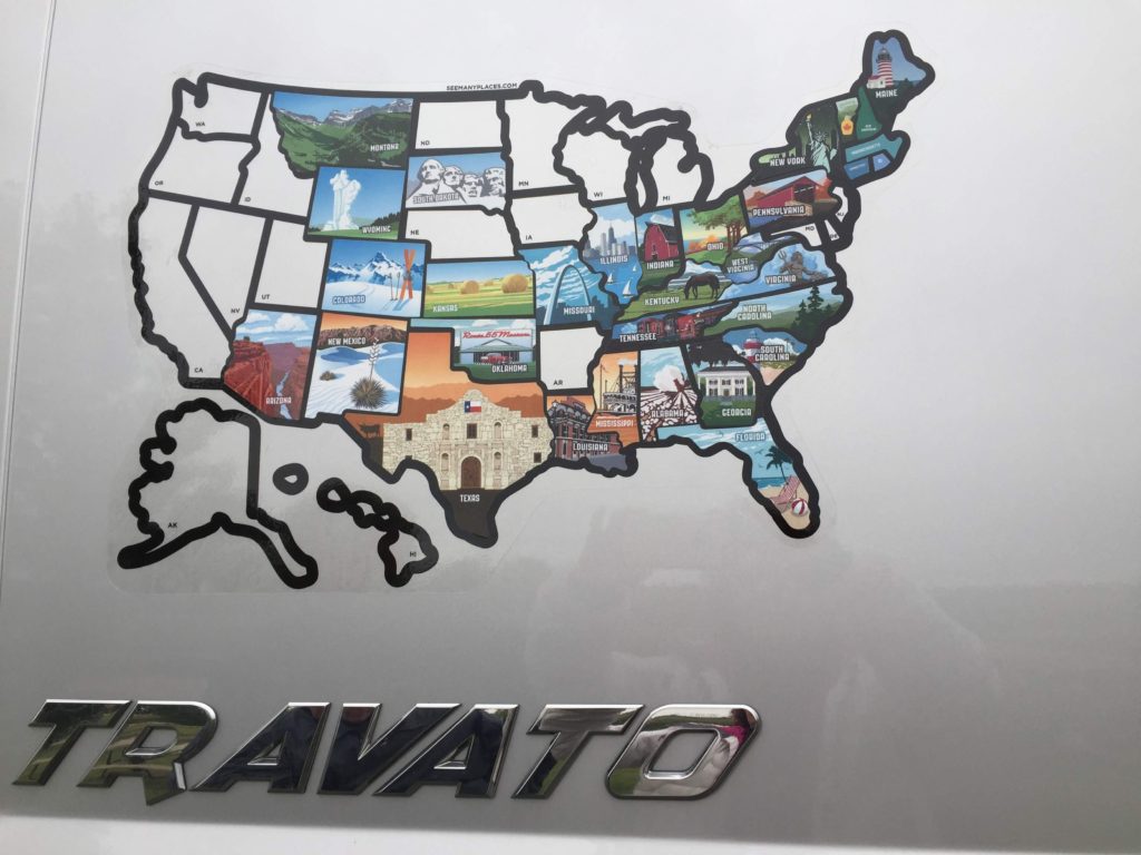
They also sold stick-on maps of the USA — a must for the
serious RV traveler. We can now
boast of our RV travels with the best of them. (We think it unlikely, though, that anyone actually takes
their RV to Hawaii.)
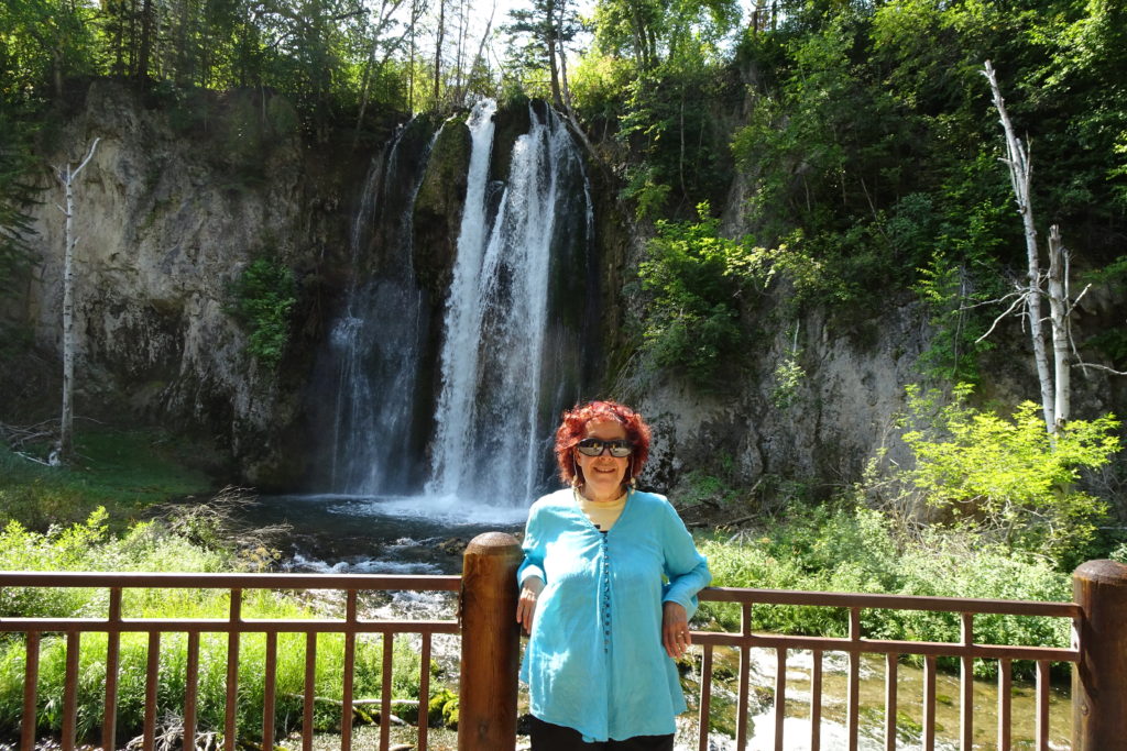
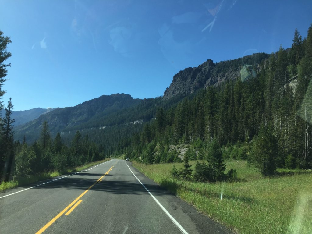
One of the popular routes out of Spearfish is through Spearfish Canyon and into the Black Hills. The scenery is lovely and apparently the fishing is good — the Spearfish River is the only one of the stocked rivers in the Black Hills in which the trout spawn naturally.
Frank Lloyd Wright apparently said that the Spearfish Canyon deserves to be as well known as the Grand Canyon. I’d dispute that, but it was a lovely drive.
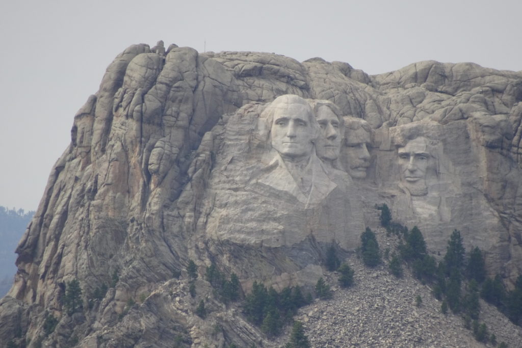
We drove down the highway to see the Crazy Horse
Monument. Neither of us is really
in favor of carving up the landscape in this way (and that includes Mount
Rushmore) but it seemed like a “must see”. We did a quick drive-by and then backtracked a bit to camp
at Oreville State Forest.
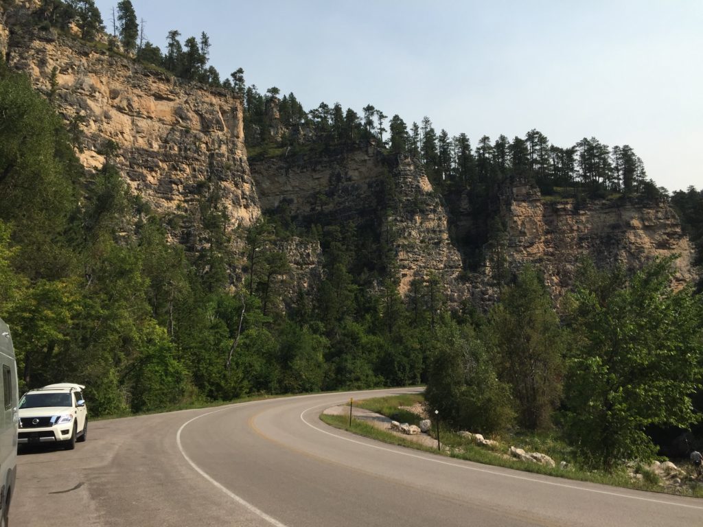
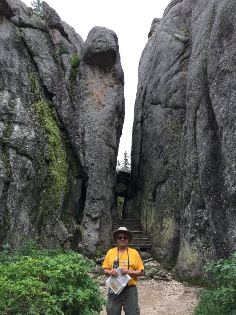
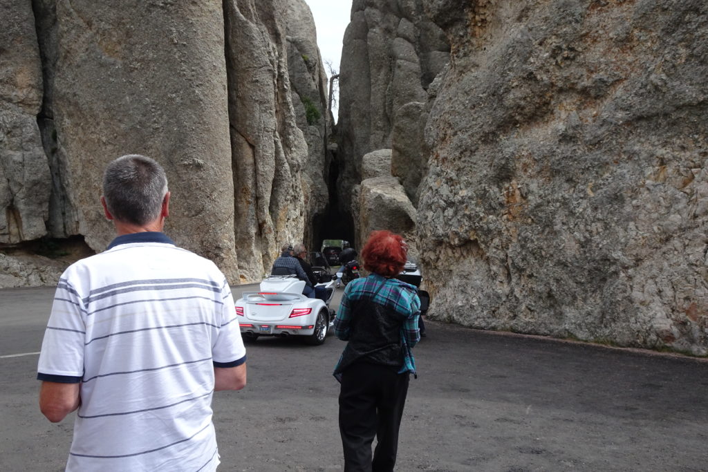
Friday was a big day.
We started by driving the Needles highway – quite an amazing experience,
both because of the scenery and the road itself. It was commissioned for tourism and features 3 small
tunnels, which are 8 feet wide and just over 9 feet high, as well as a series
of bridges built as corkscrews called the Pigtail Bridges. We were really in the largest vehicle
that could navigate this road.
Building it was a bit of an engineering marvel.
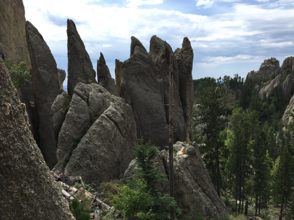
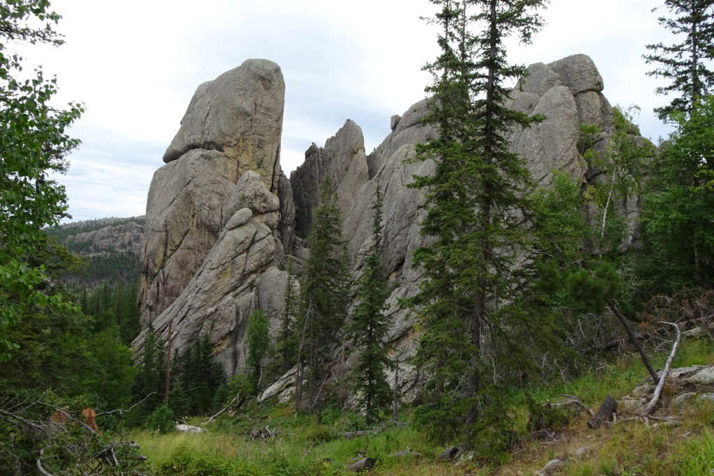
The highway is named for the rock spires that it
traverses. Not surprisingly, it is
a popular climbing destination.
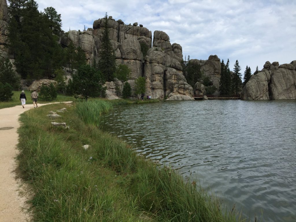
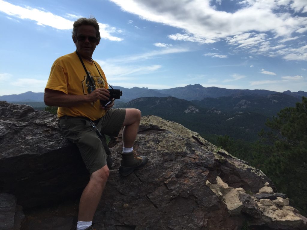
We stopped at the beautiful Sylvan Lake for a hike and lunch. We did the beginning and end sections of the Sunday Gulch Trail. The beginning is a very steep descent into the gulch.
Sylvan Lake trail
We were discouraged from continuing by a) rain, b) wrong footwear c) the length of the trail. However, the trail is a loop from the lake. When the rain stopped, we walked in the other direction. It was really spectacular terrain. (Again, I am overusing spectacular, but I would not want to say anything less.)
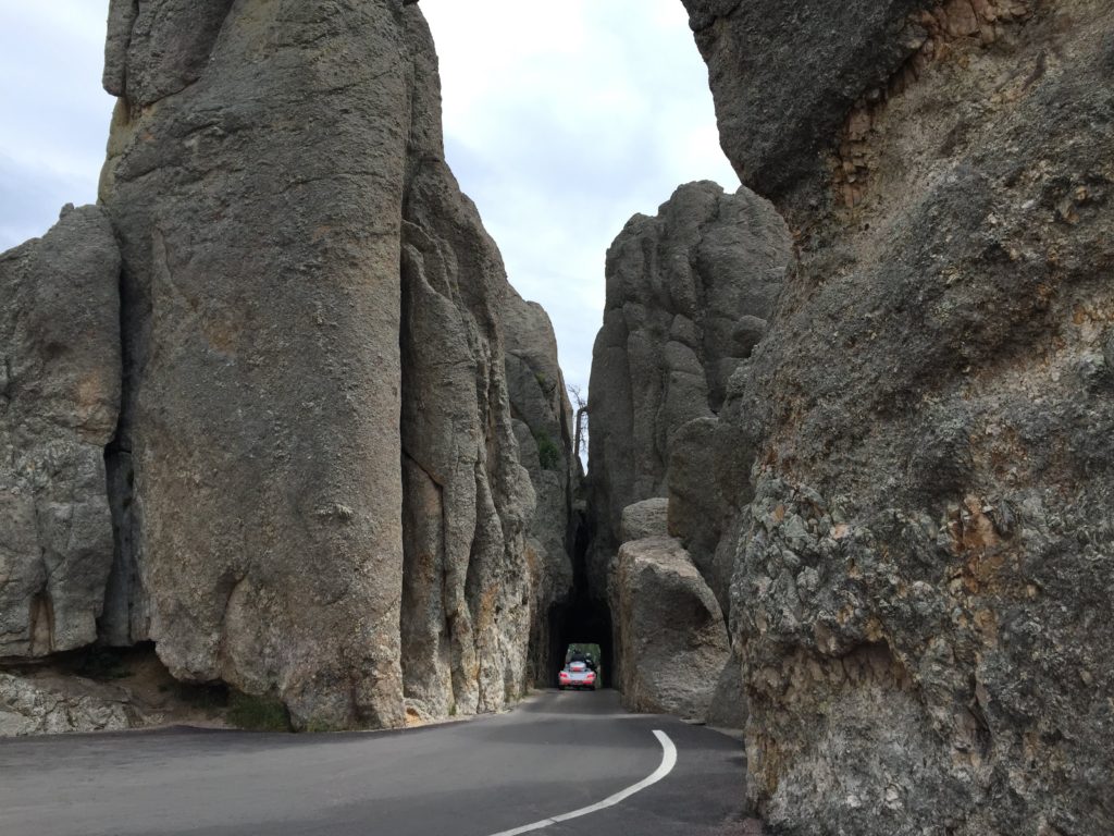
After Sylvan Lake, the road becomes even more interesting. The next tunnel is the Needle’s Eye, named for a rock formation. However, I will always think of the “Eye” as the long and tiny passage through the rock.
The third tunnel is also tight, but seems easy compared to the other two. It takes you out to the Pigtail Bridges, which spiral down and take you to the Custer State Park Wildlife Loop Road. This is another great place to see bison. But we have already posted many bison photos.
After the Needle’s Eye
The Loop Road feeds into the Iron Mountain Road, with more great scenery. The road was specifically designed to slow traffic so that travelers could enjoy the scenery. This road also has 3 tunnels, although these are more manageable, being larger. There are also several pigtail bridges.
From the rest stop there is a great viewpoint to Mount Rushmore — one of the major motivations for the road was to provide views of Mount Rushmore.
The Iron Mountain Road ends in the tourist town of Keystone,
where we stopped for ice cream.
Keystone seems to have many attractions, but we carried on to spent the
night in the suburbs of Rapid City.
The Bighorn and Little Bighorn Rivers run close to
Billings. The Battle of the Little
Bighorn is one of the most disputed battles of US history. It was also part of one of the many
shameful treaty violations by the US government.
The circumstances, battle and follow-up are all
complicated. I’ll try to summarize
here.
In 1868, the US government signed a treaty with several
Plains Indian nations ceding much of western Wyoming, including the Black
Hills, to them. However, when gold
was discovered in the Black Hills, Americans began to trespass on Indian
territory. The US army at first
tried to stop the illegal hordes, and when that failed, the government offered
to purchase the Black Hills. When
the Indians refused, the government ordered them to return to reservation
lands, and declared that those who did not do so would be treated as hostiles.
Meanwhile, the Indians grew increasingly defiant of these orders. Sitting Bull, a spiritual leader of the Lakotas, held a Sun Dance and received a vision of enemy soldiers falling upside down in the Lakota Camp. This was interpreted as a military victory over the American forces. This, as well as desperation about life in the reservations, a longing for the traditional Plains life and Sitting Bull’s offer to form a united front, attracted a large group of Lakotas, Cheyennes, Arapahoe, and other plains tribes to join him in an encampment of about 7000 people, including about 1500 warriors, on the shores of the Little Bighorn. Sitting Bull did not participate in the battle directly, but his leadership was a key to the fearlessness of the warriors.
Meanwhile, Custer, a hero of the civil war and a veteran of
many battles against the Indians, strategized that his best tactic for ensuring
surrender of the Indians was to capture the women and children. He was unaware of the size of the
encampment, but hoped to round up the civilians while the warriors were
engaged. To this end, he divided
his forces, which, unknown to him, were greatly outnumbered.
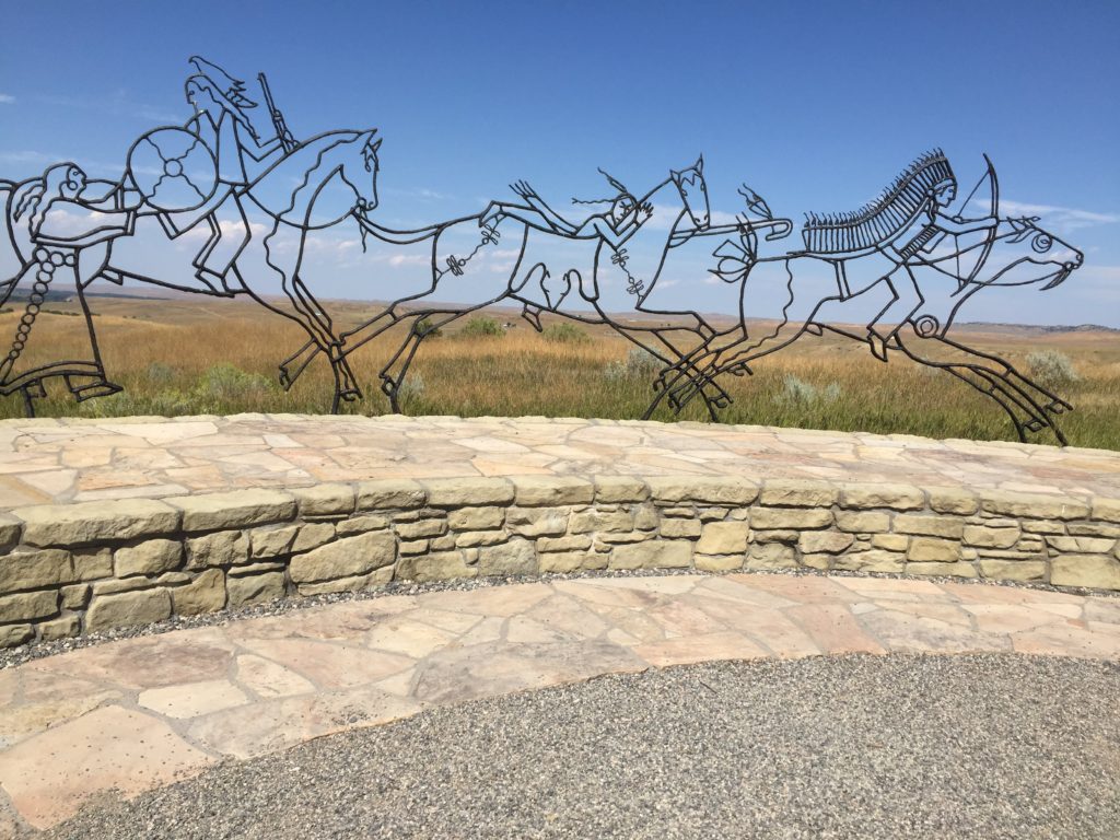
The details are best read about elsewhere. In short, the Indians won a resounding
victory in the battle. Custer and the 41 men accompanying him,
including his brother, all died.
60 – 100 Indians and at least 249 Americans lost their lives.
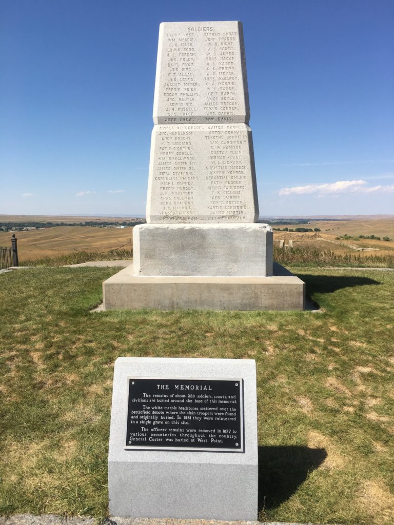
The Little Bighorn National Monument tries to explain both sides, but mostly explains the battle itself. A ranger gave an animated presentation. You can wander over the main part of the battlefield and the hill on which Custer and his men were killed (and later buried).
There is a memorial as well to the Indian warriors – the Indians moved their remains from the area immediately after the battle when the encampment broke up.
As we know, the Indians won the battle but lost the war. In the end, the tribes were forced onto the reservations and the Black Hills were opened to American settlement. Sitting Bull and his followers fled to Canada.
They remained in Canada for 4 years before political tensions and their inability to procure enough game forced them to return to the US, where Sitting Bull formally surrendered to the US government.
Travelling on, we crossed the Crazy Woman River – no idea
what the story on that is! We
decided, however, to camp at the Crazy Woman Campground in Gillette — we never
met any of the staff, but we presume they just liked the name. They did have an eclectic collection of
rocks, broken sculptures, etc by the office. In any case, it was a small but functional campground.
Gillette is the center of the coal mining industry in
Wyoming. We did not visit the town
(or the museum, which is right across the road from the campground and is
apparently quite good). One thing
about traveling is that one hears local news. As we were leaving, the news was about programs for coal
miners who were losing their jobs as the industry implodes.
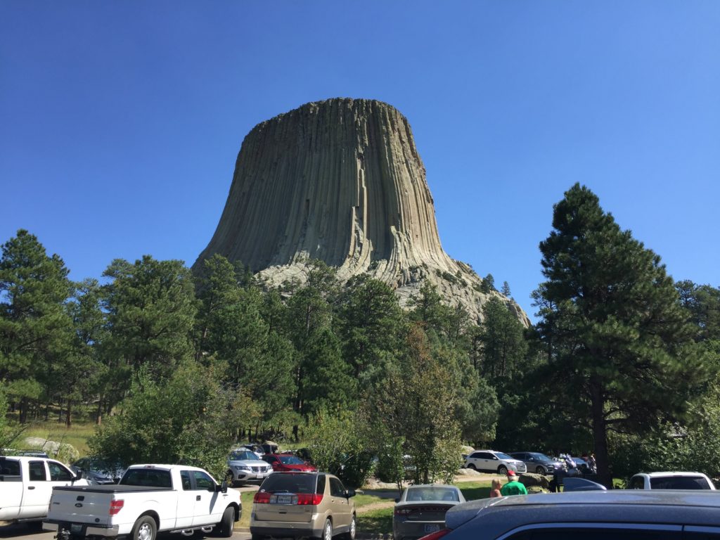
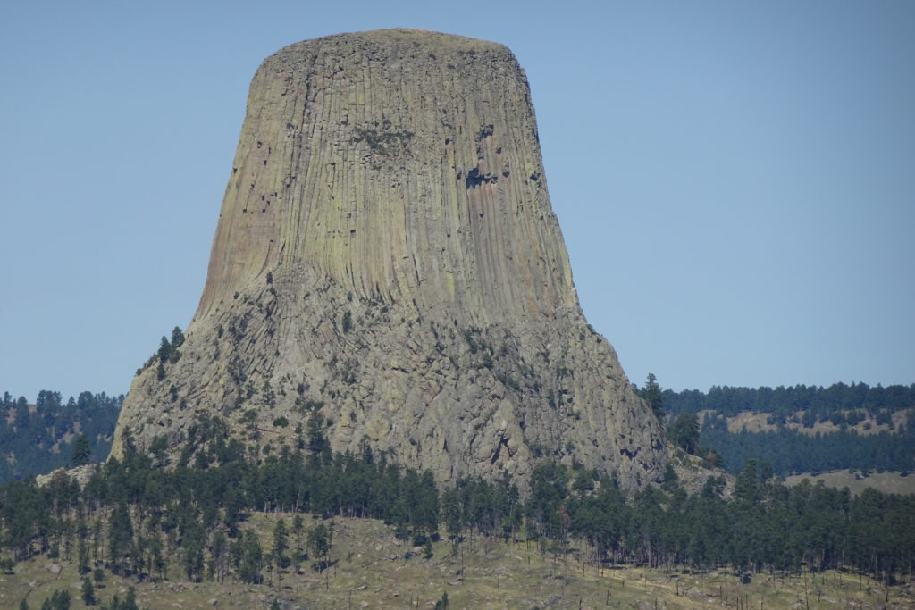
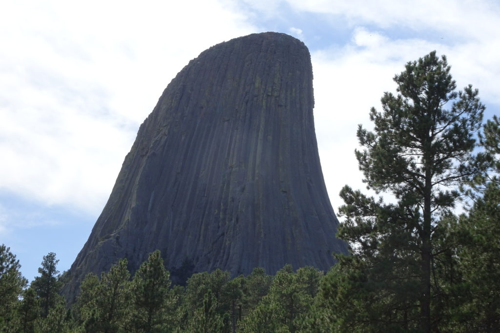
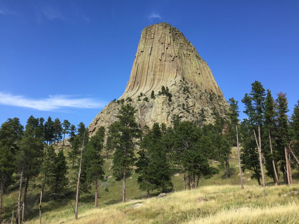
From Gillette we went to Devils Tower (known to the Indians as Bears’ Lodge). It is an amazing chunk of igneous rock! It looks like there are huge columns going up to the top. These are features that occur in igneous rock if it cools under certain conditions. I assumed that the tower is basalt, like the famous columns in the Giant’s Causeway in N. Ireland, but apparently it is not.
Actually Devils Tower is a bit of a geological puzzle, with
several theories about its origins.
There are some other smaller but similar features nearby. There are several hikes around the base
– we took the outer circle, which provided nice views from several angles. The tower looks different as you walk
around it, and also as the lighting changes due to sun angles.
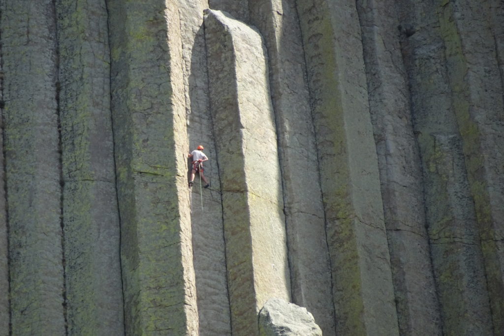
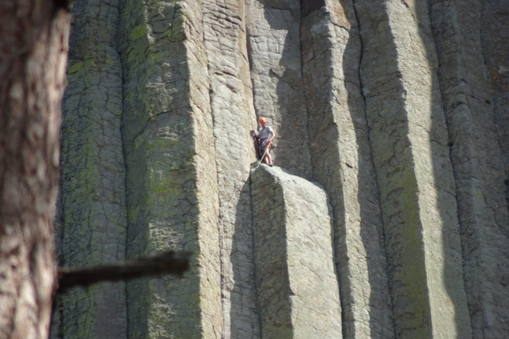
The tower is a favored climbing location. As someone who does not climb it looks like it would be tiring, but perhaps not technically challenging if you can grab a crack and follow it all the way up. But of course I am sure that what looks continuous from the ground has more variation when you are actually clinging to the cliff. (I am certainly not going to try it out – no strength, no skill.)
We watched a small party of climbers and you can see in close-up what some of the challenges might be.
In 1941 parachutist George Hopkins landed his chute at the top of Devils Tower. He was trying to demonstrate that precision landing was possible, and he succeeded.
The only problem (besides the fact that what he did was illegal) was that his climbing gear did not land at the top, leaving him stranded with no gear and no supplies. Airplanes dropped food, warm clothing and water to him, but it was not clear how he was going to get down. Finally an expert climber volunteered to go up and get him. The expert and 7 other volunteers made it to the top with little difficulty, and Hopkins, who was in excellent condition, made it down safely.
Devils Tower also has a large prairie dog town, close to the
campground and the road. They are
cute, but I bear in mind that the fleas that live on them carry the plague.
Municipal campground at Spearfish
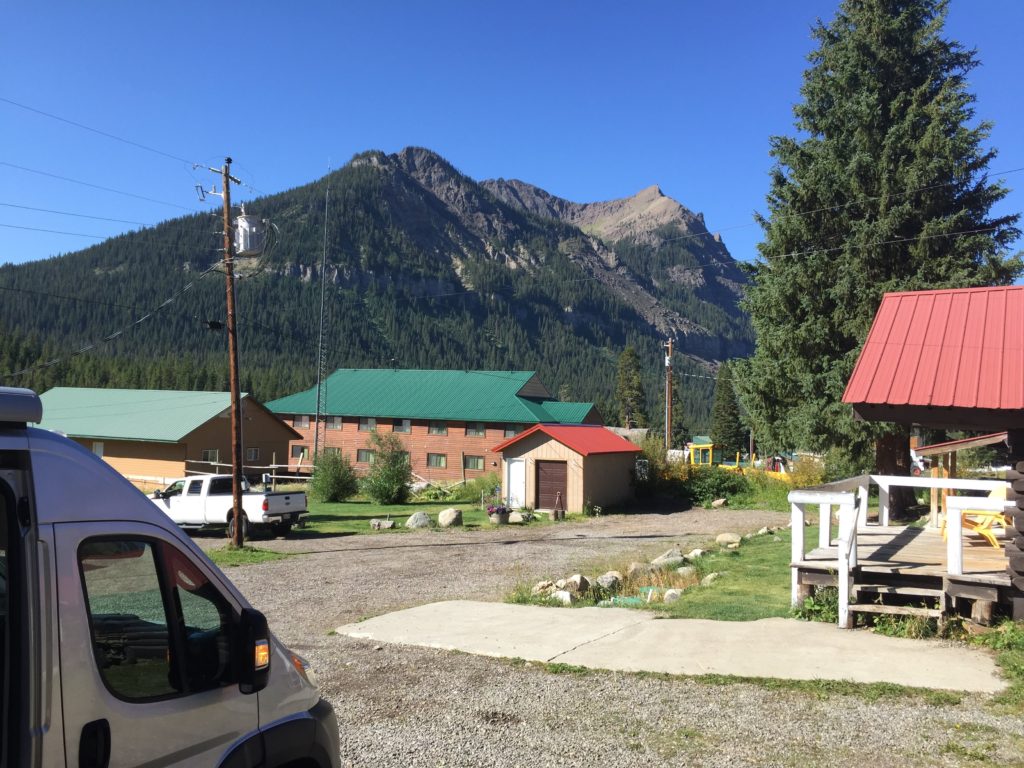
From Devils Tower we went to Spearfish, where we camped in the lovely municipal campground for 2 nights. The town itself is quite small, but it does have a couple of nice restaurants within walking distance of the campground. (The town is very small — everything is within walking distance of the campground.)
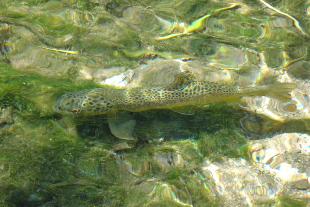
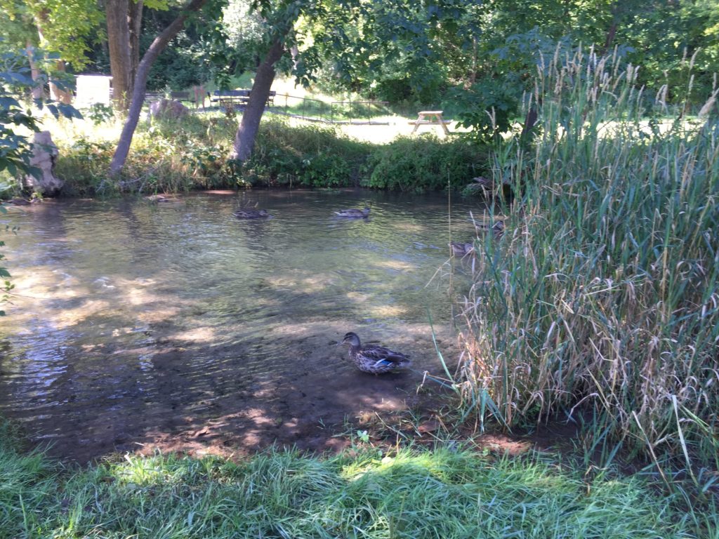
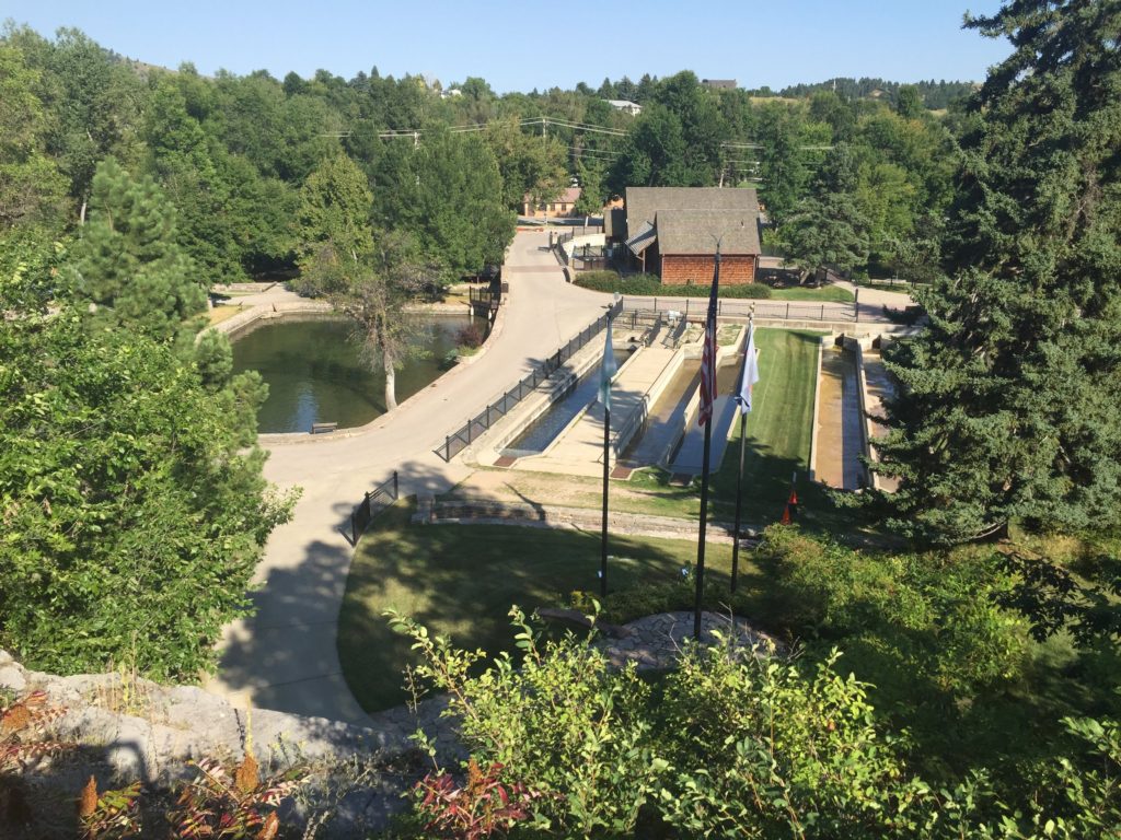
Right beside the campground is the D.C. Booth National Historic Fish Hatchery. This is the site of the first nationally funded fish hatchery. (I am pretty sure that both the campground and the adjacent civic park must be on land that was part of the hatchery.) They still hatch a few trout, but mostly it is a museum.
Trout are not native to the Black Hills, but rainbows, browns and cutthroats have been introduced for sport fishing. The museum shows how this was done in the old days, with the fingerlings carried to their release sites by horse and by foot in milk tins and buckets.
There is also a train car showing how the cars were fitted out to carry the hatchlings to the sites from which they were carried manually to their release sites.
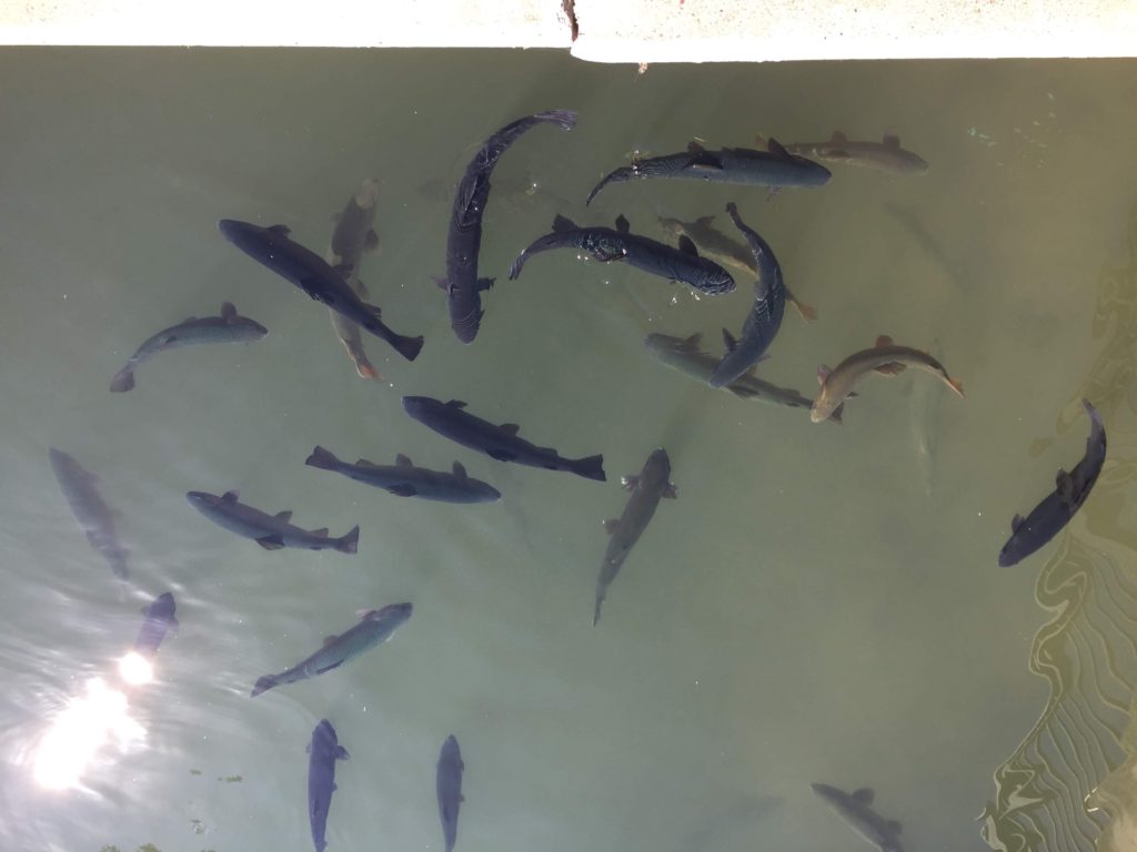
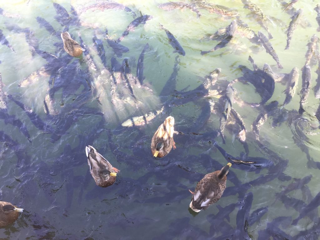
What I liked best was the fish pond. Since these fish are kept for display,
some of them are 6 years old or more.
A 6 year old rainbow trout is enormous! You can purchase fish food and toss it to the fish. This of course causes quite a frenzy,
and the local ducks also try to get in on the action.
Leaving Yellowstone via the NE exit, there are lots of small state forest campgrounds. However, the first one we checked, just outside of the town of Cooke City was full. Since it was already dark and we hadn’t eaten, we decided to stay at a cabin in Cooke City. We had a king-sized bed, a full-sized bathroom and a large kitchen with dining room. It felt quite luxurious after being in the van for 10 weeks!
Our cabin in Cooke City
Cooke City closes up very early for dinner, so we ate
take-out in our cabin kitchen. In
the morning we brought in our breakfast from the van. All in all, it was a welcome break — but oddly the van felt
more homey once we were back on the road.
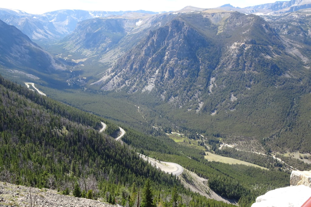
The park exit is the start of the scenic Beartooth Highway. It was too late to really appreciate the scenery the previous day, so we backtracked a few miles and started to route over. I originally assumed that the “bear teeth” were the ridge of mountains that rise about the road, and look sort of like what one would imagine if looking at the bear’s molars from inside its mouth. However, from a viewpoint later along the road, the real reason for the name is apparent – a huge incisor!
tooth
Summit
Switchbacks
The highway takes you from Wyoming into Montana, back into
Wyoming, and then back into Montana go over Beartooth Pass and into the town of
Red Lodge. The switchbacks up and
down the pass are so tight that they look from above like complete loops.
Descending Beartooth Pass
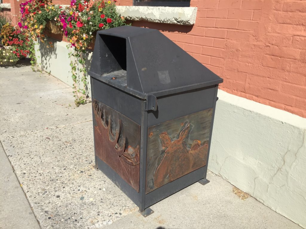
Red Lodge is another cute touristy town (with artistic metal trash cans, each with a unique scene).
We stopped there briefly before heading to a KOA just outside Billings. We spent 2 nights there doing laundry and generally reorganizing after Yellowstone before heading out again. The campground was nice, but totally overrun with grasshoppers. We did not visit Billings itself.
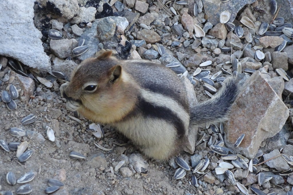
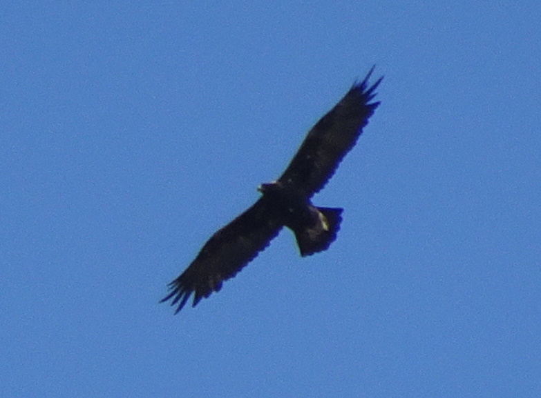
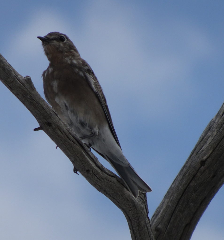
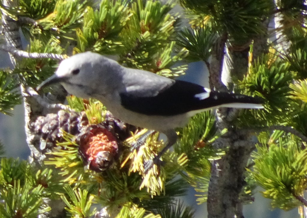
Since this is a short posting, I am going to add some of our wildlife photos here. The Clark’s Nutcracker is mine; the rest are Chuck’s.
Although we heard that it is necessary to get reservations
in Yellowstone 6 months in advance, we did not try to get a campsite until we
were sure of our arrival date.
With incredible luck, we were able to get a campsite at exactly one
week’s notice. (We avoided the
weekend, although that may not have been necessary.)
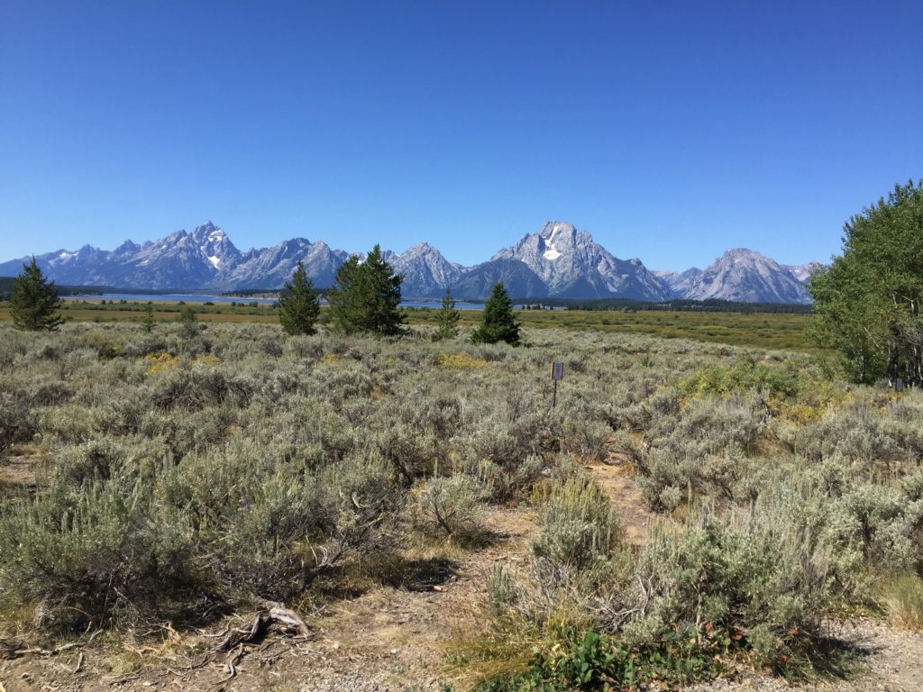
Since check-in is at 2:00, we took a leisurely drive from Dubois through the north end of Grand Teton National Park and then into Yellowstone.
The scenery in the Tetons is wonderful, with huge rock walls rising above the forest.
I am out of adjectives, since every vista seems more magnificent than those previous (and that continues throughout the trip). We mostly drove through with a few rest stops, and a brief aside to visit a waterfall.
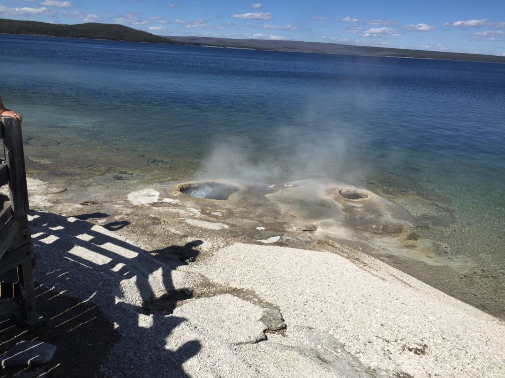
Arriving at Yellowstone, we were able to quickly register for our campsite at Bridge Bay on the shore of Yellowstone Lake. We were in the furthest of the 8 campsite loops, which gave us a quiet, wooded spot (although a slightly longer drive to the attractions).
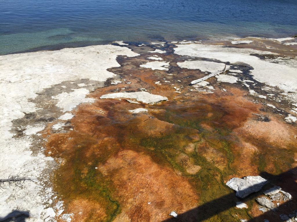
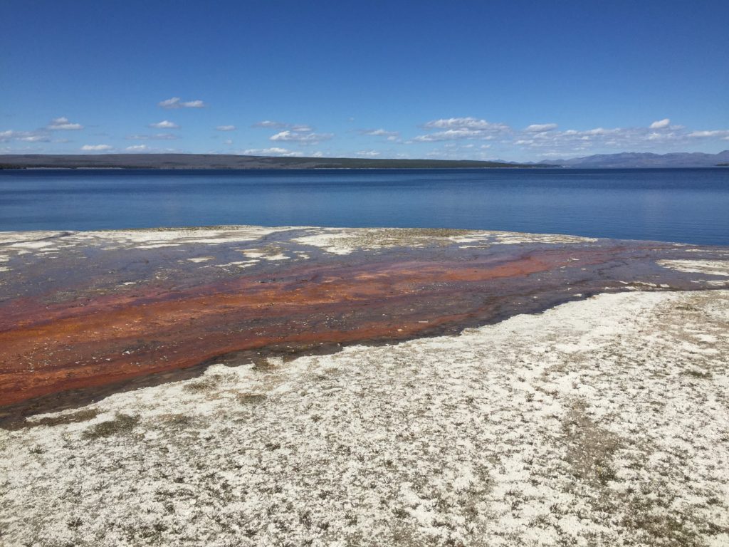
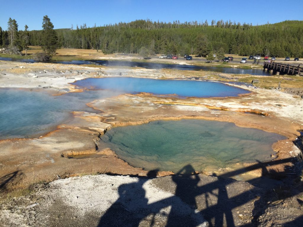
To get to Bay Bridge, we had to pass the West Thumb Geyser
Basin. Once we found our campsite,
we went back to West Thumb and saw our first thermal features – hotsprings,
mudpots and fumaroles. West Thumb
is a bay on Yellowstone Lake.
The Yellowstone volcano is responsible for the thermal
features of the park, as well as much of the terrain. However, multiple eruptions and collapses have led to a
complicated set of ridges and lakes.
The first eruption which took place 2.1 million years ago was one of the
largest eruptions known on earth.
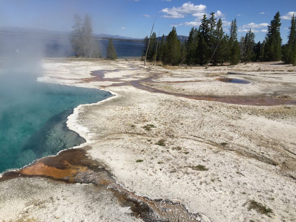
West Thumb Geyser Basin is the result of a fairly recent event — about
174,000 years ago. The caldera
from this eruption collapsed to form the bay. The area is full of hot springs, mudpots and fumaroles, many
of which are under the water. The
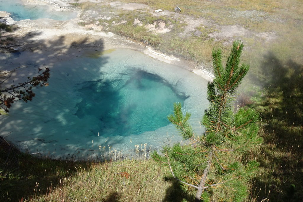
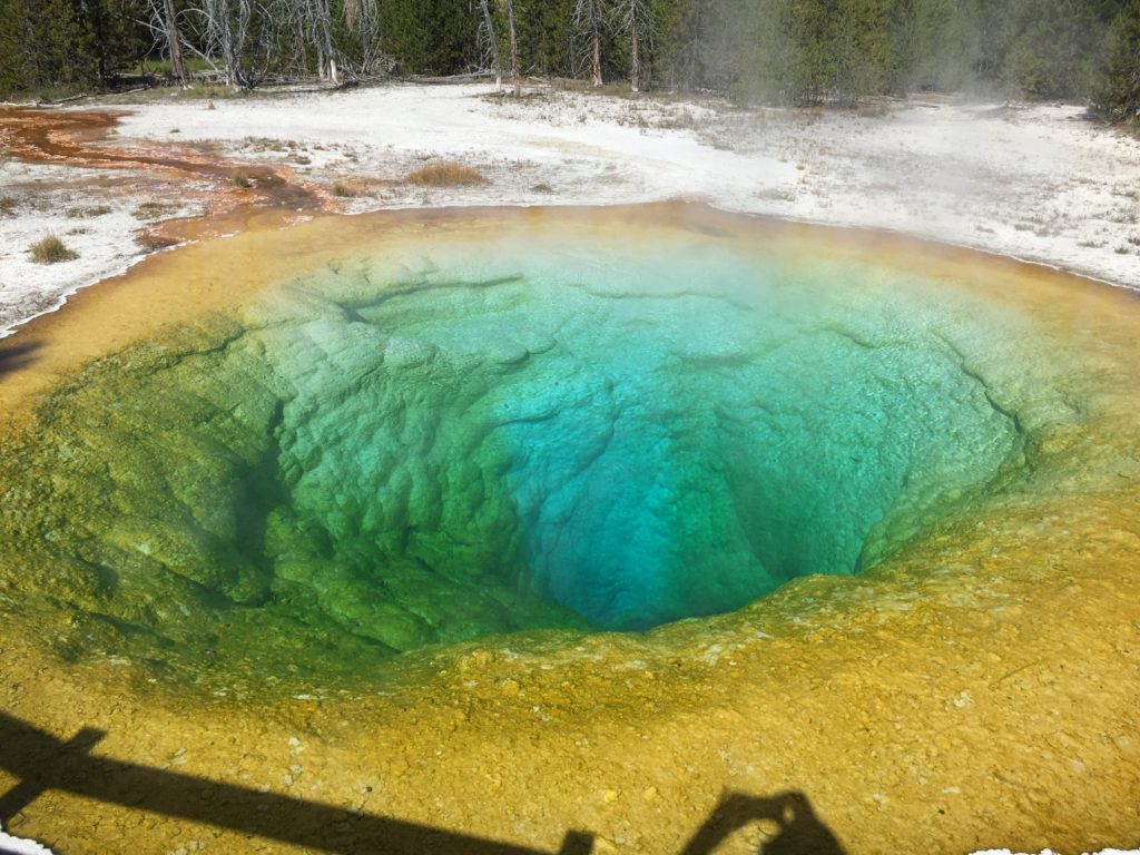
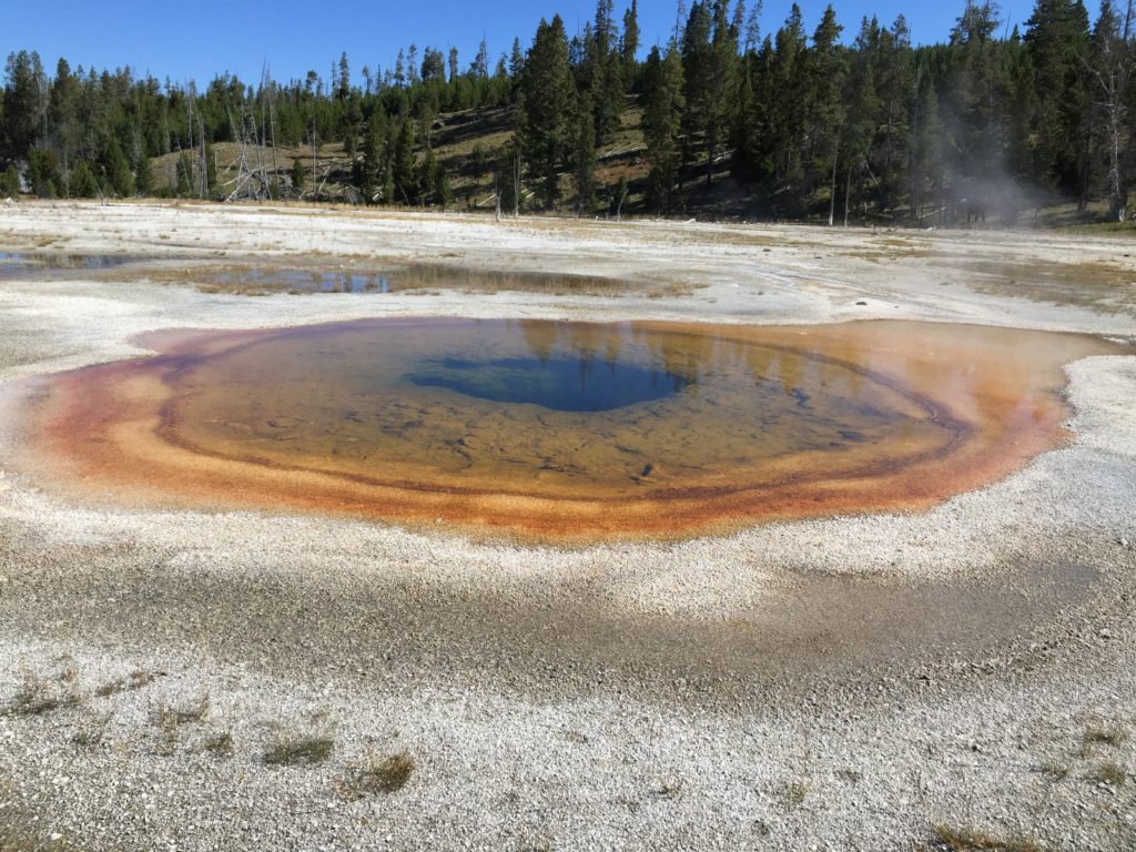
hottest springs on land are too hot even for extremophile bacteria. Due to minerals and the lack of life,
the water appears turquoise. Due
to the altitude, water boils about about 200F, and some of these springs are
boiling. Where the water is
somewhat cooler (I think the guide said 176F or lower) colorful extremophiles
thrive — many are rust colored or yellow and at even cooler temperatures they
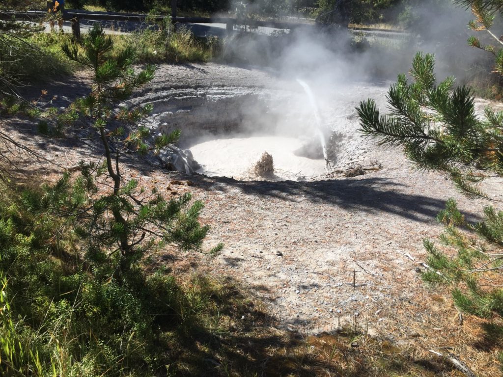
may be green. There are also lots
of pools of boiling mud.
The exact location of the hot spots is unstable, as is the behavior of the features. Apparently the park wildlife is attuned to the dangers, as we saw lots of animal tracks among the thermal features. Tourists are not so attuned. This is why the occasional unwary tourist who steps off the paths for a photo may get scalded. Deaths are not unknown. The park visitors we saw were much more respectful of the signage than one finds in a typical park.
Having satisfied our most immediate need to see hot springs,
we returned to our campsite and finished supper in time to go to the ranger
talk. This was about the early
exploitation of the park by American entrepreneurs. The encouraging thing was that the government created the
national park as soon as the unique features of the area were discovered. (It was apparently the first national
park in the world.) However, the
“opening” of the park to tourism was subject to the usual mix of
ambition, fraud and greed.
The talk ended after dark and so on our walk back to the
campsite we were able to enjoy the full splendor of the night sky. It was absolutely clear, far from any
town and 7000 feet above sea level.
Not only was the Milky Way visible, it looked like a trail of bright
glitter. Even in northern Ontario
I don’t recall seeing so much detail.
Even without the other glories of Yellowstone, it would have been worth
going there just to see the night sky.
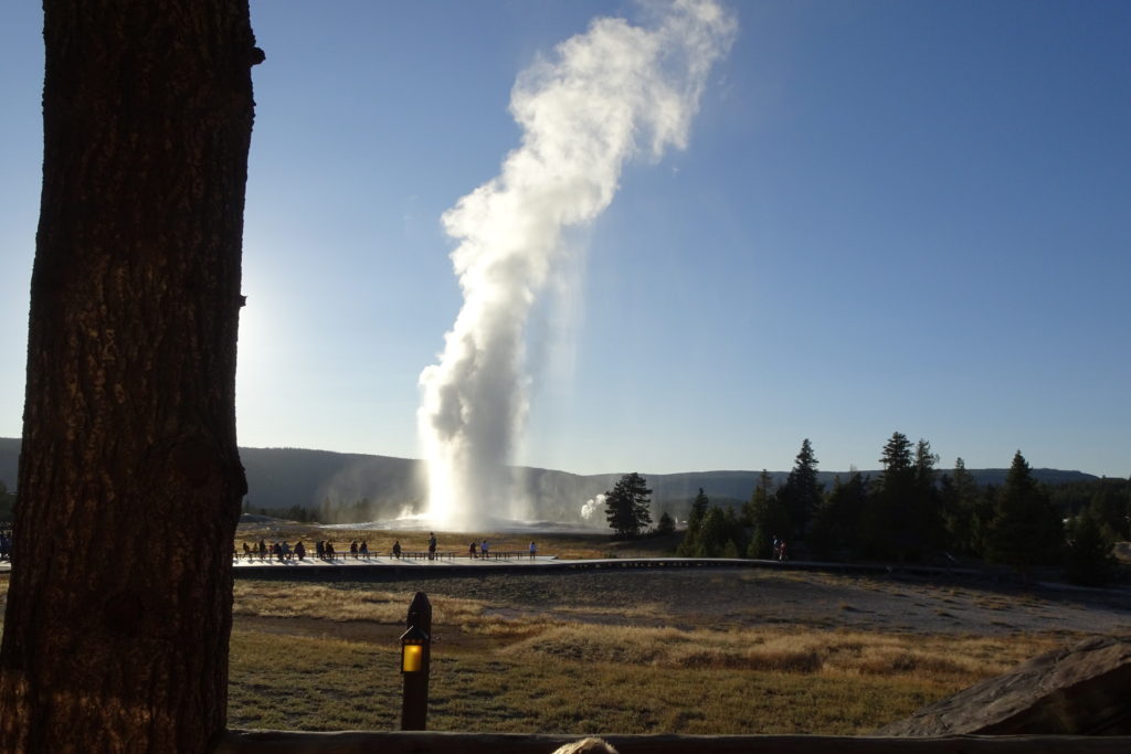
In the morning we awoke early in the hopes of seeing the
park’s famed wildlife along the road to the Old Faithful Geyser field. In fact, when we work up, there were
several elk grazing among the campsites.
However, we learned later that the other wildlife are found at specific
locations in the park at each time of year and the road to Old Faithful is not
a prime wildlife area.
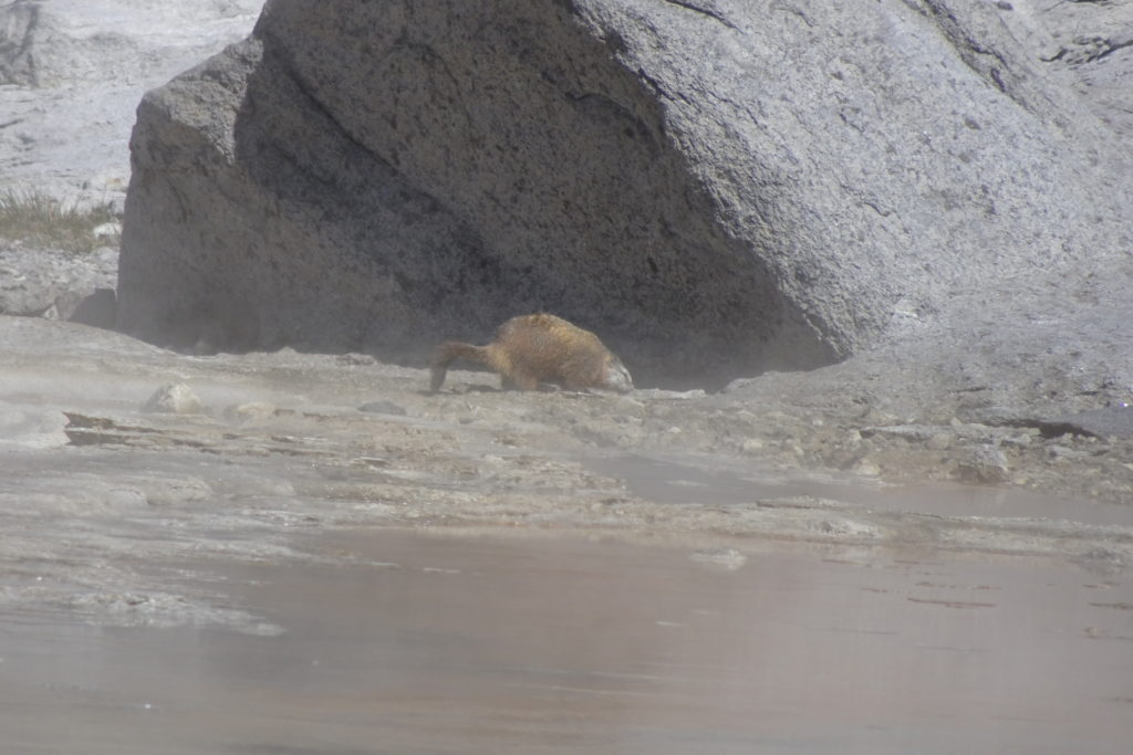
Marmot at mouth of geyser seconds after eruption finished.
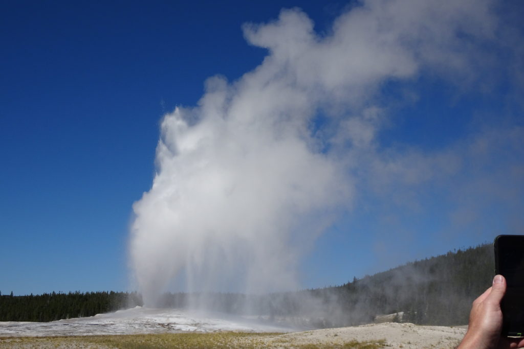
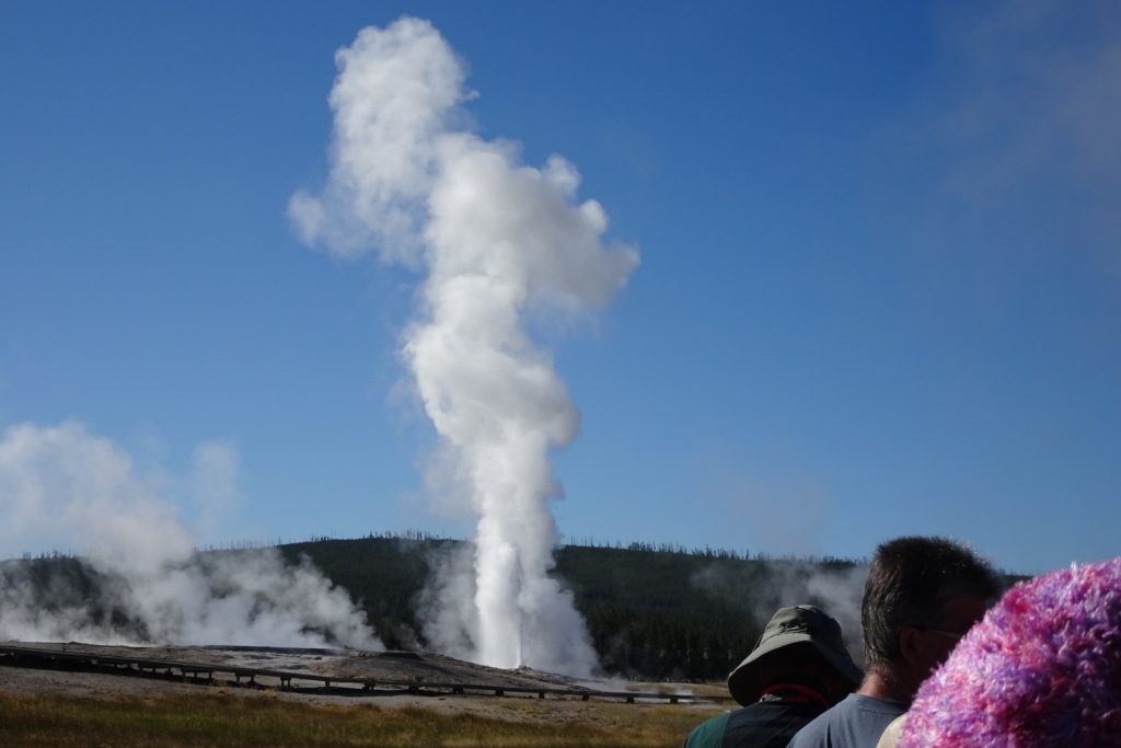
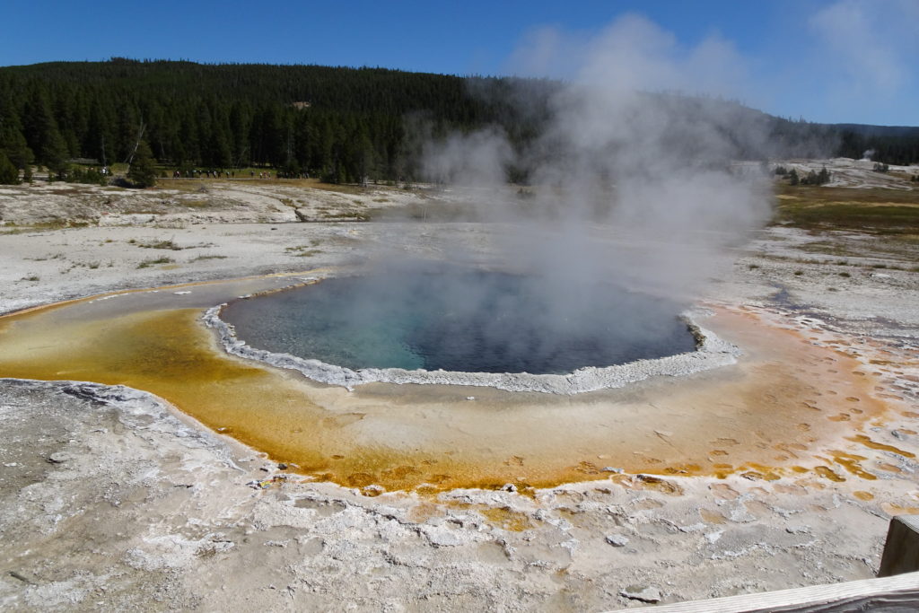
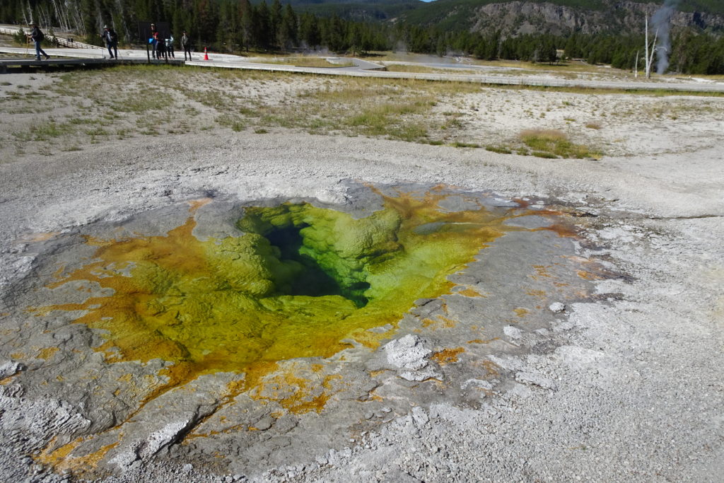
We got to Old Faithful in time for a park ranger hike. The ranger took us to various hot springs and geysers and explained the colors of the pools, the predictable and unpredicable geysers and some of the geology. During the walk we saw one of the Lion Geysers erupt. After the hike, we continued along the trails to see some of the other notable features. We then went back to the Grand and Turban Geysers, which which erupted quite spectacularly in the predicted window, to the oohs and ahhs of hundreds of tourists. We were quite amazed when, seconds after the eruptions ended, a marmot walked calmly to the mouth of the geyser. We then went to the Old Faithful viewing area and watched it go off, again pretty much at the predicted time. The photos above are of the 3 geysers. Old Faithful is top left.
Some of the hiking trails were posted for bicycle use, so we pulled out the bicycles and went for a ride up to the smaller Biscuit Geyser field, where we saw yet more hotsprings. The trail follows the Firehole River, which has many hot springs and fumaroles on its banks. The photos above show some of incredible colors which are due to dissolved minerals and the extremophile bacteria which grow in the water (when it is not too hot).
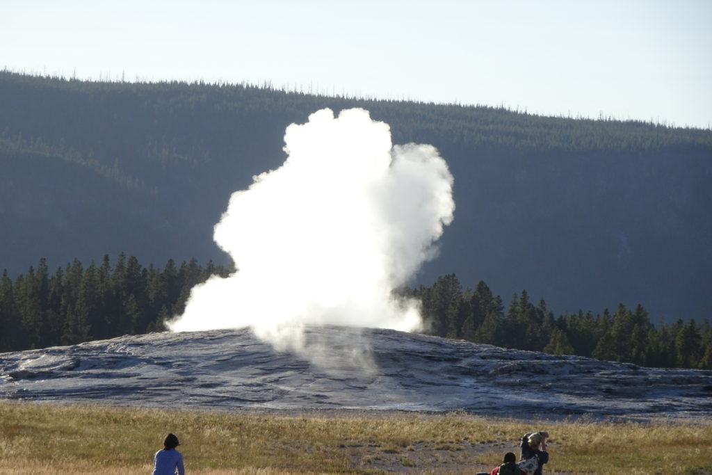
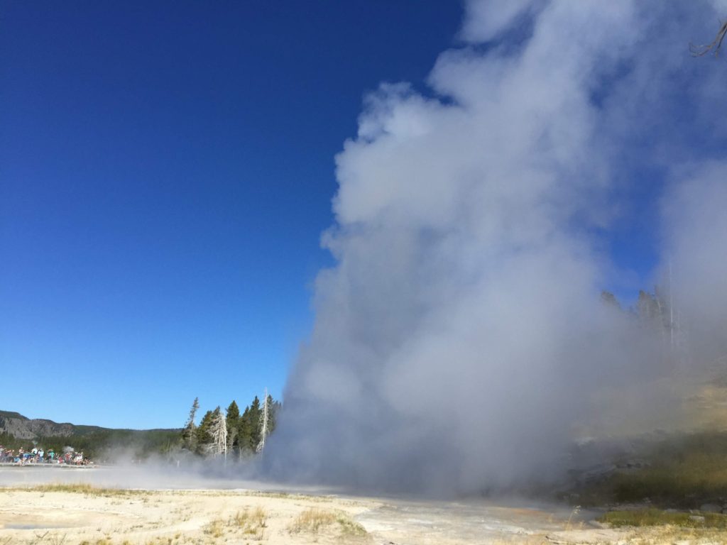
After our bicycle ride we decided to have supper at the Old
Faithful Restaurant. The dining
room has a porch that just happens to overlook Old Faithful. We hung out until the predicted
eruption window had passed with only a few minor snorts. Since eruptions are occasionally small,
I figured that was all and went off to buy a few souvenirs. And so I caught only the tail end of
the biggest eruption of the day.
We returned to the campground in time for another ranger
program, again about the American history of the park. This time it was about the 3 government
expeditions sent to explore the park and report back. The landscape in the park is so bizarre that I suspect that
their reports were met with a healthy dose of skepticism.
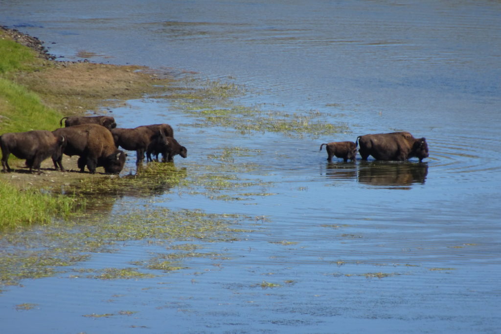
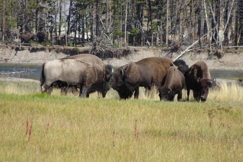
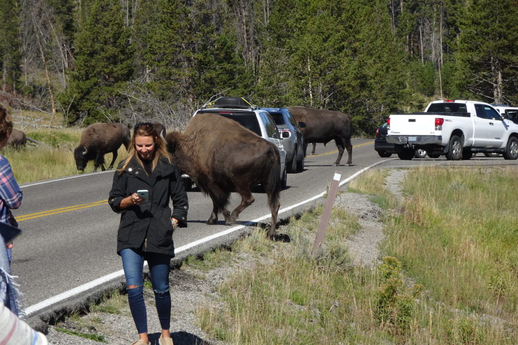
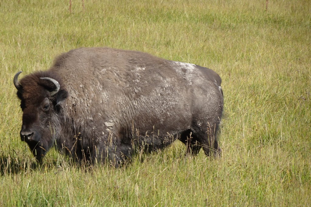
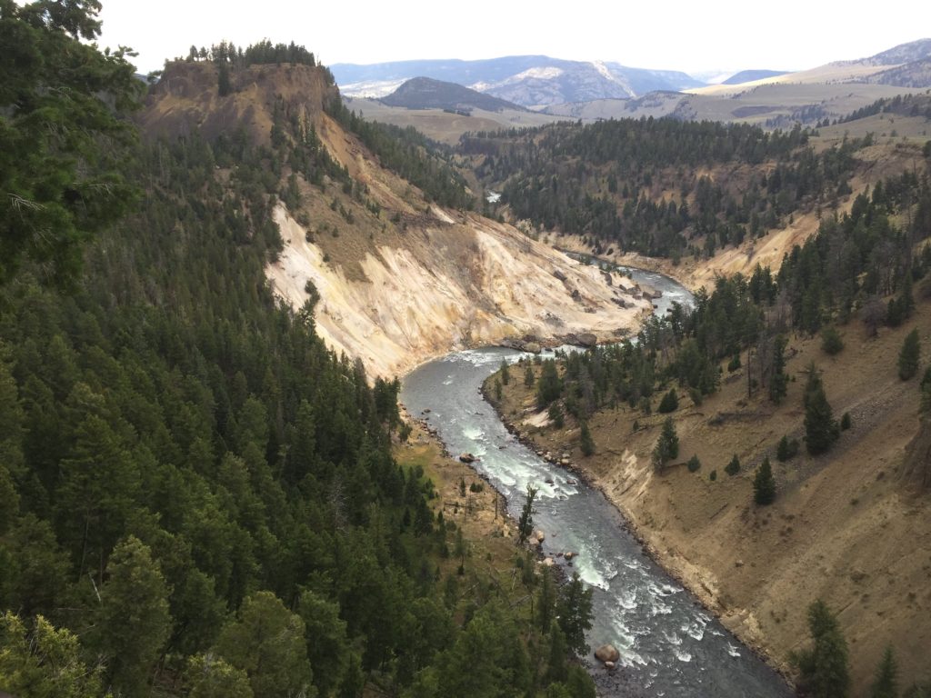
On Wednesday we headed to Yellowstone Canyon. Getting there took us through the Hayden Valley, which is the home of one of the large bison herds in the park. After our initial excitement at catching our first glimpse of a bison, we realized that we were going to see many more bison, much closer than expected.
We stopped with a group of tourists to watch a group of about 20 animals on the other side of the Yellowstone River. After about 20 minutes, we realized that the herd was crossing the river and following one of the bulls along a path that led directly through the group and the parked cars to the other side of the road.
This was the first of many bison traffic jams that we were part of. During the next 3 days we were frequently so close to bison that if we opened the window of the van we could have petted one (inadvisable as this would have been).
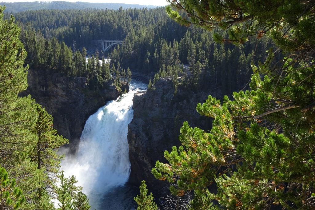
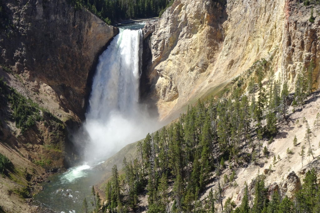
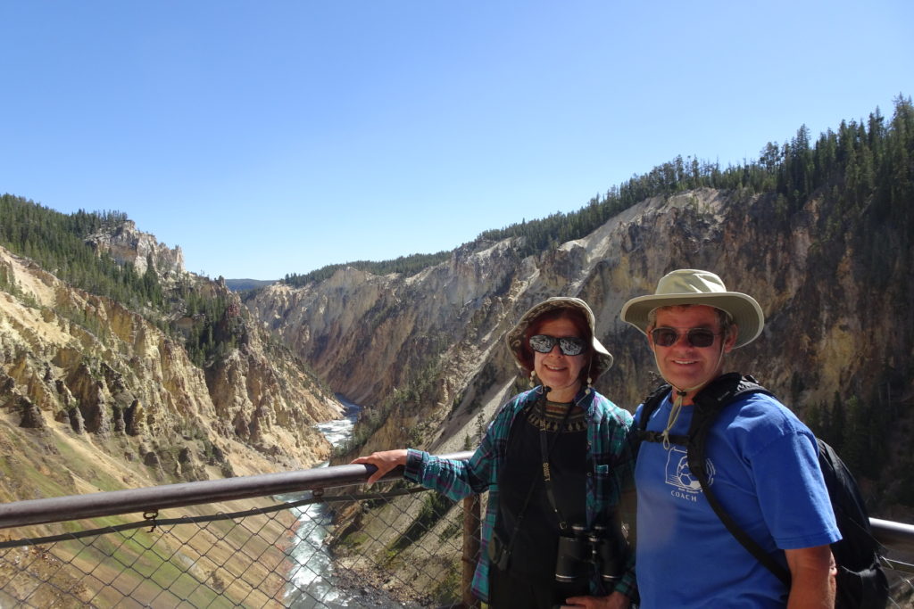
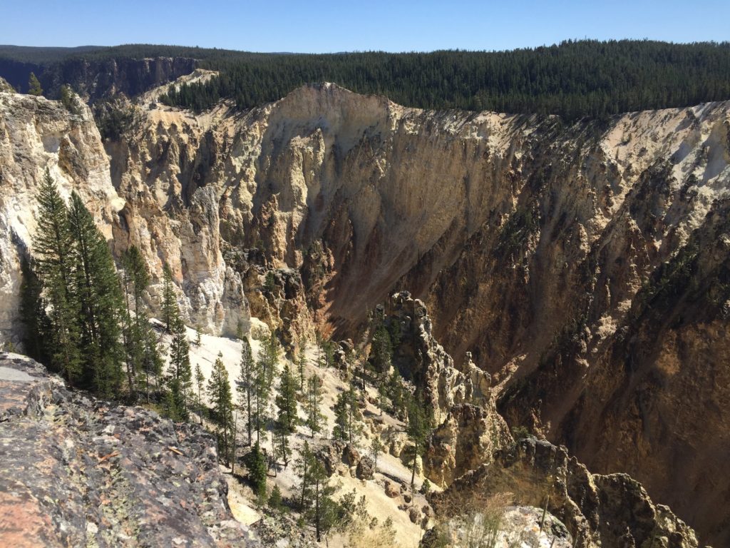
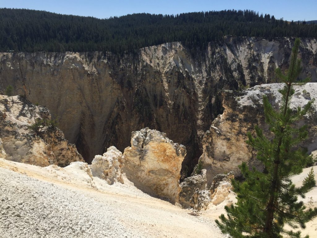
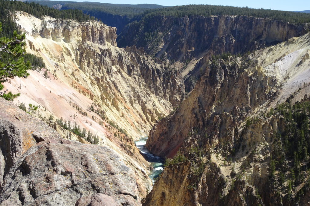
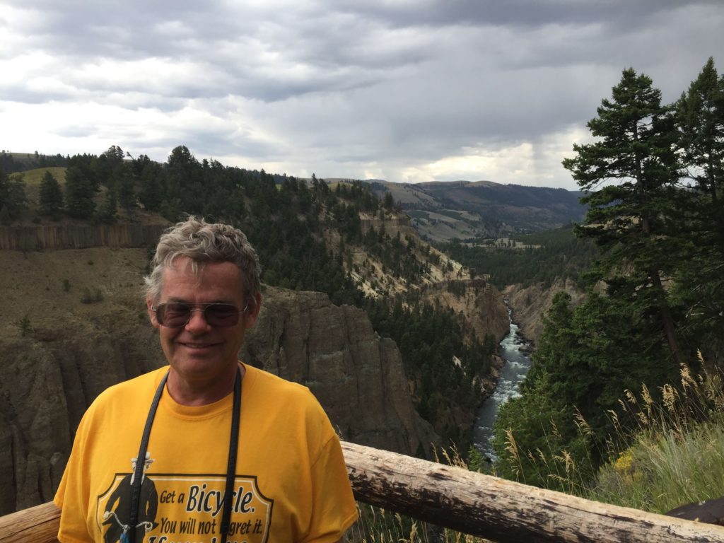
The Yellowstone Canyon is spectacular. (Have I over-used that word recently?)
upper falls
lower falls
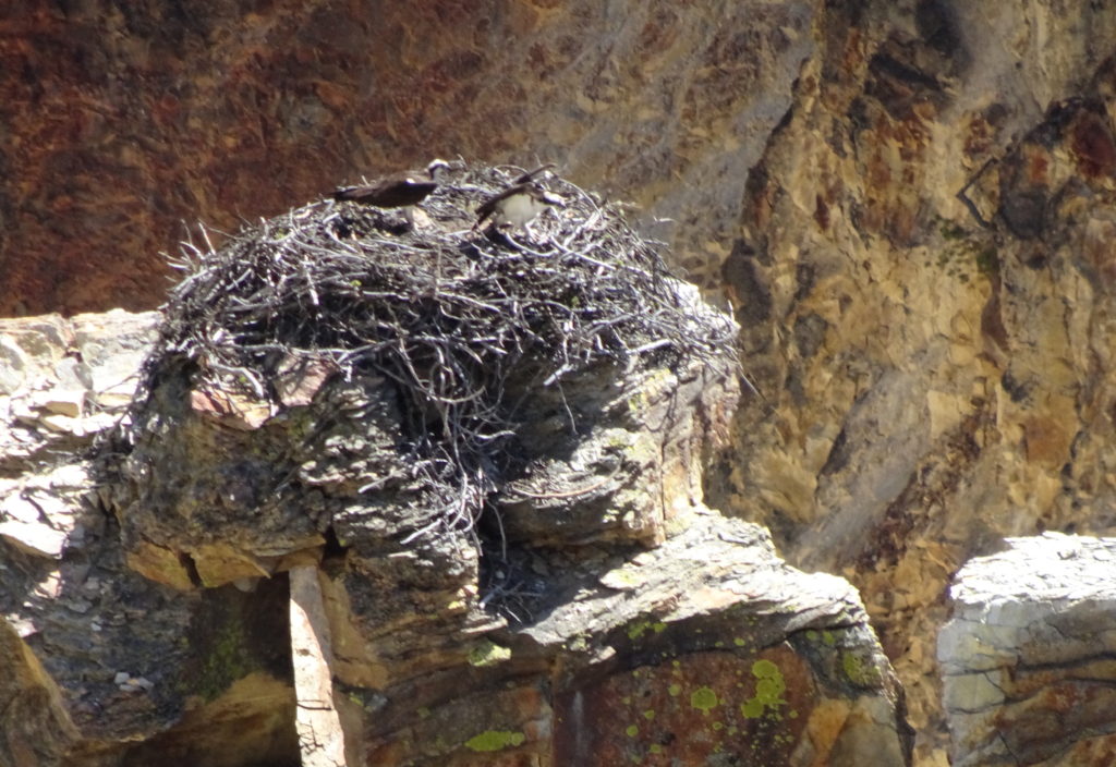
In some spots, fumaroles or hot springs break through. There are drives along both the north and south rims affording wonderful views of the waterfalls and canyon. At one point we looked down on an osprey nest and the nestlings.
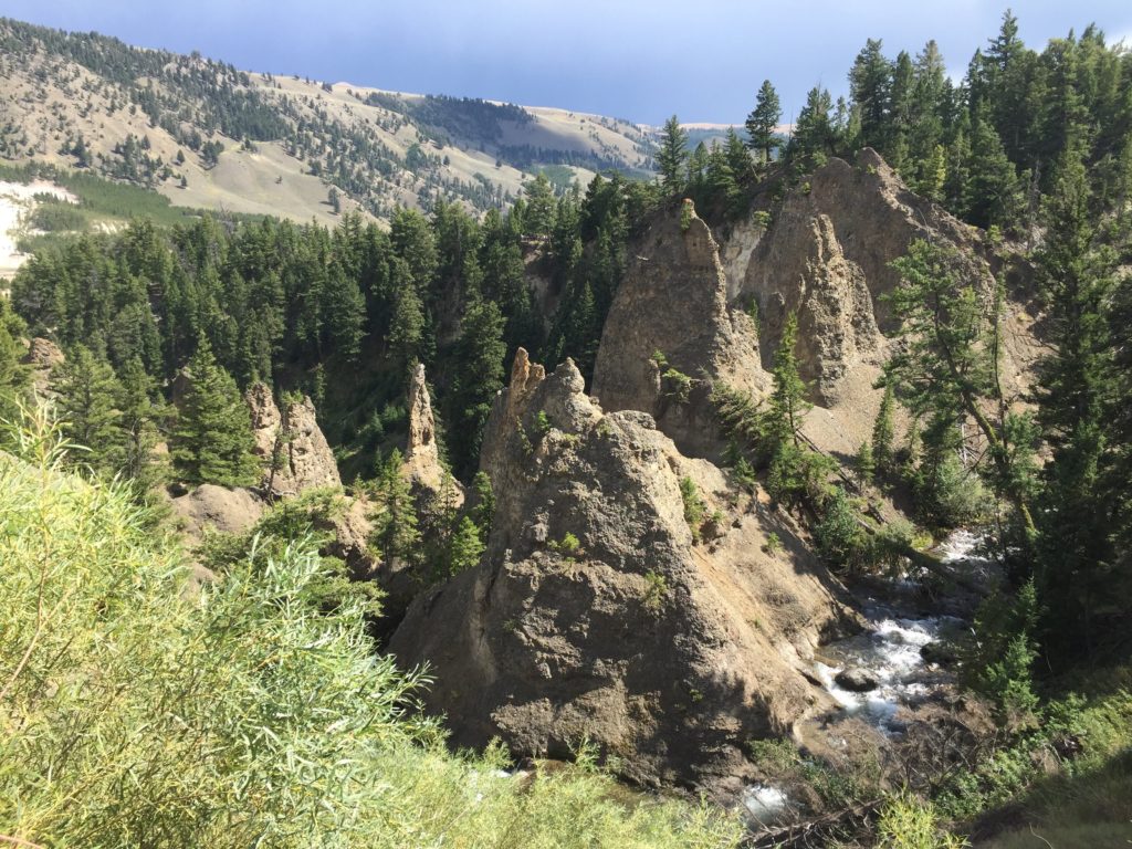
There are 2 large waterfalls. Below the lower falls, the river has cut fantastic shapes and spires through volcanic ash, creating a surreal landscape.
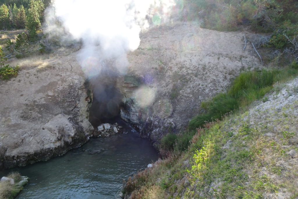
Dragon’s Mouth Spring
There are just too many interesting features of Yellowstone to see them all, or even start to describe the ones we did see. For example, Dragon’s Mouth Spring is a cave with a spring. Deep in the cave is a fumarole and the steam escaping from the cave makes a roaring sound.
The ranger talk for the evening was about wolves (and incidentally coyotes). We learned that wolves primarily prey on elk, and that the elk herd has been much healthier since the wolves were reintroduced. Winter is actually the best season for the wolves as the elk are bogged down in the snow, while the pursuing wolves just follow in the elk tracks. Apparently bison are just too smart and too aggressive for a wolf pack to handle. We also learned that grizzlies are not very energetic predators, preferring to chase off the wolves from their kills.
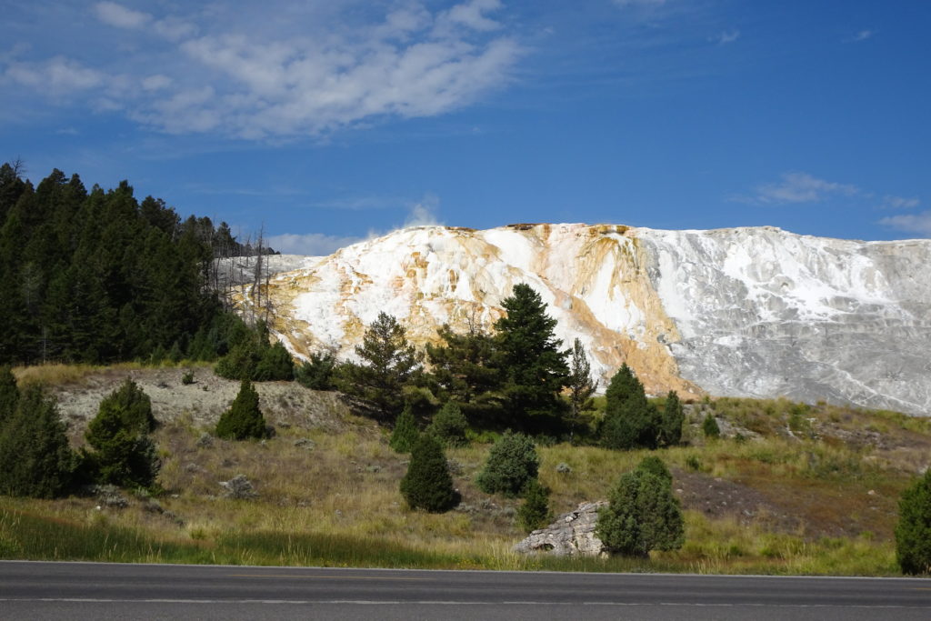
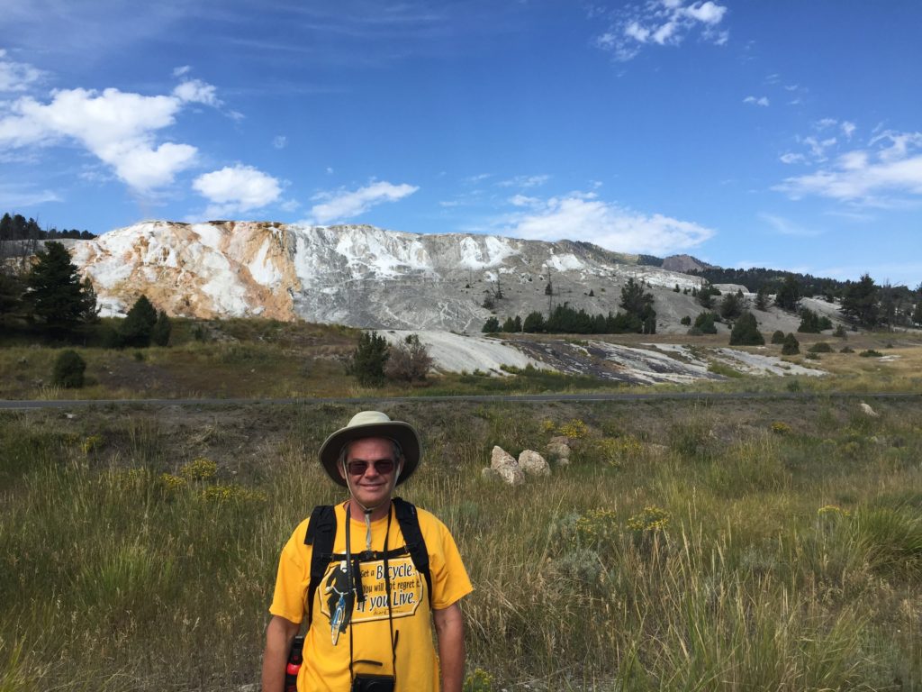
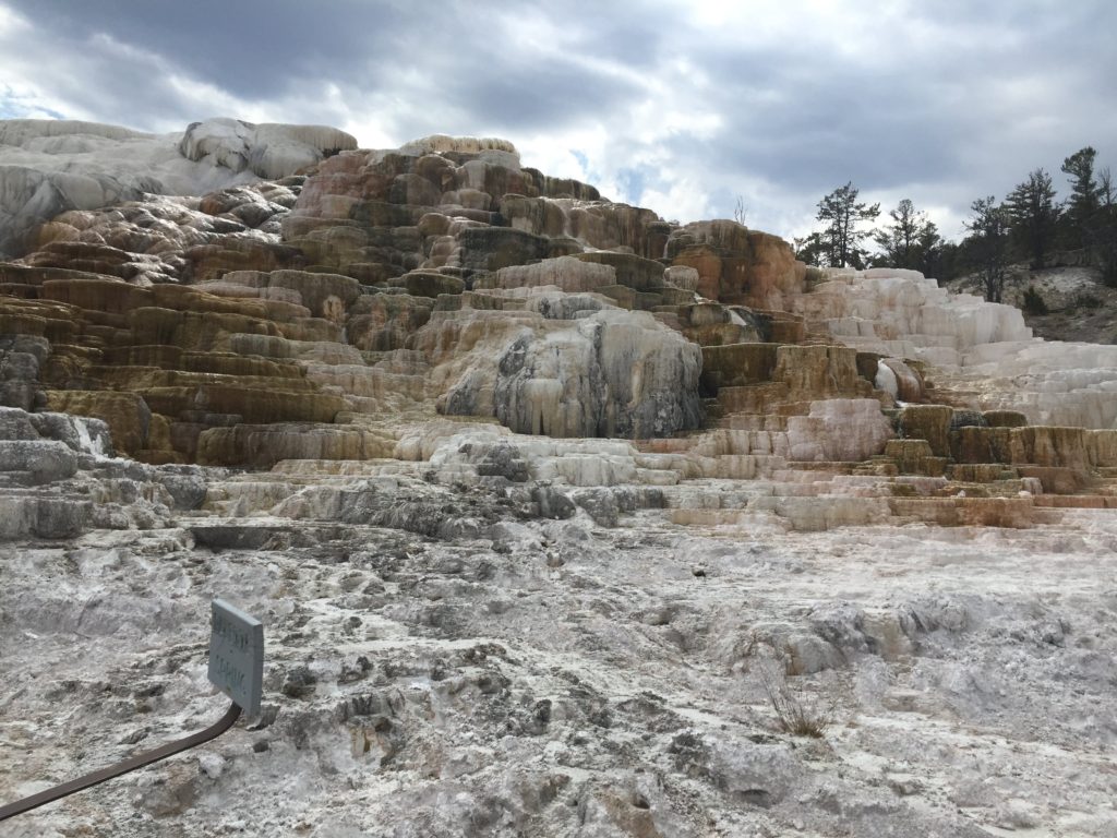
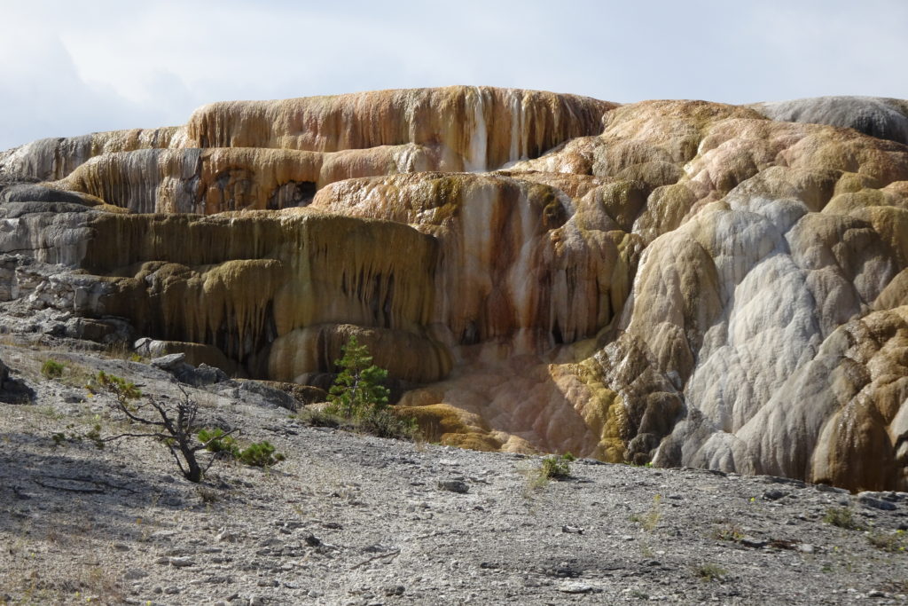
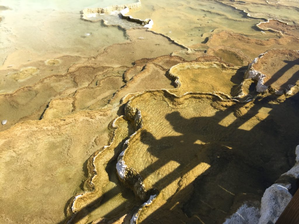
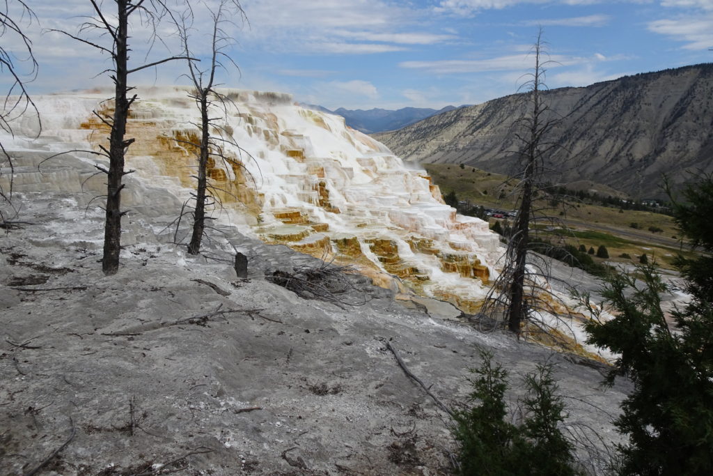
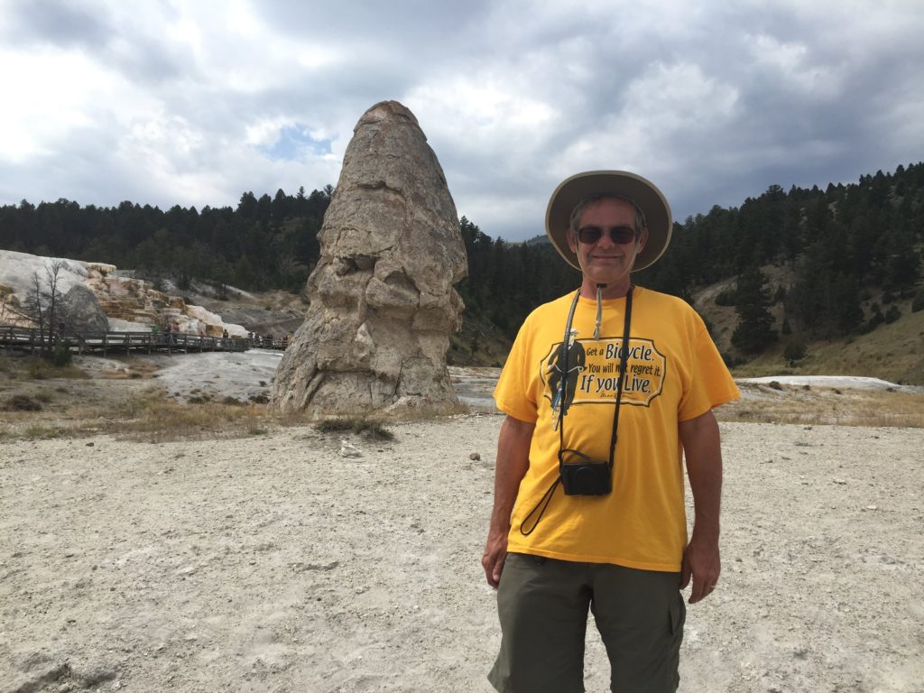
On Thursday we drove to Mammoth Hot Springs. This took us again through the Hayden Valley and its bison. Mammoth Hot Springs is probably my favorite park feature. The combination of mineral rich hot water and bacterial action created a huge terraced mound of travertine, some of it richly colored. We hiked several trails from the lower part of the springs, including a path that took us to the upper part. These trails circle around and up and down the entire mound.
Geyser core at Mammoth
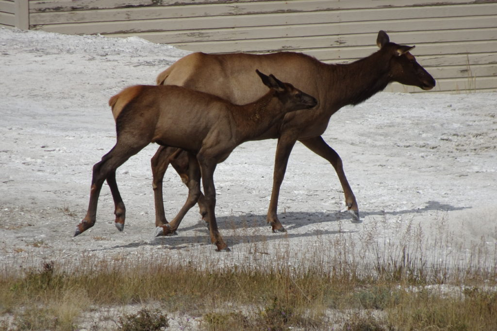
Elk at Mammoth
We also hiked the road around the upper part – a disappointing trek given that the most interesting features of the mile long circuit are just a few feet from the end.
We spent some time at the Mammoth Hot Springs Visitor Center, the only spot in the park with high speed internet. I had a tenure recommendation to file, and it definitely felt important to get it in on time.
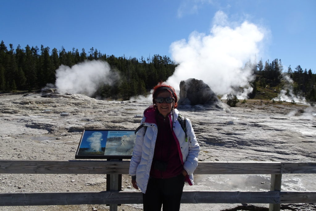
On the way back from Mammoth, we stopped at the Norris
Geyser field, to see the Steamboat Geyser, the largest active geyser in the
park. It has been going off about
twice monthly in the past year, and we saw only the smoking vent. Given more time in the park, we could
have visited many other Geyer Basins.
However, I suspect that interesting and colorful as they are, you have
to be a real aficionado to visit all of them with enthusiasm.
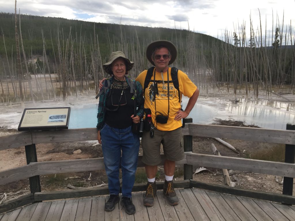
Cistern Spring at Norris
Friday was the start of the Labor Day Weekend. We decided not to try to prolong our stay in Yellowstone, as we would have needed a day or two to rest up before doing more sight-seeing. Instead, we decided to take a long day to traverse the Lamar Valley, where the park wolf packs hang out, and taking the Northeast exit out of the park. This meant again wading through the Hayden Valley bison herd.
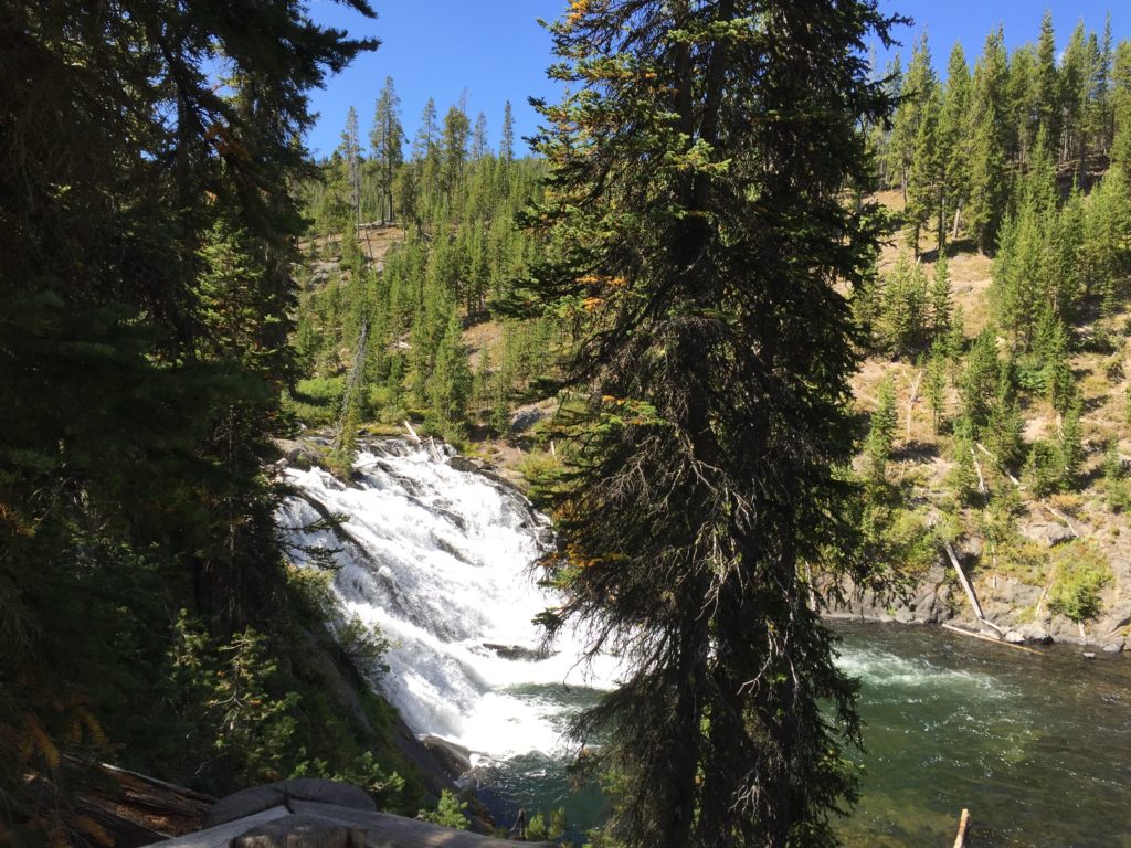
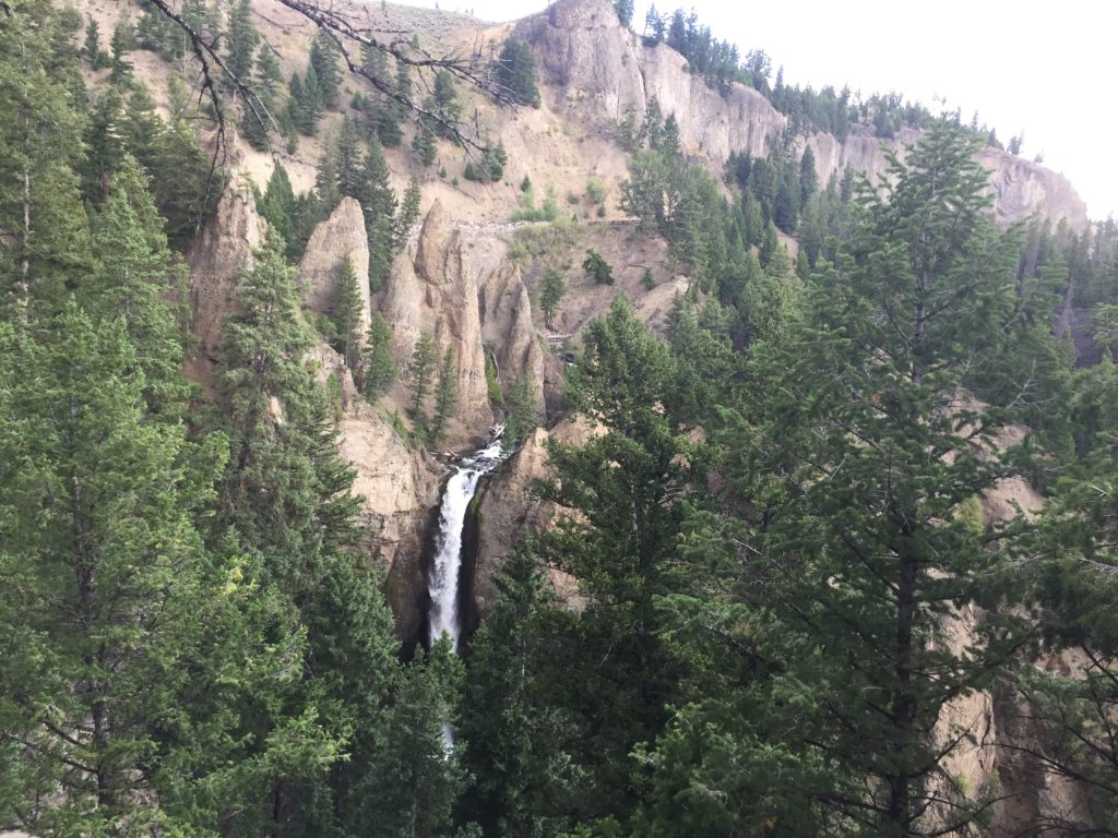
Before reaching the Lamar Valley, we passed Tower Falls, which reminded me of Taughannock in Ithaca, although the volcanic ash erodes in fantastic spires quite differently from the Ithaca shale.
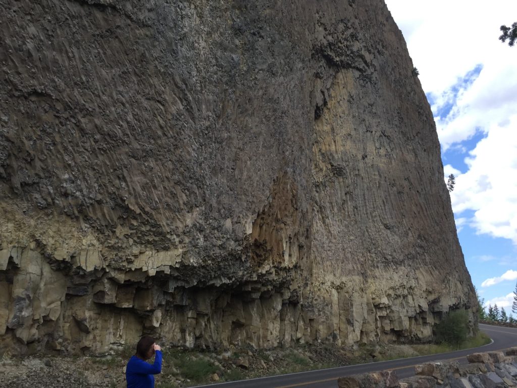
Before entering the Lamar Valley, we passed under this huge basalt wall which was created when molten lava was stopped by a glacier.
The Lamar River Valley is mostly grassland, with herds of buffalo and pronghorns. It yields to Soda Butte, which as lots of wildlife, but more interesting terrain. After Soda Butte, the Soda Butte River Valley again becomes grassland.
Soda Butte
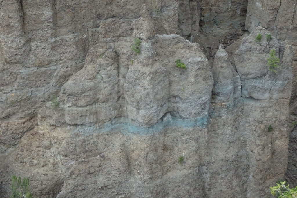
vein of blue clay in Soda Butte
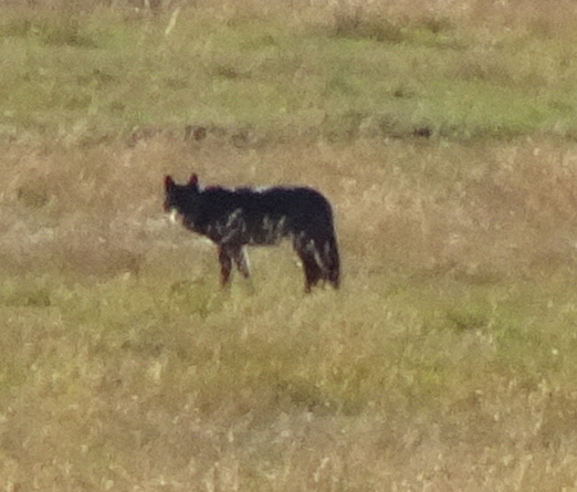
At some point we saw a small but enthusiastic group sitting
by the side of the road with tripods and big camera lenses. We learned that wolves had been seen at
the spot earlier in the day. As
well, a dead bison had attracted a mother grizzly and her cubs and they had
been seen the previous day. We
decided to wait around with everyone else.
It made for quite a long day, but we ended up chatting with a young couple who had seen a couple of wolves that morning. Because we were talking, we stayed much longer than we might have otherwise. And we were rewarded by spotting a wolf. The wolf stayed in the area for quite some time, and seemed to be worrying at something near the creek. However, even with binoculars and a telephoto lens, we could not see what it was doing. Since the ravens did not seem to be interested, it probably was not dealing with prey.
Once the wolf left the area, we did too. The grizzlies did not make an appearance. We just missed seeing a bear that was ambling near the road farther along, but the bear left the area as we were parking.
Road to Northeast Exit
We still had quite a distance to go to leave the park and get to Red Lodge, where we planned to spend the night.
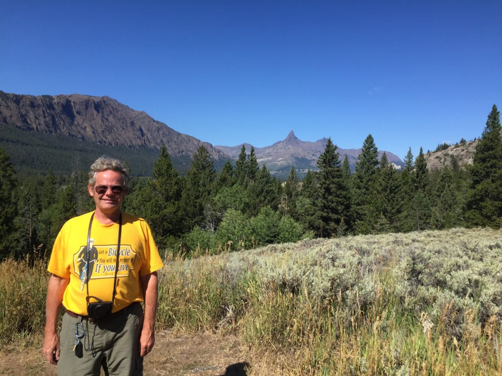
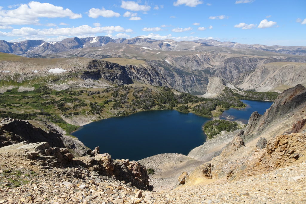
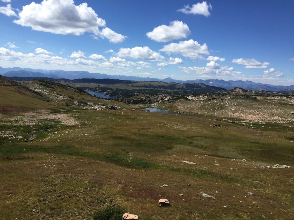
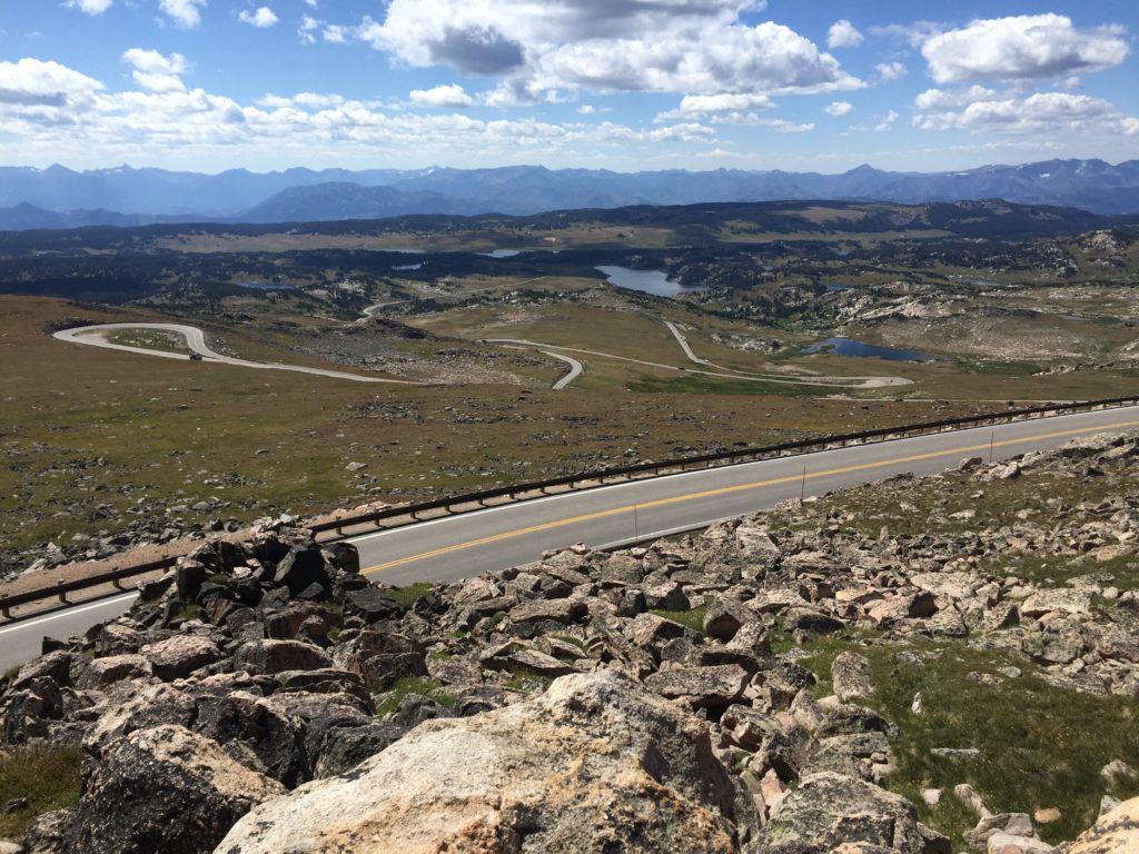
Tim suggested that we head for Yellowstone via the scenic Medicine Bow Pass and spend the night at Saratoga Lake, just outside Saratoga Springs WY.
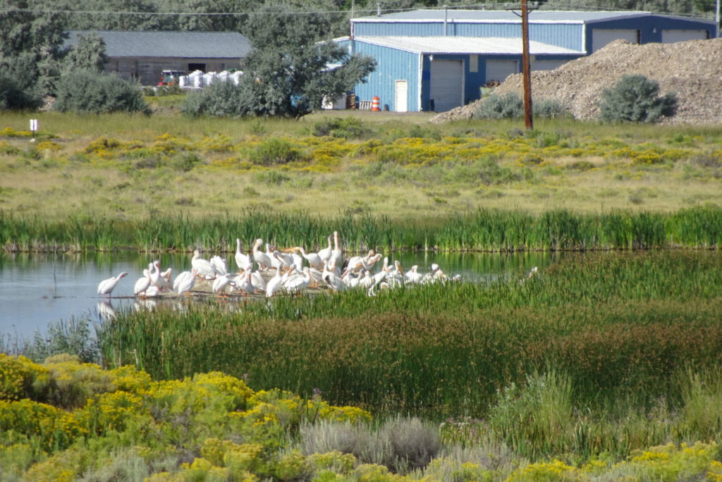
This is a lovely little restored wetland and lake with lots of birds and deer. There is a large flock of pelicans that summers here. We also saw many nighthawks — a bird that looks like a large swallow and comes out at dusk to scoop up the insects that congregate around the lake.
I
n the evening we went into town for dinner at the fancy Wolf Inn.
Life imitates art in Saratoga Springs
In the morning, we got up early and braved the bugs for a wildlife walk. Once we started walking, we kept going, under the incorrect impression that we could walk around the lake. However, after walking about an hour, we realized that the far end of the lake had a deep inlet that led to a river and that the closest bridge was quite some distance more. So we turned around. We met lots of fishermen, but no wildlife except the pelicans and some ducks.
After our walk we packed up and headed out through the Wind River
Indian Reservation towards Dubois, WY.
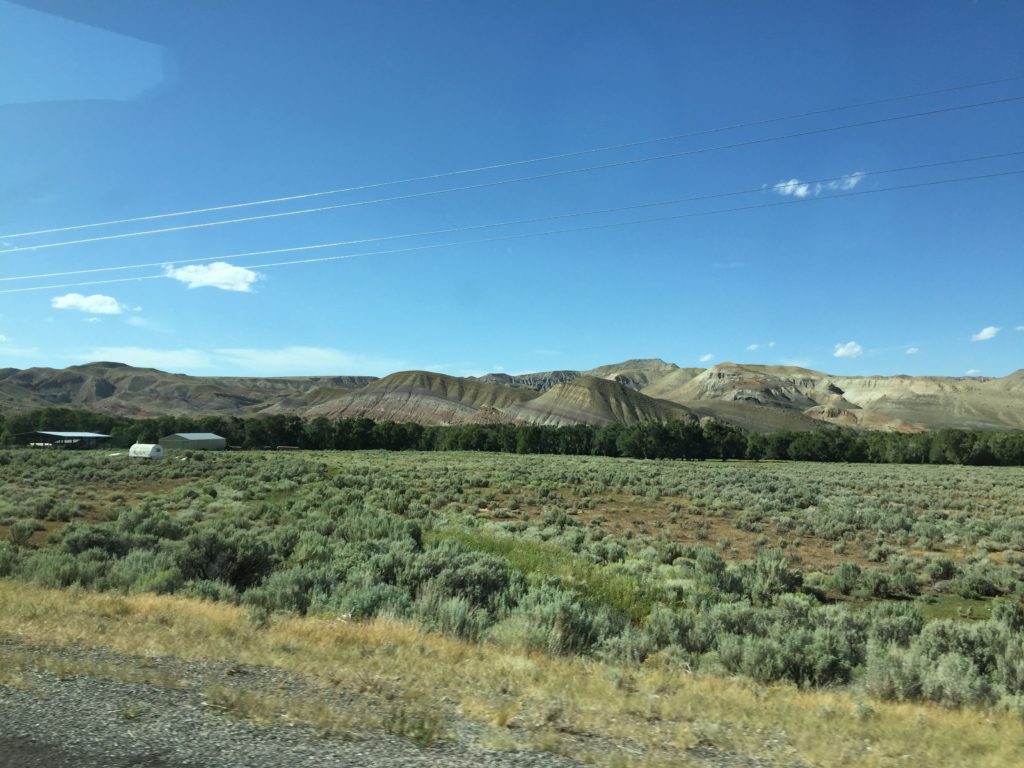
The route starts off as grasslands, but as you approach Dubois, the
terrain gets hillier and turns into badlands.
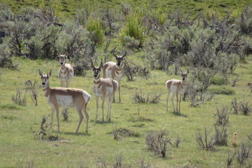
In the grasslands, we saw our first small herds of pronghorns. These graceful animals congregate in small herds. They are the 2nd fastest land animals (after the African cheetah) and it is thought they might have evolved with a fast predator, now extinct. An interesting factoid is that while they are good jumpers, they do not jump fences. Again, this is thought to be due to the lack of obstacles when they evolved. In any case, because of this, they are not a problem for farmers and are easily kept off roads. On the other hand, even low fences are an obstacle to their annual migration, and so special fences are being designed that will provide barriers to cattle, but allow the pronghorns to get through. Their instinct is to go around fences (which can go a long way in the plains) or try to crawl under (which can cause injury).
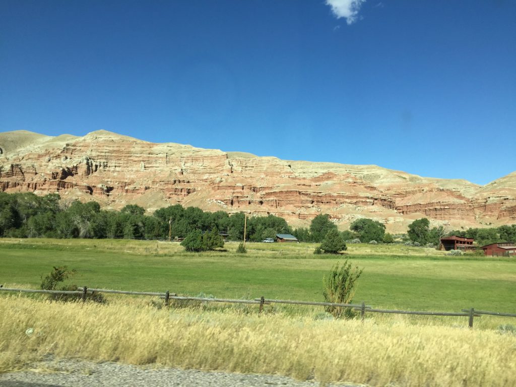
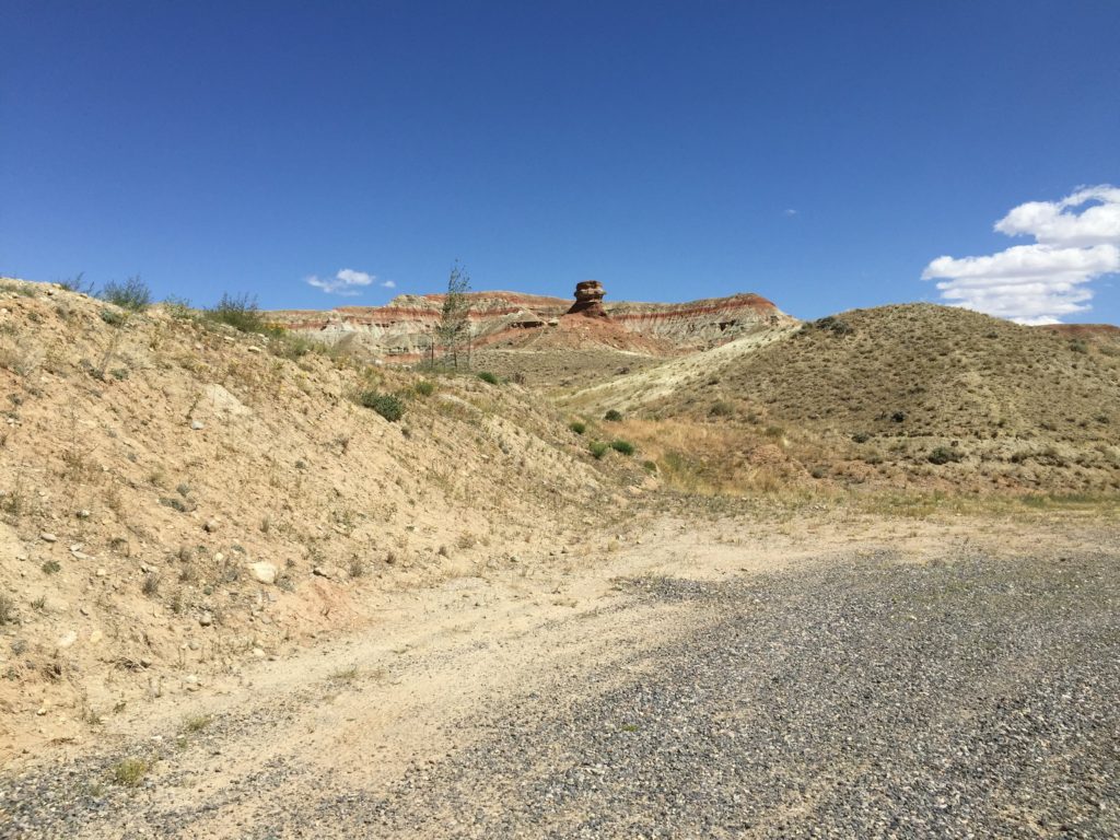
Approaching Dubois from the southeast, the badlands are to
the right– to the left are rolling hills. The first RV park you come to, Solitude,
is right amidst the most eroded terrain.
On the other side of town, the hills are lower. The KOA where we stayed was on the Wind
River at what appears to be the end of the badlands. We had a very nice river front site.
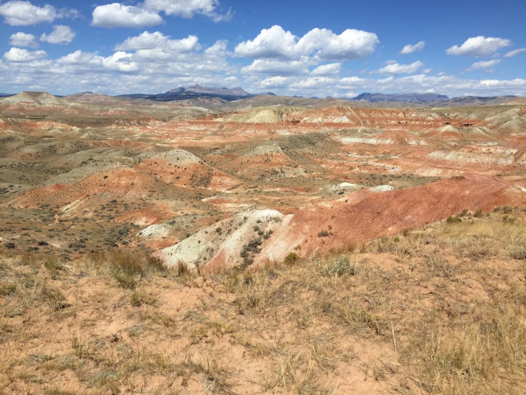
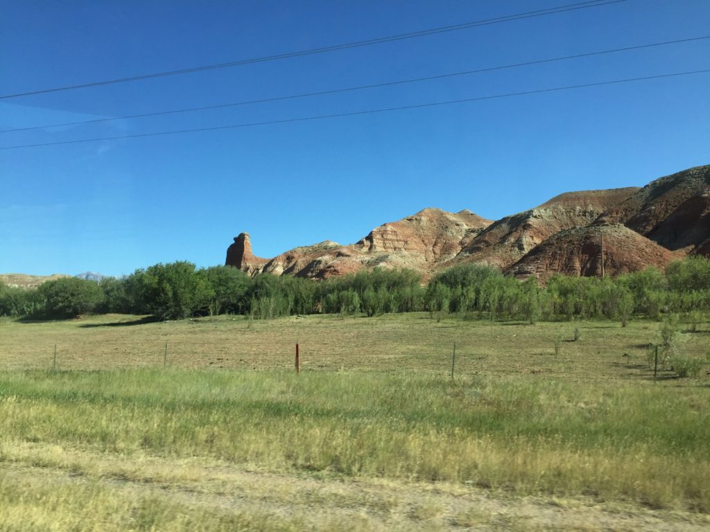
The next day, I took a bicycle ride through town and up into
the badlands. The wind at the tops
of the bluffs is fierce and I had to fight to stay on my bike. I was able to follow a backroad into
the Solitude RV Park and get a very good look at the eroded bluffs. I also rode along the back edge of
town. The view is over the green
fields and into the eroded bluffs – very scenic.
Chuck decided to ride over to the Bighorn Sheep Center on the other side of town. Once I had done with my ride, I joined him there. Besides the information about American bighorn sheep, they had an interesting display of mountain sheep from around the world. There is a sheep reserve near town, but we did not go to see it.
An interesting thing we learned is that there was a group of
Shoshone who lived on the sheep.
They eschewed the Plains Indian lifestyle, and remained in the
hills. However, once the Plains
Shoshone were (forcibly) relocated to the Wind River Reservation, they decided
to join their brethren.
We spent most of the remainder of the day, resting up for
our trip to Yellowstone.