
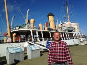
Halifax (Sept. 20)
Just before we left PEI, Chuck’s phone had a message that he had used up his roaming data. This is rather alarming, since we both use our phones heavily for everything from calls and text to weather and news. Chuck’s is a bit more heavily used, because he also dlownloads some video. In any case, since we plan to be in Canada for another month, this is not a good thing, and we delayed our departure from PEI to call Cricket Wireless to see what could be done and what the consequences might be.
This is the type of problem one does not want to take to the service personnel – i.e. something rare. After about half an hour we gave up. We will need to revisit the whole thing (and probably repeat the entire fruitless conversation) later.
The New Brunswick countryside looks a lot like northern Ontario, Maine, or for that matter, the less hilly parts of forested Pennsylvania. There is lots of moose country, and lots of moose warnings on the highway. One of the moose warning signs was flashing, so I went to the internet to learn what this means. We were interested to learn that there is a new moose detection system and a light flashes on the moose warning signs when there are moose between the fencing and the road. This system is also used for elk, and apparently has cut down on accidents where it is installed. If we hit a moose in the RV, the moose is likely to be much worse off than we will be. But in a car, the death of both parties is common, so cutting down encounters is a good thing. For better or worse, no moose were to be seen by us.
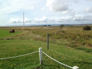 We entered Nova Scotia near Amherst. There is a very nice welcome center there overlooking fields leading to the Bay of Fundy, with a picnic area and interpretative signs for both the Bay of Fundy and Amherst. The Acadian population of the area was among the first to be expelled by the British, and the town was burned to ensure that they could not return. Canadian history is no more pleasant than others.
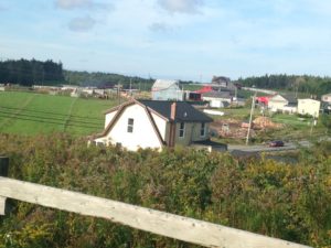
The road to Truro and on to Halifax is very pretty. It is mostly forested hills, and there are lovely vistas from the highway.
We arrived at the Woodhaven campground just in time to prepare for Erev Rosh Hashana (the start of Rosh Hashana). If we were home, I would be preparing a meal with friends. In an RV, the prepared foods section of the supermarket is the cook’s best friend. After a false start at a local supermarket (which turned out to be tiny and not well-stocked) I found a Sobey’s and bought a BBQ chicken, Chinese style ginger beef, baked beets, baked winter squash, a cranberry/blueberry salad, chocolate cake (honey cake would be more appropriate, but happily for Chuck it was not available), baby potatoes, apples and sour dough bread. (Challah would have been better, but you cannot have everything.) We used the honey from Daniel and Caleigh’s wedding for our apples and honey, and the blueberry wine from Fredericton (both of which were more meaningful than our usual fare). I did not think it would feel like Rosh Hashana, but it did.
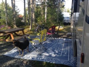 The next day was a lovely day. Our campsite is wooded and mossy enough to feel like we are in the woods, and our feeders attracted several blue jays, chickadees and nuthatches.
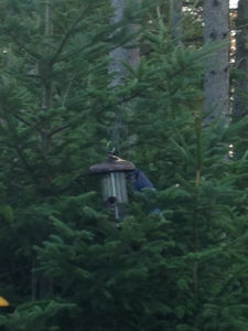
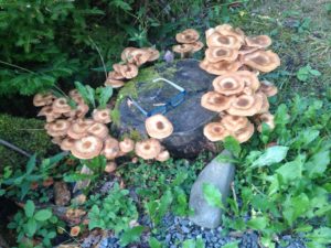
 The mushrooms are coming up in droves. Chuck needed to work, and I needed to finish off some recommendation letters. So, we stayed around the campsite and enjoyed the ambience and the bucolic views. This also gave me time to make a zucchini kugel for our second Rosh Hashana meal, along with the left-overs from the first night.
 On Friday we drove the “Lighthouse Drive” towards Peggy’s Cove, a pretty fishing village and artist colony. We were discouraged from taking our kayaks due to the wind and fears of big ocean swells. We did not realize the extent to which this coast is sheltered by small islands and long fjords.
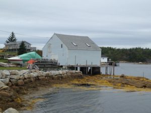
 The drive goes close to the coast at many places. Where it does not, there are side roads, but many of these lead to small villages rather than to scenic vistas. However, there is plenty of scenic shoreline. This picture that looks like a boardwalk was taken at a weather beaten old hotel – that was gorgeous inside. We were looking for a snack, but their kitchen was not open for business.
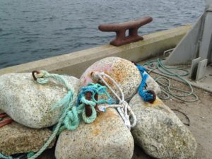
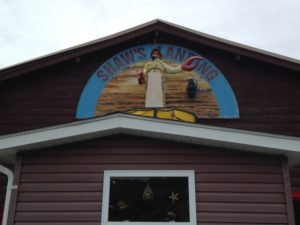 We stopped at a scenic cove, Shaw’s Landing, for lunch on the restaurant balcony. It was quite chilly, but we try to eat outside when Rumple is with us, so he does not have to stay in the car. The restaurant is right on the cove, with a great view. I enjoyed the blending of colors of the houses, the boats, thebuoys,
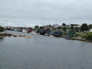 the ropes and the seaweed. I also like the way bolts were placed into these rocks to make what I assume are weights for fishing.
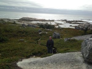
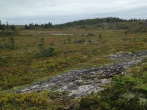 As we got closer to Peggy’s cove, the scenery changed and began to look very alpine, with large smooth exposed rocks, heathery growth, blueberry bushes (which proved to be laden with over-ripe berries) and mosses. The glaciers of the last ice age scoured this shore down to the bedrock, and soil has been slow to form, creating this barren but beautiful landscape. We stopped for a hike on the barrens and down to the sea.
The glaciers also picked up and moved enormous boulders, several of which appeared to be balancing precariously on the bedrock, although clearly this one had been around long enough to accumulate a crown of plants.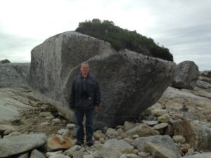
 As we walked, we were joined by Kia, a young woman with a passion for kayaking. She had seen our kayak racks and wondered if we, like she was, were in Nova Scotia for a workshop on ocean kayaking. It turns out that she knows the person who makes the kayak sails and we had fun discussing kayak sailing and surfing.
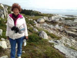
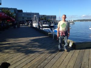
OK, my hair was out of control that day, but it was just as cold and windy as it looks here. I was wearing my winter jacket, and glad to have it.
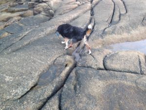
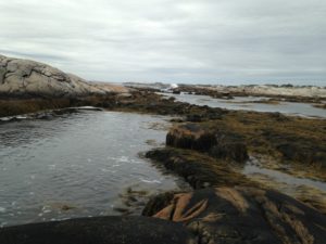 The tidal pools were filled with Irish moss. Rumple still does not understand the concept of dense water plants, and ended up taking an unexpected swim. I am sure he was shocked not only at being in the water, but also at the taste of salt.
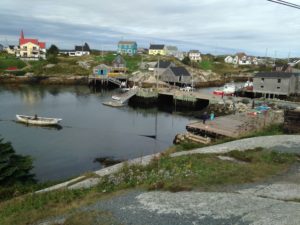
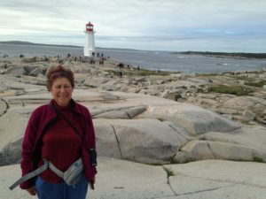 I was last in Peggy’s Cove about 20 years ago, also in the off-season. My friends and I were the only people there. Now, despite the chilly weather, the place was overrun with people, tour buses and just general activity. People come for the scenery and the lighthouse.
 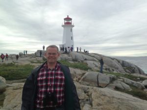 Other than that, there are a few homes (it is still a working lobster fishing village with a year round population of less than 40), art galleries, and restaurants. Peggy’s Cove is a national preservation area, which limits development.
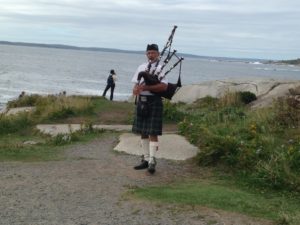 After parking near the famous lighthouse, one is greeted by a bagpiper. This is pretty common at Nova Scotia tourist sites and is a tradition that Chuck and I like.
 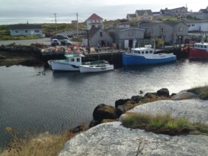 We clambered over the rocks and around the lighthouse and enjoyed the scenery and waves before walking through the town and a few souvenir shops. I am pretty sure the colorful lobster traps and boats at the dock on the right were there during my last visit 20 years ago!
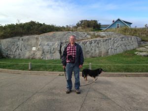
William deGarth was an artist who settled in Peggy’s Cove in 1955. His property included a large outcropping of granite which he used to carve a Fishermans’ Memorial out of the living rock.
Since, we still had lots of left-overs, and the tourist businesses in Peggy’s Cove roll up shop at 5:00, we headed back to the RV for dinner.
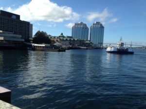
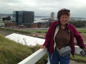
On Saturday we headed into Halifax. The road takes you right along the long Halifax harbour, past the shipyard and one of the two container freight harbours.
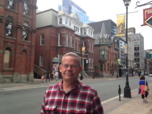
 Downtown Halifax is squeezed between the Halifax Citadel and the tourist harbour. We started our walking tour at the Old Burial Ground, the oldest cemetery in the city, which includes a Crimean War Memorial.
 At this point I was reading book 3 of the Anne of Green Gables Series, Anne of the Island. Anne has left PEI to go to university, and is going to a co-ed university in a city. She goes for a walk in an old cemetery – and Montgomery exactly described this burial ground as well as some other sites we saw! So I surmise that Anne went to the local university, Dalhousie, which at that time had most of its campus downtown and was the only co-educational university in Nova Scotia. It can be a great pleasure to read literature while you are visiting the actual setting!
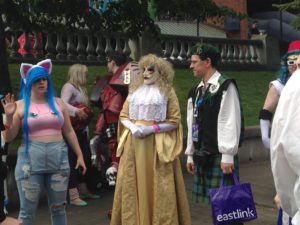 We wandered around the historic district for a while, and then came to The Grand Parade, a paved park between St. Paul’s Church and the City Hall (the original Dalhousie University Building). Hal Con was taking place, with lots of people in costume.
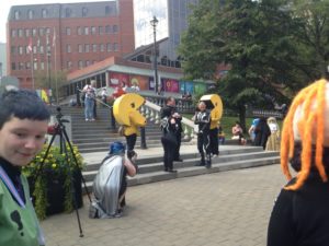 Unlike the previous day, this was a very warm humid day, but one must suffer in the name of art, I guess. Certainly the Star Wars Storm Troopers and many others were encased head to foot. We stopped to watch a very public “renewal of vows” of a couple dressed as characters out of Tron, with a pair of PacMen (or maybe PacWomen?) attendants. For the rest of the weekend, we saw people dressed up and wandering the streets.
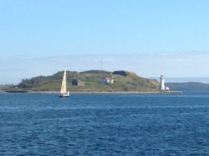 We walked a couple of blocks down to the harbor, and walked along the boardwalk. There is a good view over the harbor to George’s Island (which is also described in Montgomery’s book.) George’s Island was where the Acadians were interred before deportation, and also has a fort and a small lighthouse.
 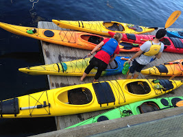 It is a popular landmark for kayakers to circumnavigate, but no-one is allowed on the island.
 The Halifax boardwalk goes about 2.5 miles along the waterfront from Pier 21, which is the current cruise ship harbour, farmers’ market and immigration museum, through a restaurant and shop district, past the Marine Museum and on towards the office buildings of the non-historic downtown.
 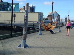 One feature I liked was the set of hammock stands below. Only one hammock was up, but it would be quite feasible to bring your own to have a restful spot on the boardwalk.
It was too late in the day for us to see the Marine Museum, but we looked from the dock at the two historic ships. The one in this photo is the HMS Sackville a WWII Flower-class corvette. (I don’t really know what that means.) However, her task was to be on the outer edge of convoys of warships sailing across the Atlantic. With her blue and white paint, she provided camouflage for the other ships.
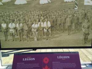 There were also a series of historic plaques commemorating various local people and/or troops. I was taken by this photo of a WWII Jewish legion – particularly as the Maritimes have a very tiny Jewish community.
Of course, there was the requisite Canada 150 sculpture.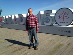
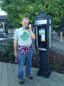
Something that you see fairly frequently in Nova Scotia is the device at the left. Does anyone under the age of 20 actually know what this is? Cell phones became so ubiquitous so fast, that pay phones disappeared practically overnight in the US and Canada. Reception is good everywhere we went in the Maritimes, so I am not sure why pay phones are still around.
 We walked from near the Marine Museum to Pier 21, and then back to the other end, before returning the restaurant district to look for a place we could eat with Rumple.
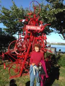
In Halifax, dogs cannot be on the restaurant property, even an outside deck, but if they can be just off the deck. We wanted to be on the water, and these constraints severely limited our choices. In the end, we ate at The Bicycle Thief. 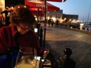 I have no idea where they came up with the name, but they do have this nice sculpture outside.
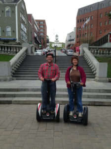
For Sunday we booked a 2.5 hour Segway tour of Halifax. As we were the only people on the tour, we had our knowledgeable and personable guide, Shannon, to ourselves. We revisited some of our previous day’s walk, including a sculpture Chuck liked consisting of 3 contorted street lights. (I forgot to get a photo, but you can see them here: http://www.bucketofblood.info/#/the-way-things-are-sculpture/) Apparently the dock on which they reside had been quite dark and was a favorite spot for drunk college students. The city commissioned a student at the Nova Scotia Crafts and Design School to improve the area. The 3 lights are a prone drunk and his/her drunk but still standing companion, and the 3rd light is call “The Call of Nature”. It used to feature a small fountain shooting a jet of water into the bay – unfortunately, too many people were taking pictures while emulating it, and the fountain had to be turned off. Now the third light looks much like the standing drunken companion.
From there we could look out on George Island. We also learned that 139 cruise ships visited Halifax harbor this year. Given that the cruise ship season is only about 6 months (although the harbor is ice-free all year) that is almost a ship every day. At dinner the previous night we had watched a small cruise ship depart, lights ablaze. On this day, a much larger cruise ship had come into the dock.
From there we went back to the cemetery and then on to Halifax Public Garden.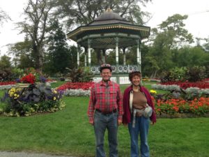 The garden is still in full bloom, or rather Shannon tells us that they change the display about once a week, working at night so that fresh plants are on display. The Garden, which is right downtown, is a National Historic Site. The reason for this is that it was established in 1867 (Confederation year, if you recall)
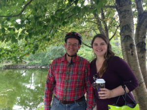 and has all the elements of a traditional Victorian Garden, including a pavilion and statuary.
Shannon was a fount of information, including the history of the current domestic pond goose, Diana, and how her goose buddy ended up in the veterinary hospital due to an unpleasant encounter with the pond’s snapping turtle.
 Shannon also took us to the Halifax Citadel, the old fortress. It was a lot easier climbing up on the Segways than by foot.She explained some things about its design and also the large masts, looking like ships’ masts, that were used to run signal flags – one mast for military flags and one for civilian.
 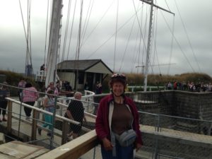 We also saw the schoolroom which was used by children whose families lived at the fort.
One interesting thing was the fort tailor shop. The uniforms were imported from Britain in pieces, and then fitted to the soldiers. Since these were Nova Scotian regiments, the uniforms included kilts (which are heavier than you’d expect) and heavy woolen coats. Even the informal uniforms were very hot and heavy, but the dress uniforms seemed terribly uncomfortable.
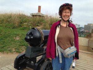
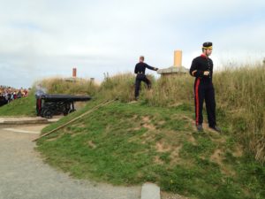 At noon daily, a salute is fired from one of the cannons. The procedure of loading and firing the cannon was explained in detail by one of the Citadel interpreters. One interesting factoid is that they used to fire 2 pounds of gunfire but this was loud enough to trigger car alarms in town between the fort and the harbour (which is the historic tourist section of downtown). So, now, only one pound of powder is used. The fort itself is dug into the hilltop, so the sound is absorbed in the other direction. In fact, the hill absorbed the impact of the great Halifax Explosion of 1914 saving the buildings behind it.
On the way back down, we saw The Pearl, a modern glass apartment building with an amusing history. The Saudi student who came to Dalhousie to study architecture was unable to land a position in an architectural firm after graduation. So he leaned on his father, who fronted the money for the building, where he now lives in the penthouse suite, renting the remainder. Whatever the entire story, it is the most pleasing of the modern downtown residential buildings in my opinion, so the local architecture firms missed an opportunity.
With the tour over, we headed to the Farmers’ Market on the pier for lunch. There were a lot of tempting goodies that had to be bypassed so that I could have a donair and Chuck a chicken wrap. We bought some blueberries and pumpkins seed snacks which we left at the car, and then went to the Maritime Museum.
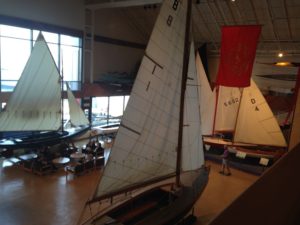 The Museum had the usual collection of boats, models, etc, a magnificent Fresnel lens from a lighthouse, and two special exhibits, one about the Halifax Harbour Explosion and the other about the Titanic, which sank not far off the Labrador coast.
In 1917, Halifax Harbour was a flurry of war-related activity. On the morning of Dec. 6, the ship Mont-Blanc was in the harbor, laden with ordinance bound for Europe, when (reminiscent of some recent collisions between civilian and US navy vessels) she was struck by the ship Imo, which was collecting relief supplies for European civilians. With the vessels burning in the harbour, many Halifax residents came down to the shore to view the spectacle. So, when the Mont-Blanc suddenly exploded, the largest human-generated explosion until Hiroshima, the loss of life was even greater than might be expected from a shock wave that lifted a woman clear off her feet and landed her half a kilometer away. Over two thousand people died, and many others lost their sight as they had been peering at the ship when the blast occurred. Pieces of the ship were like shrapnel. Big twisted chunks can be seen in the museum. There were some unbelievable tales of heroism, like the tugboat that set off to pull the burning ships away from shore (the boat was destroyed and all hands died) and the telegraph operator (who also died) who reported the incident, so that shipments of doctors and relief goods arrived within 6 hours (although the train tracks were lifted right out of the ground, so that the trains were not able to get right down to the harbour).
When the Titanic sank, the survivors were taken by the Carpathian to NYC, but the bodies that were retrieved were brought to Halifax for identification and burial. A system that was developed during the Halifax Harbour Explosion for handling and identifying remains was used. Most of the bodies that were retrieved were buried in local cemeteries, although some were taken by their families.
Mid-afternoon, Chuck interrupted these sad tales to return to the Segway place to have a look at the miniPro, a smaller cheaper version of the Segway. I thought that we might end up adding two miniPros to our load of recreational equipment, but we agreed that their usefulness was limited to cities where we might be better off taking a Segway tour. The tours also come with guides, who are usually knowledgeable, witty or both. So, we Segway ownership is not in our future.
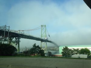 On the way back to the campsite, there were some rather interesting fog effects over Halifax Harbour. I took these photos of one of the bridges, which is closed for repair, and the shipyards, in which an Arctic exploration ship is being built.
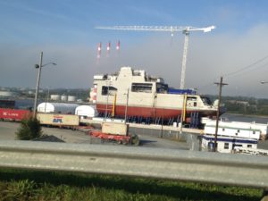
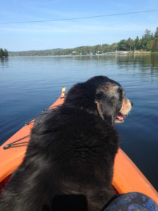
On Monday we spent a lazy morning at the RV and then headed out to the coast for an “ocean” kayak trip on one of the bays. Rumple clearly had not enjoyed his 9 hours alone in the RV the previous day, and whined piteously as we loaded up. Since there was no way to let him know that this would be a much shorter trip, we took pity on him and added him to our party.
Getting Rumple into the kayak has never been easy, and is getting harder. Getting me into the kayak when Rumple is already occupying the entire cockpit and trying to escape is also not easy, but we did manage to launch. Rumple stayed fairly calm when we were in the sheltered part of the bay.
Once we had a bit of wind, although there were no real waves, Rumple got pretty agitated. (He sounds a lot like Eeyore.) I am not sure whether this was due to the very slight chop of the water, or because Chuck needed to tack and so kept zigzagging to and fro. Although Rumple is definitely my dog, he prefers if both of us are around.
In any case, it was a very nice paddle, although we were accompanied throughout by the melody of Rumples brays. I am sure anyone in the vicinity wondered what we were doing to our poor mutt!
We hear from friends that it has been ridiculously hot in many parts of the eastern US and Canada. Here in Nova Scotia, the weather has mostly been perfect – some foggy mornings, but clear days with temperatures in the 70s.