Albuquerque (Nov. 7)
If you are a late riser like us, driving west is a problem. In the early afternoon, you find you are driving straight into the sun. The problem was exacerbated for us due to the change back to standard time on the weekend. We learned our lesson coming into Amarillo, and decided to leave very early on the way out. As a result, we were on the road by 8 a.m., stopped for breakfast en route, and were camped in Albuquerque in time for lunch.
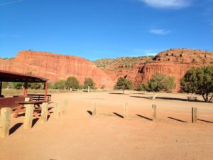
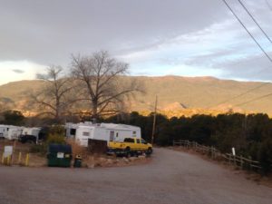 Our campground, Hidden Valley, is actually to the east of Albuquerque in the town of Zuzax, (love the name!) just east of the Sandia Mountains. There was not much space between sites, but the campground had a good view of the mountains, a nice lounge, free coffee and a large book exchange. (I ended up with 7 new books.)
Another problem of driving west, particularly with the end of Daylight Saving Time and a stubborn dog, is that we needed to turn our clocks back by 2 hours. Rumple’s attitude, of course, is that there is no need to adjust to an arbitrary clock. So he now wants his evening walk around supper time, and is quite disgusted that we do not want to head for bed around 9 p.m. On the other hand, at 6:30 a.m. he feels his morning walk is very overdue (and we are lucky that over the last few months he was getting up later – otherwise he would be feeling perky at 5 a.m.) Since it now gets dark at 5, and most museums also close around then, we would probably be better off following Rumple’s example. But of course we reset the clocks and our schedules.
My new habit has been to call up all the knitting places as we pulled into town, in the seemingly hopeless task of finding the 11 balls of yarn needed for Elisabeth’s sweater. Happily one store said they had 9 balls and another had 5. I decided that this was the best I was going to do, as even special orders would not guarantee a single dye lot.
In the morning, I drove into Albuquerque and picked up my 9 balls of yarn from one store and 3 (just to be safe) from the other. Astonishingly, they were from the same dye lot. The next day I decided I needed a bigger margin of error, so I picked up the last 2 balls. So, I ended up with 14 balls of yarn from the same dye lot and have been knitting away ever since. Anyone in Albuquerque who is interested in this particular yarn is going to be out of luck until the next shipment comes in.
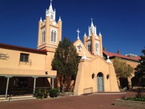
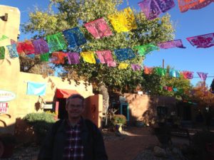
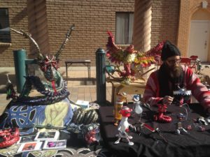
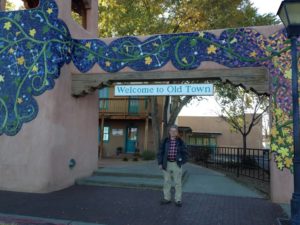 The yarn excursion took up the entire morning. For the afternoon, we visited the Old Town of Albuquerque. This is the oldest part of the town, built around the old plaza and church. The buildings all look very Mexican, and have mostly been converted to restaurants and tourist shops.
 We spent some time wandering around and admiring the old buildings, as well as dropping by the Tourist Information Center, where the friendly volunteers gave us advice about the local attractions.
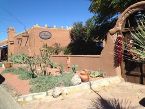
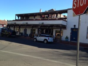 Decorating with strings of red peppers is definitely the thing here. As well, there are lots of small alley ways opening up to small plazas crowded with shops.
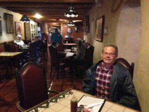
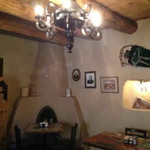
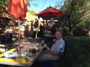
For lunch we went to a restaurant that is situated in what was once one of the oldest homes in the area. It was well worth it just for the ambience, as it retained the interior architecture and was beautifully furnished.
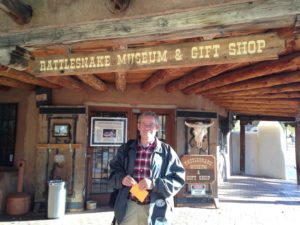
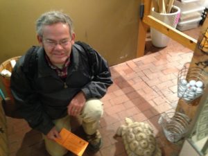
After lunch, we decided to go to the Rattlesnake Museum. As advertised, it was full of live rattlers of various types – we had no idea that there were so many types of varying sizes. Other wildlife – most other snakes and reptiles – were also featured, including a couple of tortoises that were always under foot. As well, they had a nice collection of art and artifacts with snake themes.
 By the time we were done, it was rather late to go to the Albuquerque Museum. (I was there for a conference, and it has a great art collection.) However, the museum gardens are open and free. They have a monument to the Spanish settlement of Albuquerque which is on a scale similar to the Oklahoma City Land Rush monument.
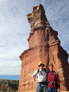
With a work day on Friday, we were eager to get back to sightseeing on Friday. There is a back route from Albuquerque to Los Alamos that follows Jemez Creek as it goes through the mountains and includes many scenic and historic sites. We decided to follow the route, stopping at sites of interest as we went.
We started out at the Coronado Historic Site and Kauau Pueblo archeological site. Around 1540, The Spanish “explorer” Coronado searching for the fabled (and non-existent) cities of gold, followed the Rio Grande with retinue of about 2500 Spanish and native American soldiers and arrived in the Albuquerque area. There he found several villages of Tiwa Indians. Whether willingly or by force, the Tiwas (whose villages, including women and children were quite outnumbered by the Spanish) fed and housed Coronado and his retinue. Eventually the Tiwas resisted. I do not recall all the details, but within a few decades, the Kauau Pueblo was abandoned until archeological excavations were started in the 1930s.
The Pueblo on the shores of the Rio Grande was apparently first occupied in the 1300’s, and there may have subsequent immigration and absorption by other groups, as evidenced by artifacts at the site. The site includes several kivas (underground ceremonial sites) of various designs. Visitors can wander along the trail going through the pueblo, but to visit the famous painted kiva you must go with a park docent.
 Due to a lull in the stream of visitors, we had a docent to ourselves. She showed us how artifacts are constantly rising to the surface, from pottery fragments to pieces of metate to shards of flint. She also noted several types of vegetation that grow wild in the area but that were very useful to the native peoples as foods, fibers and building materials.
The above ground buildings were all make of adobe and have been washed away over time. The outlines of the walls have been redone in adobe bricks as part of the exploration of the site, but the original walls were not build this way. One of the building has been reconstructed by archeology students using the original technique, which was to stack balls of mud. Once a couple of layers have been stacked, they begin to compress and flatten out. They were then left to dry and harden before the next layer was added. When the walls were finished, a layer of adobe plaster was smoothed over the entire shebang. The roof was constructed of branches covered by brush and then more mud. Apparently these structures could be built several storeys high. The individual rooms are quite small – mostly about 8′ x 8′, with smaller structures thought to be storage rooms, in some areas. I can vouch from the reconstructed building that the rooms stay cool even in the hot sun.
 One of the kivas is open for viewing. It is unique partly because it is square, rather than the traditional round room, and partly because the wall paintings were preserved. Apparently painted walls have been found in many historic kivas, but all were destroyed during excavation. The interior walls of this kiva were carefully deconstructed and moved to the Albuquerque Museum. Seventeen layers of paintings were found – apparently from time to time the old paintings were covered with a thick layer of adobe plaster and new paintings created. The paintings that can currently be seen are reconstructions of the originals from the last 2 layers.
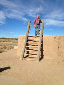
To enter the kiva, you climb on the roof using a wooden ladder, and then climb down through a hole in the roof using another ladder. In theory, Rumple could have entered the kiva, but the logistics dictated against it. I went down with the guide and a few people who had joined us. Chuck waited with Rumple and then went down with a different guide and the next group.
The interior of the kiva, besides being well decorated, had a number of interesting features including a ventilation shaft, guarded by a low wall, which also shielded the central fire pit and a small alcove meant for sending messages to the heavens. The murals depicted kachinas, eagles, various animals such as snakes, and rain. Apparently the symbols are known to the local Native Americans and are still considered sacred. Photos are not allowed. Our guide has clearly spent a lot of time contemplating the murals and pointed out features such as the commonality among parts of the mural and well-known symbols. It was quite interesting.
The interpretive center also had some artifacts from the Spanish occupation. One interesting set of posters was about Estevan, a Tunisian slave of a Spanish noble who might have been the first westerner to set foot in New Mexico. He survived a shipwreck and went on to become an explorer in his own right.
 Finishing at the Coronado Historic Site, we continued on to the Jemez Mountain Trail National Scenic Highway. Having bypassed the restaurants in nearby Bernallilo e hoped to find lunch at the next town San Ysidro. This tiny spot has only a church and a few houses, however, so we carried on to the Jemez Pueblo. This village is situated in a gorge of bright red sandstone which make the red soil of PEI look faded. We did not go into the town, which appears to be residential, but a roadside service station served a very palatable lunch which we ate outside while admiring the scenery.
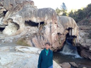
Carrying on from there, we discovered that Jemez Creek cut this very interesting “hole in the rock” waterfall. One interesting feature is that the rocks (including the one I am standing on) are covered in flowstone such as you usually see only in limestone caves. I am not sure why this occurs, but it seems that either the waters of the creek are very mineral rich in this area, or that there is a local deposit of soluble limestone that is quickly redeposited.
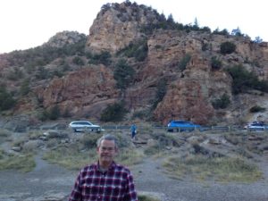
 It turns out that the entire area through which the trail wends was formed by successive episodes of volcanism. The mountain range is actually the outer edge of a giant calderon. There is a road to the interior of the calderon, which makes this more apparent, but we did not have time to explore this.
We then continued up the road to the next geological site, which is called Battleship Rock, and is another layer of eruption rock. We did not stop for a photo, but there is a good one at this website. http://www.jemezmountaintrail.org/Jemez_State_Monument.html
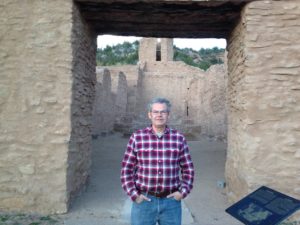 As it was getting late, we decided we had time for only one more stop: the Jemez Historic Site. This is the site of a Spanish Mission, and includes the old basilica and an art gallery.
With sunset around 5:00, we reluctantly turned back to Albuquerque to avoid being on twisting mountain roads after dark.
However, our adventures for the day were not yet over. While looking for a restaurant for lunch in Bernalillo, Chuck had read a review of the Range Restaurant and decided we needed to go there for dinner. It was a very interesting choice. Bernalillo is not exactly a tourist hotspot, but there in this quiet suburb is this very popular restaurant, wildly decorated with local art. As well it is attached to a large New Mexican artisans’ store. To avoid waiting in line for a table, we decided to sit at the bar. This was a fortuitous choice for two reasons.
Firstly, it turned out that the dessert station was literally right in front of us. Although I am sure they had a pastry chef in the kitchen, the final flourishes to the desserts – swirls of chocolate sauce or whipped cream, sliced fruit or whatever – were prepared right on the counter where we sat. We got to watch dozens of desserts laid out as we ate.
Secondly, the owner of the store plopped down beside us and proceeded to tell us how she had known some of the great pueblo potters and artisans while growing up, had moved away and then returned a few years ago to assist her aged mother with the shop. I still cannot see how this shop can remain in business away from the main shopping area of Albuquerque but both it and the restaurant seem to be well attended.
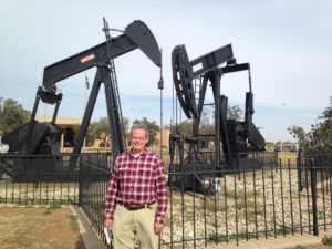 The Permian Basin Oil Field is the largest oil repository in the continental US. Everywhere one looks there are nodding donkey pumps, like the ones shown here in front of the Petroleum Museum. This particular set of 3 there is a very small pump between the 2 larger ones) is interesting because all 3 pumps use the same shaft, but draw oil from different rock layers. Our understanding is that the pumps are driven by electric motors, and that the oil is directed by pipeline to a central repository.
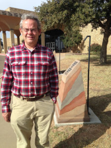 We found the Petroleum Museum interesting, but definitely directed at school children, with lots of information about how to get a job in the oil industry and interactive displays. There was some geological information about how petroleum is formed and deposits are trapped. I like the way that these historical markers outside the museum depicted the geographic strata as part of the marker.
 Since the buffalo and prairie dogs were pretty much eliminated, the plant life of the region has changed. Mesquite bushes like those in the photo used to be sparser. However, the cattle eat the leaves and seed pods, and spread the seeds (well fertilized by manure) and so the bushes have spread. Mesquite is a legume, so it adds nitrogen to the soil. Various other plants and lots of birds and mammals thrive. Apparently prairie dogs are returning to the area, along with their predator, the black ferret, as farmers now recognize their value in maintaining the ecosystem.
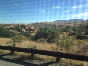 W
W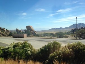 e started by retracing our path to Las Cruces and then carried on to Texas. One thing that struck us during this part of the trip was that there are many large farms near the highway, with hundreds of cows. We think these are dairy farms, both because the animals are the classic black and white and because they are mostly corralled and eating from troughs. The countryside looks very dry to be supporting a dairy industry, although east of Tucson there is less cactus and more scrubby bushes.
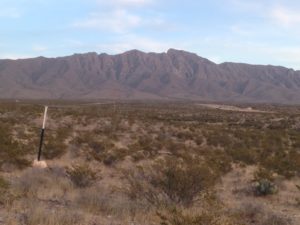 The scenery around El Paso is dry and mountainous. Because there is so little vegetation, the mountains, although not high, appear stark. El Paso itself is in a mini-Badlands, with gullies and jagged hills.
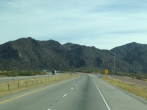 East of El Paso the terrain is flatter, although some considerable mountains. are still visible in the distance. The highway speed here is 80 mph – undoubtedly a boon to truckers, but far higher than we are comfortable with.
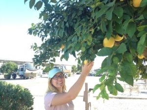 The campground, although favoring desert landscaping as is the usual now, has a lot of trees. Most of these are citrus trees – oranges, lemons, grapefruits and limes. Although it is a bit early in the season, much of the fruit was ripe and guests are encouraged to use it. I enjoyed oranges and grapefruits during our say and also came away with a few lemons for future use. Here is Rebecca picking a grapefruit.
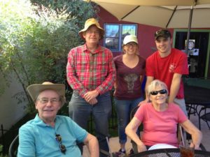 Our primary objective for this visit was to spend Thanksgiving with Chuck’s parents, who have a house in a lovely suburban development. Our nephew Jake and his girlfriend Rebecca who graduated from U. Maine in May and are now living in Phoenix, also came for the week to stay with my in-laws. We spent a lot of time with the family, enjoying meals out, Thanksgiving dinner and lots of left-overs, as well as women’s college basketball – some UConn fans in the crowd.
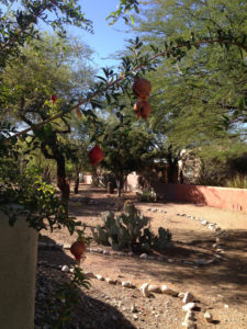
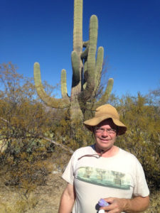
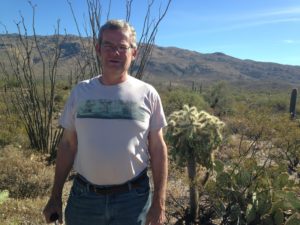
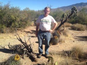 The entire Tucson area has a lot of cactuses, both in gardens and growing wild where there might be weeds or underbrush in other parts of the country. Saguaro National Forest is literally a forest of huge saguaro cactuses, along with many other types of cactuses (or is it cacti?) agaves, and dry-land plants. In the photo to the left, Chuck is posing with several barrel cactuses (in bloom) and one of the types of cholla.
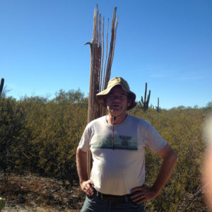 The saguaro is able to grow so tall and support its large branches because its main stem is made up of woody supports as shown to the left. When the plant is alive, the pulpy flesh between the supports is a perfect place for insects and birds to burrow, and the forest is alive with bird, insect and animal life.
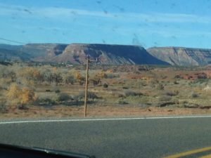
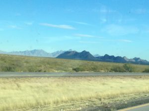 The route from Albuquerque to Las Cruces is mostly flat and dry, with spiky, dessicated mountains cropping up from time to time.
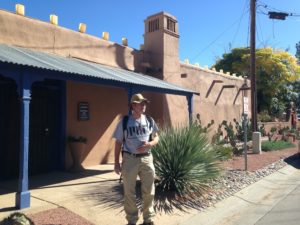
 On Wednesday we went into Mesilla, about a mile from the campground. Mesilla is the oldest part of Las Cruces, and consists of a large church and many older adobe buildings which are mainly now restaurants and tourist shops – some quite high end. It is very pretty and New Mexican. Mesilla was a stop on the historic Butterfield Stagecoach route from St. Louis to San Francisco. Like the Pony Express, this mail service ran for only a few years, but had a large impact in American western legend.
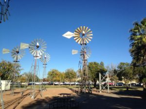 In the back yard of the Zuhl was an exhibit on windpowered water pumps, as seen to the right. In the northeast, these have been replaced by electric pumps; those that remain are ornamental wind vanes still turning but detached from the pumping mechanism. However, in the west, particularly on the cattle ranges, we saw plenty of pumps still working and filling reservoirs. This exhibit showed how the wind works the pistons that pumps the water.
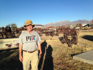
 After the Zuhl, we continued out of town to the New Mexico Farm Museum. As promised, it had exhibits about farm life. We started by crossing the historic Green Bridge, moved to the museum from its former location on the Pecos River. This took us to the outdoor exhibits. We started in the Dairy Barn and learned about how milking was done historically and now, including the evolution of the milking machine. We saw a huge collection of old tractor parts. The museum boasts a large “zoo” of different breeds of beef and dairy cattle, including Texas longhorns (which are seldom seen on farms today). We also visited the saddlery, where the workshop of saddle maker Slim Green is on display along with some of the beautiful leather work he did. Unfortunately, we did not have time for the exhibits in the main building.
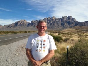 The scenery in Las Cruces is dominated by the Organ Mountains, a chunk of igneous extrusion (whatever that means). At the base of these mountains is an oasis, Dripping Springs, with a nice hike.
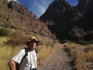 In the 1870s, a resort was built there and visitors came the 17 miles from Las Cruces by stage coach or horse to enjoy the setting. When the hotel was abandoned, a tuberculosis sanatorium was built on the site. Now the buildings are abandoned, but the stage coach road provide a good trail to the site, which is very pretty.
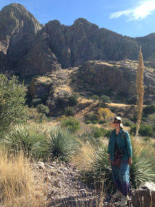 On Thursday, we headed out to Dripping Springs and walked along the old stage coach trail to the resort and sanatorium. The vegetation is interesting, with lots of varieties of yucca and other semi-arid plants. Due to the constant water supply from the springs, we expected wildlife. However, what we saw was an interesting assortment of insects.
 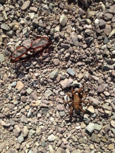 The most exciting, which we saw almost as soon as we started walking was a 4″ tarantula, (my glasses are in the picture for scale) walking calmly across the trail, as well as a smaller tarantula nearby. The grassy vegetation was full of grasshoppers, most of which were black while at rest but which had scarlet wings when they flew off. There were also a smaller number of grasshoppers which appeared similar while at rest but which had bright turquoise wings. Both varieties are very noisy in flight.
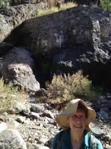 Near the springs and creek there are a lot of birds.
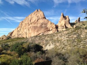
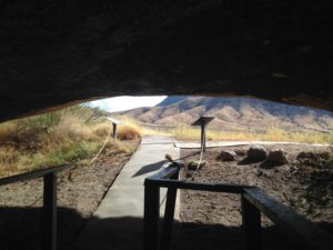 As well, from the spring you can hike around some interesting rock formations and also visit a cave that was inhabited for a while by a hermit. The cave is really an ideal dwelling – spacious and high enough to walk around in, with a nice view of the rock formations, valley and creek as can be seen from this photo taken from inside.
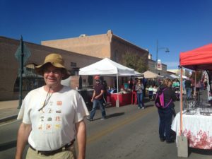
 Saturdays and Wednesdays Las Cruces has a downtown Farmers’ Market. This would be more properly called a crafts market, as there were very few farm stalls. It also had the unique feature (at least on the Saturday when we were there) of having a children’s section, where many enterprising youngsters were selling crafts. (I bought a duck tape purse and a clay pendant – the latter because the 3 little girls staffing the booth were such excellent salesladies that I felt I had to buy something.)
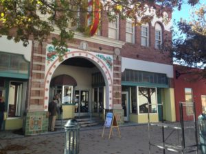 The vendors were very friendly. We spent quite a bit of time chatting with one woman whose main product was Jerusalem artichokes. I had previously been unsuccessful in getting much of a crop, so besides extolling the nutritional value of the tubers, she explained her experiences in cultivating them and concluded that I had not given them enough sunshine. We bought a few tubers, but I cannot say they will become a regular part of our diet.
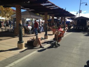 It was quite fascinating. He had some beautiful pieces, too. He uses modern cutting tools to make the blanks, which is less wasteful than flaking them by hand, and then finishing by hand knapping. He also had some very innovative handles.
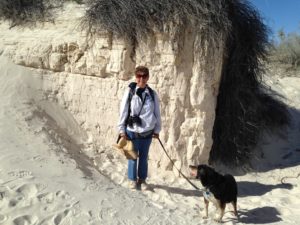 Our final day in the Las Cruces area was spent at White Sands National Park. This park, which is right beside the White Sands Missile Range, consists of huge dunes of white gypsum sand covering (according to Wikipedia) 442 square kilometers. I thought that the texture of the sand would be like drywall dust, but it is actually more like very fine table salt. The sand is formed from desert evaporites which are blown off the surface by the wind.
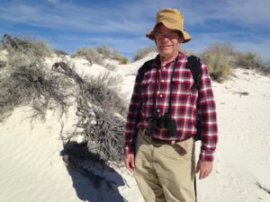 To reach the park, we drove through a pass in the mountains, which, in itself was quite interesting. We then drove through the missile range. We also had to pass through our first immigration checkpoint, which seems to be designed to make sure that vehicles are not transporting illegal immigrants. I was surprised at how quickly the big semis went through the checkpoint, but my nephew pointed out that there is probably heat-sensitive technology for scanning the rigs. We passed through several more of these in Arizona.
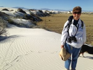 The dunes appear quite suddenly and seem to be confined to a certain region, perhaps a basin. Here I am at the edge.
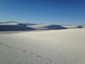 However, we did not get the full impact of the impact of the dunes until we got to the Alkali Flats Trail.
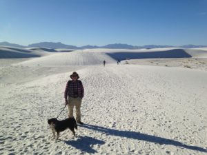 The Alkali Flats Trail is at the farthest point on the loop drive into the park and is not at all flat due to the dunes. It has no interpretative signs, and needs none. There is nothing but sand – huge white sand dunes. Except that the sand is so pure white, it looks like an idealized picture of what a sand desert should be. On our outward journey, we walked up the steep lee side of the dunes, and down the gentle windward side. This was very strenuous work in the loose sand.
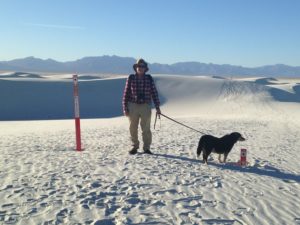 But on the return, we walked up the gentle slow side and then could literally leap down the steep slopes, landing in soft sand up to mid-calf. I had to empty my shoes several times. I really felt like a kid, launching myself down the slope like I was bouncing up and down on a bed.
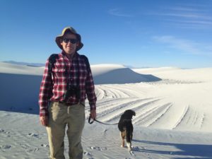 The force of the wind could be seen in many ways. The trail is marked with 6 foot steel markers – you can see here that these are often buried in sand after a few years. As well, in some places between the dunes there are flat areas that appear to have tire ruts. Upon closer examination, you can see that these are the compacted layers of sand from dunes that have been swept out of the area.
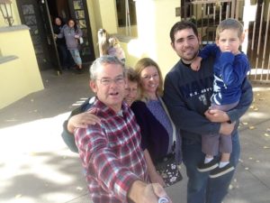 After admiring their new house and taking Rumple for a walk around the neighborhood, we headed off to a Mexican Restaurant for lunch. We appreciated the decor, which was more Mexican mansion with murals than the typical Mexican restaurants elsewhere. We also appreciated the heaps of food, although I decided that lamb is really too heavy for tacos. Sopapillas were a new treat for us: puffy pancakes with sweet fillings.
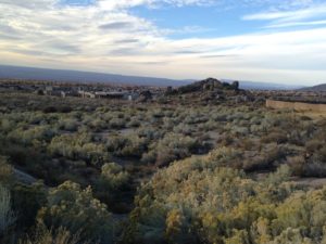
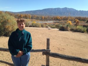
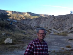
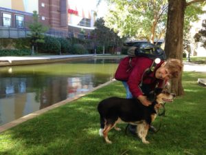
 After lunch, Melissa and Sebastian headed home for a nap while Chuck, Nevin and I collected Rumple and headed for the foothills of the Sandia Mountains, which start pretty much behind the house. The paths climb (of course), affording great views over the Albuquerque area and the surrounding mountains and volcanic cores.
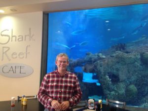
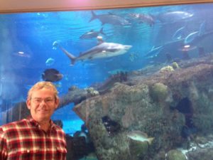 The person manning the kennel was extremely nice and noted that dogs often calm down once the owner was out of sight and smell. We decided to go to the Shark Reef Cafe for lunch while waiting to see whether Rumple would adjust, as it has an outdoor seating area where we could sit with him if necessary.
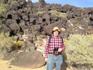
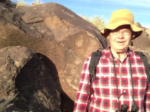 One of the Albuquerque attractions is a trail with ancient petroglyphs (actually, several such trails). These rock carvings look very simple on the whole – like pictures done by young children. However, it is through that they had religious significance and may still have importance to the local Native Americans. (They hold their cards close to the chest on this.)
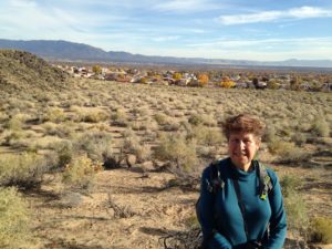 The trail that we took was at the base of some rocky crags. A suburban neighborhood starts at the edge of the park, and one is always within a half mile of the houses, with scrubland between. Despite this there was a lot of wildlife. We saw a coyote, many black-tailed jackrabbits, ground squirrels and a roadrunner. The jackrabbits have enormous ears, which reminded me of Ms. Frizzle (the Magic Schoolbus) and her “ear-conditioning” comment (although that was about desert foxes.)
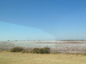 We set off from Oklahoma City at our usual late hour, passing through oil country and a relatively flat landscape. What looked like snowy fields proved to be cotton – lots of cotton. (Read the first few chapters of The Grapes of Wrath to understand some of the ramifications of this.)
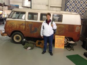
 The campground was very close to two of Amarillo’s more bizarre landmarks, which I visited without Chuck the next day. In 1974, a group of hippie artists from California partnered with billionaire Stanley Marsh III, to build a piece of “art” to confound the locals. Cadillac Ranch is a field with 10 Cadillacs half-buried nose down. Much of the exposed parts of the cars have been stolen, but it has become a place of pilgrimage on Route 66 – in fact I first spotted it because of the line of parked cars out in what otherwise appeared to be a corn field. The idea is to come out with one of more cans of spray paint and document yourself (or your kids) spraying graffiti onto what is left of the cars. Since there is a constant trek of visitors, you can expect your artwork to last about 15 minutes before it is covered up by the next visitor. The main trick is to get the photo without getting someone’s spray paint on your camera lens.
 In honor of Cadillac Ranch, our RV park has its own half-buried vehicle.
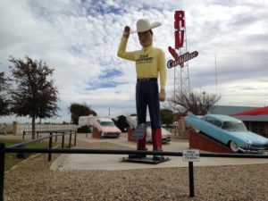
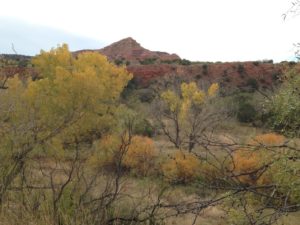
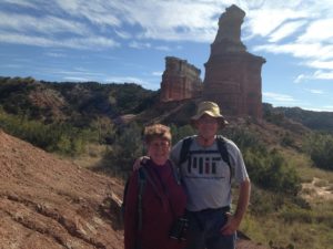
 I ended up going twice – once with Rumple but no Chuck (who was tired after driving from Oklahoma City) and once with Chuck but no Rumple (because it is really hot on the canyon floor, and there are too many pricklies for a bootless dog.)
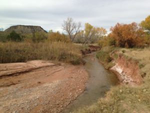 The canyon was carved out by a branch of the Red River, which is just a small creek about 3 feet across when there is no rain.
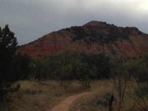
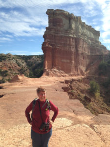
 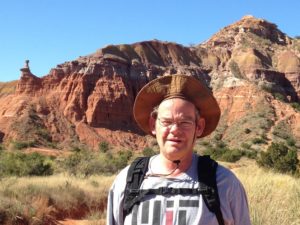 The river is red, because most of the rock is bright red – our cameras are not good enough to get the actual color. The road winds part way around the canyon rim and then descends to the canyon floor, where there are lots of river depth gauges (all starting about 10 feet above the creek during my visit) and flood warnings. The canyon is filled with camp grounds, and we later heard that these frequently need to be evacuated if there has been rain. It certainly looked more like a desert during our visit, except for the cottonwoods near the creek, which are brilliant yellow at this time of year.
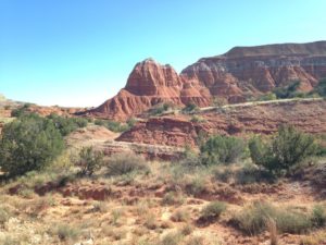
 Ω
Ω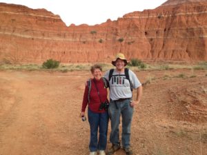 some interesting hoodoos (pillars) where erosion of the underlying rock was impeded by the harder cap.
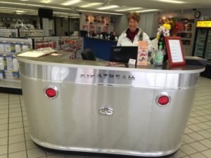 Another attraction in Amarillo is the RV Museum. This is the private project of Jack Sisemore, an Amarillo RV dealer, and one of the founders of Keystone RV (one of the large manufacturers.) The RV showroom has some interesting uses of RV parts, like this sales desk made of an Airstream front end.
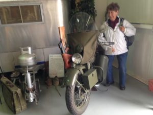
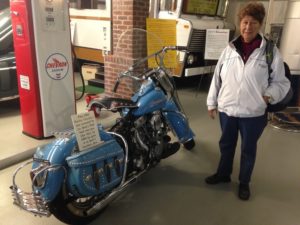 Two of the motorcycles that more interested me were a WW I cycle complete with rifle holster, and the beautifully detailed vanity model below.
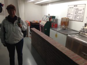 The museum also had this original A&W lunch counter.
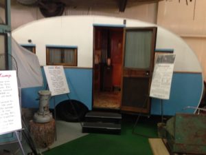
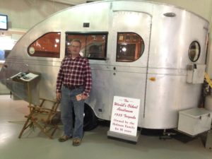
 (which has a bed inside and the kitchen in the tail, accessible from outside only). Most of the RVs, even going back to the 1930s, would not look out of place in an RV park today. However, indoor toilets did come a bit later on the scene.
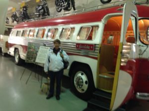
 For the afternoon, we went to Medipark. This is a rather large park with a pond and the Amarillo Botanical Gardens, surrounded by the city medical complex, with most of the hospitals.
 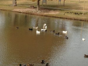 The park is home to hundreds of long-tailed grackles and the pond is full of ducks and geese. We added a lot of duck species to our viewing list, including some domestic varieties which must have escaped into the wild. We also enjoyed the Botanical Gardens, which were still full of blooms.
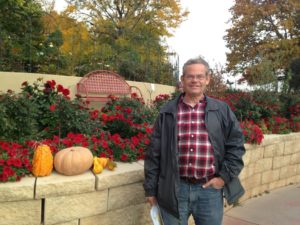
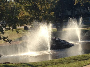 In any case, we are now camped at the Twin Fountains RV Resort just outside OK City. Outside it is windy and cool, but sunny. With the curtains open, inside it is like being in Hawaii. Here is the view from my window of the Twin Fountains. Notice how the wind is whipping the water around!
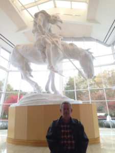 The first exhibit as you walk in is this huge sculpture named “The End of the Trail” by JE Fraser. I thought this referred to the Trail of Tears, but apparently the title was much more politically fraught. Fraser thought that Native American cultures were doomed, and this was his way of depicting it. There is an explanatory note on both walls – one from Fraser’s perspective and one from the Native American perspective, noting that Native American cultures have survived and are thriving.
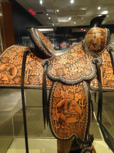 The first gallery that we viewed had modern cowboy crafts – primarily leatherwork like this amazing saddle, silver work, and rawhide plaiting. The other galleries that we saw included TV cowboys, a rodeo, including a history of women rodeo performers, cowboy life in the late 1800s in various parts of North, Central and South America,
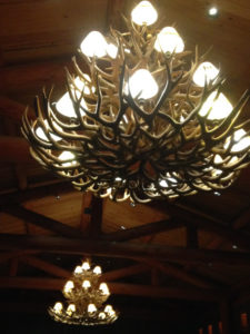 art by and about cowboys and Native Americans, and more. It was very interesting and we were “museumed out” before we could see everything. I was intrigued by these candlebras made from deer (or maybe elk) antlers.
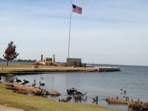 The next day, we both worked in the morning. In the afternoon Chuck decided to stay at the RV, so I took Rumple to Hefner Lake (no relation to Hugh as far as I know) for a walk. On the map, the lake looks like a pond, but it is actually quite large – certainly big enough for sailing. With the strong steady wind, I could see sail surfers in the distance, even though the lake is not big enough to generate waves. There is a biking and hiking path that goes around the perimeter of the lake. However, as is often the case, the path did not afford good views of the lake.
 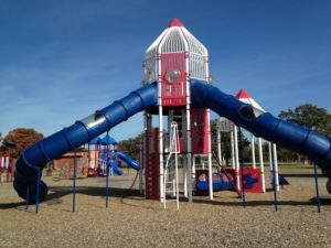 Instead, Rumple and I branched off to a number of side-paths which took us through woods and brush and closer to the water. I parked at Stars and Stripes Park. I guess I am still Canadian enough to be amused at the “over the top” color scheme of the playground at the park.
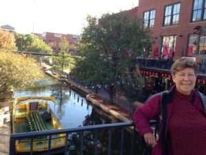
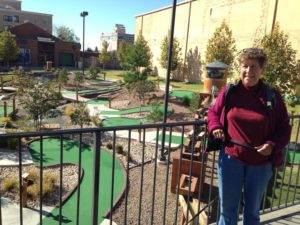 A walkway on both sides of the canal provides a pleasant stroll through the center of the tourist district, and is lined by eateries and hotels and even a downtown mini-golf course.
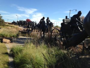 At the farthest end of the canal, near where it meets the Oklahoma River (aka the North Canadian River), is the Land Rush Memorial.
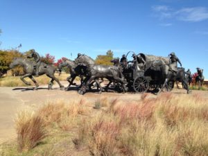
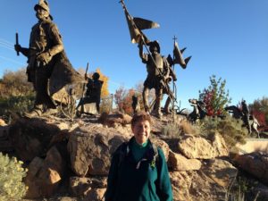
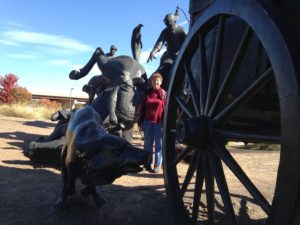 After shoving the Native Americans into ever smaller areas, the federal government found itself with 2 million acres of “unassigned” land. The government announced that the land would be open for claims of 160 acres at noon on April 22, 1899. Although some settlers jumped the gun, and managed to hide out in the “new” territory to stake their claims in advance, an estimated 50,000 potential settlers lined up at the border and set out when the gun was fired at noon. (We met the ancestor of one of the successful settlers a couple of weeks later at a campground. ) The event is commemorated with a monumental set of twice life-sized bronzes of settlers, wagons and their animals. We had not set out to see this memorial, but it is well worth the trip.
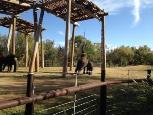
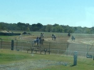
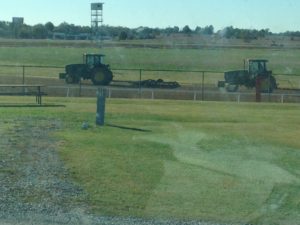
 We parked facing the race track, and so we had ringside seats for the Saturday and Sunday races. The races start at noon, but in the morning the horses were being exercised on the track. Later in the morning we watched as the track itself was groomed by tractor and water truck.
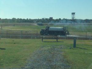
 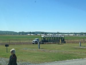 It was really fascinating and reminded me of how we used to entertain ourselves in Montreal by watching the precision snow-plowing operations. This last item going onto the track is the starting gate.
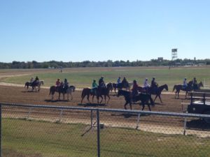 At this time of year, the quarter horses are being raced. As we learned in State College, quarter horses are bred for quarter mile races. Most of the races on we observed were 350 yards to 440 yards, although there was at least one longer race.
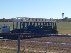 are escorted to the gate by some type of groom, with the jockey riding high in the stirrups.
 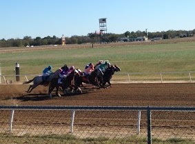 It was quite interesting to watch the jockeys and their escorts line up at the starting line. We had an excellent view of the horses as they left the gate and could hear and feel the thunderous pounding of their hooves. It is quite exciting to watch.
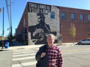 We started by visiting the Woody Guthrie Museum. We learned a lot about the Dustbowl and also about Guthrie’s life and work. It turns out that a lot of songs that I thought were American folk songs were written by Guthrie. Besides being a songwriter, singer and political activist, he was also an accomplished artist, cartoonist and writer.
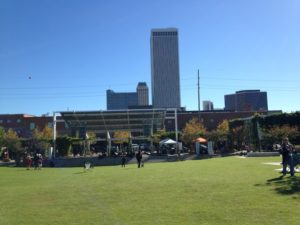 Across the road from the museum is Guthrie Green, a small park. There is a Sunday afternoon music series, and today there was also a bit of “Trick or Treat”ing for the kids. So after we ate we returned to the Greens to sit in the sun, listen to music and watch the kids in costume.
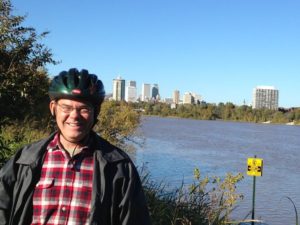
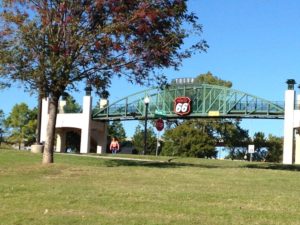 The Arkansas River runs through Tulsa. Both sides of the river have (separate) bicycle and walking paths, and there are several bicycle and walking bridges. In theory the path forms a loop, but due to construction this is not currently available.