Baddeck (Sept. 25)
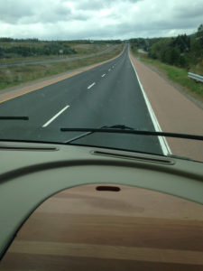 The trip from Halifax to Cape Breton Island is beautiful. One interesting feature, is that some of the paving uses the local red sandstone. In the photo to the left, the lanes have been repaved with regular surfacing, while the shoulders still have the original red surface (which shows through on the lanes wherever they are worn out.
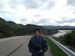
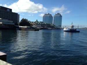
As we approached the Canso Strait, glimpses of the ocean added to the scenic views, and the Appalachian Mountains of Cape Breton Island begin to be seen.
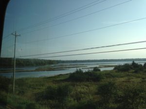
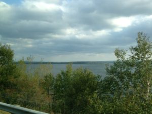
Cape Breton Island is separated from the mainland by only a very narrow strait, now spanned by a causeway and swing bridge. Despite this, a few mainland plant and animal species are not found on the Island. Once on the Island, the views are even better.
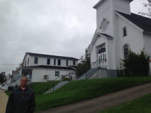
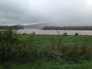
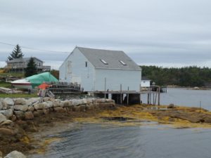
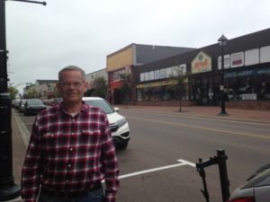
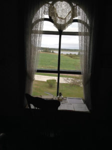
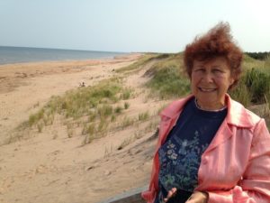
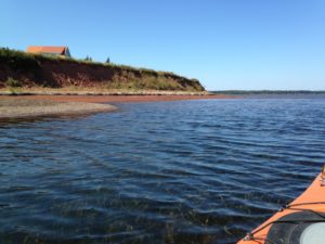
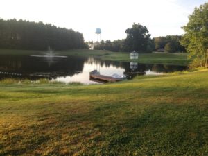
We camped in Baddeck (pronounced B’dek) which is on the Bras D’Or Lake. Our plan was to use this as our home base for a driving trip on the Cabot Trail.
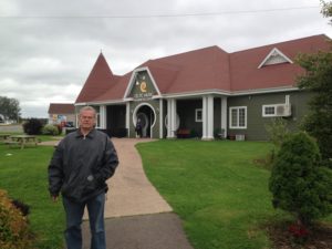
Our first full day in Baddeck came with some rain and a persistent “Scotch mist”, as my family used to call it – something that is wetter than fog, but not quite rain. It was not weather for viewing the scenery. However, one thing on our agenda was to go to the Alexander Graham Bell Museum in Baddeck, so this created the opportunity.
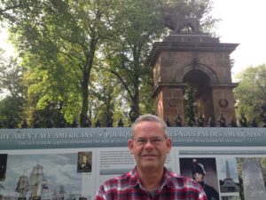
Alexander Graham Bell was born in Scotland. However, after two of his brothers died of tuberculosis and he became ill, his parents moved the family to Brantford Ontario (my birthplace). He was already in his twenties at this point, with a few minor inventions to his credit. His history can be read on Wikipedia.
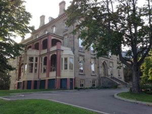
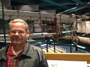 The salient fact for Baddeck is that although his main residence was in Cambridge MA, Bell used some of the proceeds from the Bell Telephone Company to build a large summer residence in Baddeck. While in Baddeck, with funding provided by his wife Mabel (a very interesting character in her own right) he worked with a number of aeronautics pioneers including Glenn Curtiss to design and build both tetrahedral kites (which Bell thought would better for powered flight than airplanes) and airplanes. Although the Wright Brothers had already demonstrated powered flight before any of the Bell planes got into the air, Bell’s Aerial Experiment Association was group to create an airplane to fly a kilometer. The core of the Baddeck Museum Exhibit is about theisaccomplishment.
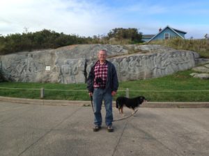
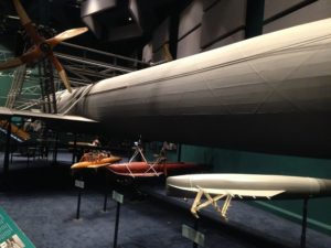 Another project which took place mainly at Baddeck towards the end of Bell’s life was the development of large hydrofoil boats. He and a young assistant Casey Baldwin built the first boat capable of going over 100 km/hr. Just as they were about to sign a large contract with the Canadian navy, WWI came to an end. They never proceeded with the project, although Baldwin continued to work on designs for smaller hydrofoil boats for recreational craft. The craft designed by Bell and Baldwin, the HD4, lay on the beach for years until it was recovered by the museum, where it is on display along with the full-scale replica above.
The museum also has displays about several other of Bell’s inventions including the graphophone (an improvement of Edison’s phonograph), a wireless phone (based on a large selenium chip) and other items.
Despite his wealth and scientific bent, 2 of Bell’s 4 children died in infancy. Remember that the death of his two brothers as young men were what spurred the family to move to Canada. I always keep life expectancy in mind when people bemoan the passing of the “good old days”.
 A section of the museum is devoted to the Bras D’Or Lake UNESCO Biosphere Reserve. Cape Breton “Island” is actually composed of several large islands that surround an estuary that is practically an inland sea. The largest body of water in the estuary is called Bras D’Or Lake, but the water is brackish so it is more properly a bay. “Bars D’Or” means Golden Arms, but the name might actually be a mispronounciation of Labrador (which is part of the Canadian province of Newfoundland). In any case, it is a hugely productive fish breeding ground and also harbours many bird species. The Museum also has a great view over the lake.
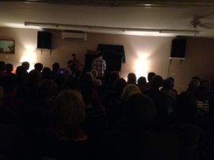
 After we were done with the museum, we wandered through town, which has a nice waterfront on the lake and a few restaurants and souvenir shops. It also has a nightly ceilidh. We decided to have an early dinner at a local bakery and then stay for the ceilidh.
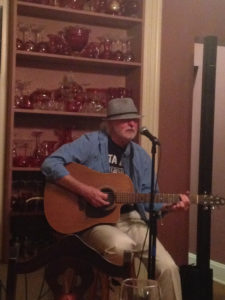
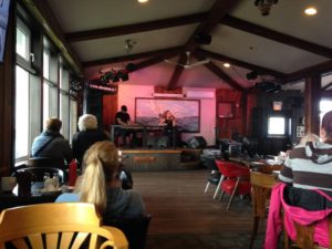
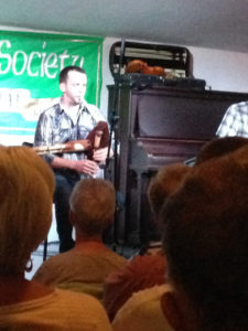
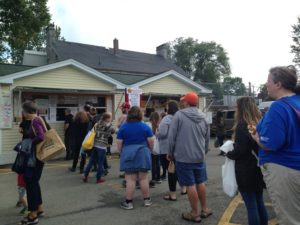
Recalling our disappointment in PEI, I headed off early to get tickets for the ceilidh. Lucky I did so, as several tour buses had already taken up most of the seats. The person selling the tickets turned out to be the fiddler and had taken a trip to central PA earlier this year, and we ended up chatting.
Michael Hall is a fairly big name in the local Celtic music scene. Despite this, most winters he has to go to Alberta to find work. The ceilidhs usually end on Sept. 25, but he had noticed that quite a few tour buses were still coming through, and asked the organizer if he could take it over and extend the season for another month. This was his first night organizing and he was gratified that the hall (which holds about 75) was full. His hope is to make enough money to stay in Cape Breton this winter. Given that there is the Celtic Colors Festival Oct. 9-15 that is already sold out for some events, I think he will succeed.
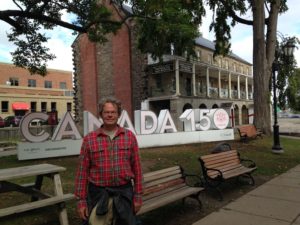
I thought perhaps the season has extended because the aging population is retiring and less tied to the school schedule. However, a museum curator speculated that the increase in visitors was due to the much-publicized invitation from Cape Breton to Americans who said that they would move to Canada if Trump were elected. This certainly brought Cape Breton to the attention of many Americans who had never heard of it. As well, Canadian National Parks are free this year to celebrate the 150th.
 In any case, the ceilidh consisted of Michael on fiddle and Rob Deveaux on keyboard. Michael explained the origins of the music, and noted that many of the tunes do not have names. As well, the fiddler strings together medleys and chooses the key, while the pianist is forced to improvise and try to keep up. Michael also explained the difference between jigs, reels, Spathpey reels and waltzes, which definitely helped me follow the music. The music was great!
Besides the music, Mike and Rob were quite entertaining. At one point, they asked the audience where everyone was from. When one woman said she was from New Zealand, Rob noted that there was a legend that a ship had left Baddeck to take settlers to NZ. The woman said that her great grandmother had been on that ship, and that she was visiting the ancestral home. To which Rob noted that her ancestral home had belonged to his Acadian ancestors before it belonged to her British ones. His ancestors had been expelled from Nova Scotia to France but their descendents returned to Cape Breton a century later.
They also told us how they learned the music and the role it had played in their childhood. Mike made the point that the music had survived due to isolation and poverty. The same could be said of bluegrass.
We went to bed to the sound of thunder and the ping of rain on the RV, and woke up to the same. Although the thunder subsided, the rain continued the entire day. We stayed in the RV and worked. I also got the blog almost up-to-date. This blog takes longer to write than I expected (and perhaps I am also getting more long-winded).
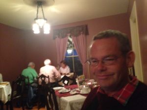
 For dinner we tried to go to a nearby hotel with a great view. With several large tour buses already there, the wait was long. Instead, we went to the Lynwood Inn across the road from St. Michael’s Parish Hall where the ceilidh was held. The ambience was better than the food, but they also had a folk singer who entertained us with some 60s folk and as some Cape Breton traditional folk songs. I have been curious about a local song writer, Rita McNeil, who was quite famous in Canada in the 80s and 90s. By then I was living outside the country and so I had not heard her music. He graciously agreed to sing one of her numbers, which I enjoyed.
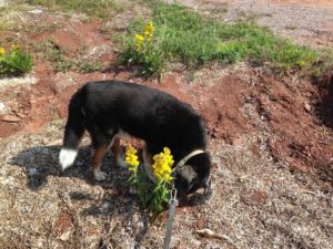
The next day dawned cloudy but rain-free. Rumple and I discovered that the RV park has a nature trail that follows the Baddeck River. After all the rain, it was like taking a walk in the creek, but it was pretty.
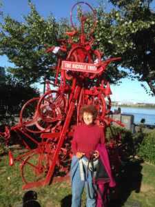
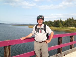
 We decided to head back to the Canso bridge and then do half of the “Ceilidh Trail” before joining up with the Cabot Trail. The Ceilidh Trail follows the southern coast of the Gulf of St. Lawrence, but the water can only be seen at a few viewpoints. There is a RailTrail parallel to the road, which runs about 100 km from the Port Hastings to Inverness. I liked the bicycle rack below appropriately looking like a musical note.
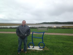
A major attraction accessible by road or bicycle path is the Celtic Music Interpretive Centre, a non-profit devoted to preserving and advancing Celtic music and the Gaelic language. In particular, they have free live music daily from 11:30 – 3:00. The music is good, and they serve lunch in their restaurant. We stopped there for a couple of hours to hear Chrissy Crowley accompanied by Allan Dewar on the piano. they are very good. 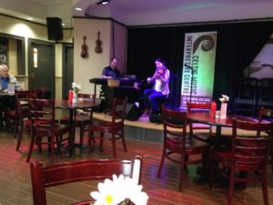 During a break we overheard her talking about how Michael Hall had inspired her to take up fiddle. Cape Breton is a small musical community.
Unfortunately, the relatively good weather that we had in Baddeck did not follow us to the St. Lawrence coast. Looking at the weather radar, a line of clouds was hugging the coast. All of the rest of Cape Breton seemed to be enjoying a lovely day, but we had rain, fog and generally bad weather.
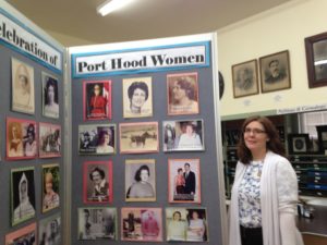 We decided to make a stop at the Chestico History Museum just outside Port Hood. This is a very small museum, with a lot of good items, and a great curator, Joanne Watts. As we were the only visitors at the time (although she said their had been a constant stream throughout the day) she walked us through the history of Port Hood and the exhibits.
Contrary to what we had thought, Cape Breton used to have several thriving communities, particularly due to mining. Port Hood was an important coal center, and was importing miners from elsewhere. Unfortunately, the shafts ran under the bay, and once breached by the sea they flooded and so mining stopped. As the mines in the area began to run out, the train was no longer profitable and started running only between Sydney and the mainland. And so Port Hood has slowly declined.
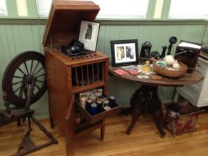 The museum profited enormously by purchasing the contents of a local home. The contents included a Bell graphophone including many wax cylinders, china wares, and kitchen items. As well, over the years they had put together several displays including a display on the impact of local women, and a display about local men serving in the world wars.
Many visitors to the museum are seeking geneology information. Joanne is an expert at doing geneology searches, assisted by lots of local information that was painstakingly uploaded by a local enthusiast. She got on the computer and showed us how all this works.
All in all, this small museum was a gem. We have often been pleasantly surprised by these small local museums, especially when a friendly and enthusiastic curator shows us around.
 With no sign that the rain was coming to an end, we decided to return to the RV for the night via a short stretch of Cabot Trail. Fortunately, there is enough slack in the schedule right now that we can afford to stay an extra day in Cape Breton and wait for better weather.
On Saturday morning, the weather in Baddeck was beautiful, but the St. Lawrence coast was still cloudy. We decided to set out none-the-less, and trust that the clouds would clear up as the day proceeded.
 We retraced our route of the previous evening, making several stops to admire and photograph the mountains. The maple leaves are just beginning to turn, so there are touches of red and gold amidst the green and it is quite pretty. Most of the way towards the coast the weather alternated between rain, cloud and sun. However, when we got to the coast the rain stopped and we had fairly clear views over the mountains, valley and ocean.
 The southwest part of the Cabot Trail runs near the coast and is relatively flat. We decided not to visit the interesting looking puppet factory below, which makes mannequins for an Acadian festival Mi-Careme.
We stopped for lunch in the main town, Cheticamp. The Doryman’s Inn has fiddling daily from 2 – 6. We got there at 1:00 for lunch, but decided to stay until 3 to listen to the music. In the interim, we were able to watch grey seals fishing in the Gulf right outside our window.
The musicians were 2 members of Chrissy Crowley’s band, fiddler Rachel Davis and pianist Jason Roach. They played with unbelievable energy, doing very long sets with so much footwork that they were practically stepdancing. The floor was vibrating like a drum. It was hard to tear ourselves away.
 Just north of Cheticamp, the road starts climbing steeply into Cape Breton National Park. There were lots of beautiful vistas, many of which had convenient stopping points. Because of our frequent stops, we did not reach the summit until almost 5:00. There is a popular hike there, called Skyline trail. It was already pretty late, the wind had picked up and the temperature dropped. As well, Chuck wanted to tune in to the Penn State football game. We decided to continue on to the next town and return in the morning.
 The road descends steeply into the town of Pleasant Bay. We stayed at a small cottage at the appropriately named Mountain View Inn. The restaurant attached to the motel has a nice dinner. And best of all, they had fiddle and guitar music in the restaurant this evening.
 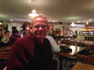 The fiddler was Christine Shaw – we did not get the name of the accompanist.
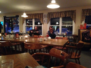
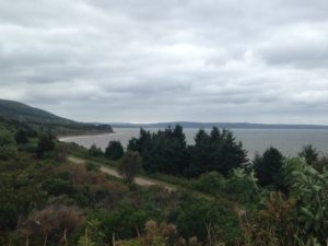
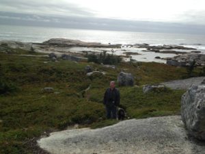
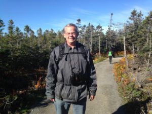 In the morning we headed back up the mountain to the Skyline Trail. This is a popular and well-maintained trail along the mountain top, with scenic views over the ocean and many interpretive signs. While it is a very nice hike, especially with the beautiful weather,
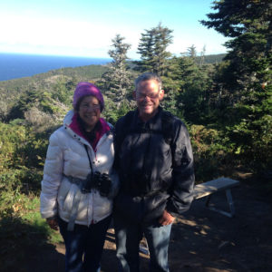 the views were very similar to those from the many roadside viewpoints.
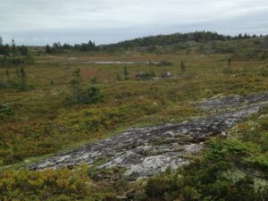
One of the things we learned from the interpretive signs was the story of moose on Cape Breton. By 1900, over-hunting had driven the moose to extinction. They were re-introduced in 1940 and were holding their own. However, in 1970, a natural infestation of spruce bud worm killed off large sections of the spruce forest. 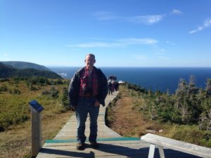 The natural progression is for birch to colonize and then for the spruce to take over again. However, moose love birch seedlings. There was an explosion of the moose population to the extent that the birch could not get established. Instead, the areas turned into upland meadows that were perfect for the moose, leading to a new equilibrium.
 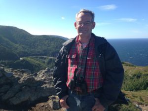 Now Parks Canada is trying moose exclusion areas to see if the old forest progression will take over.
That is the part from the interpretive signs. Chuck read in a local newspaper that were was going to be a meeting to determine if there should be a moose cull, given the overpopulation. 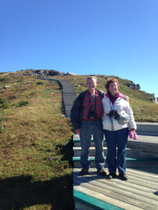
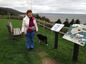
We also saw a sign protesting the moose cull, stating that almost half a million dollars had been spent in previous years to kill 37 moose. At one of the vistas, we met two moose hunters. We learned that about 30,000 people apply annually for 300 moose hunting licenses which are allocated by lottery (and these guys had been the lucky winners after 17 years of trying). They felt that the moose were sparse in some areas and plentiful in others, and that the need for culling was overstated. They also thought that Baddeck was one of the places where they are plentiful. Back in Baddeck for the evening, someone told us that the moose move off the mountains towards the coast during hunting season (which starts tomorrow) but that in any case she had seen a moose swimming in Baddeck Harbour today. We still have not seen a moose. But the hunters told us that moose are more plentiful in New Brunswick, our next stop, so there is still hope!
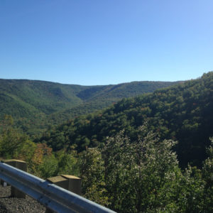
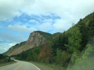
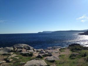
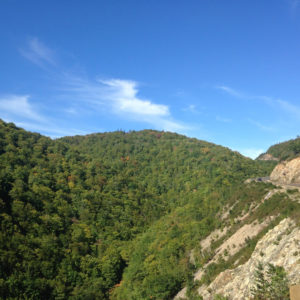 Another thing we learned on this trip is that the Atlantic Provinces have their own version of the Great Rift Valley, called the Aspy Fault. It can be seen in these photos as a very long, very wide rift in the mountains (which, incidentally, are part of the Appalachians).
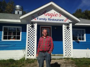
After completing the Skyline Trail, we meandered along the Cabot Trail, stopping for lunch at Angie’s – probably the best place we have eaten in Cape Breton.
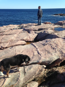
 We stopped at a lot of beautiful vista points, and clambered over rocky outcroppings. Rumple was occasionally baffled about how to traverse the many crevasses and little pools.
 We
We 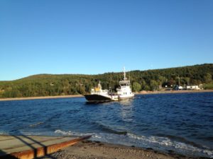
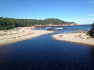
Towards the end of the trail, we veered off so that we could take the car ferry to Englishtown. This cuts out a bit of driving, but the main reason to take the ferry was for the view of St. Ann’s Harbor.
To finish off our trip, we decided to go to Baddeck for Chinese food and then back to the St. Michael’s Parish Hall for the nightly ceilidh. 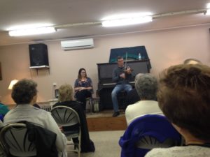 This time it was being run by Robert, who was also the accompanist, and the fiddler was Haley DeFort, who is “almost 21 and has been playing fiddle for 17 years”. Haley does not come from a musical family, but someone gave her a fiddle for her 4th birthday and the rest is history. The audience was pretty lively, and Haley ended up demonstrating step dancing with Robert playing fiddle, as well as responding to a request to do a vocal number. At that, Robert was also asked to do a vocal number, and sang an old French tune, accompanying himself on the fiddle. Not content with that, the audience also insisted on a piano solo – he managed to dredge something up that he had known 20 years ago, and acquitted himself well. Of course, they also did some Cape Breton fiddle music. All in all, it was a fun evening that made for a very nice ending to this part of our trip.
Cape Breton is going onto my “best of trip” list. One thing I would like to do is to be here for the Celtic Colours Festival, which occurs later in October and closes down the tourist season. Not only is there a lot of great music and dancing – the trees which are beginning to turn will be in full color (at least this year).
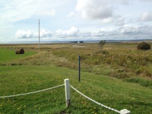 We entered Nova Scotia near Amherst. There is a very nice welcome center there overlooking fields leading to the Bay of Fundy, with a picnic area and interpretative signs for both the Bay of Fundy and Amherst. The Acadian population of the area was among the first to be expelled by the British, and the town was burned to ensure that they could not return. Canadian history is no more pleasant than others.
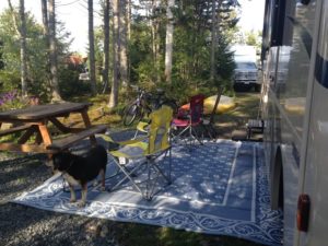 The next day was a lovely day. Our campsite is wooded and mossy enough to feel like we are in the woods, and our feeders attracted several blue jays, chickadees and nuthatches.
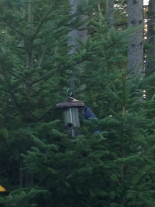
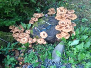
 The mushrooms are coming up in droves. Chuck needed to work, and I needed to finish off some recommendation letters. So, we stayed around the campsite and enjoyed the ambience and the bucolic views. This also gave me time to make a zucchini kugel for our second Rosh Hashana meal, along with the left-overs from the first night.
 On Friday we drove the “Lighthouse Drive” towards Peggy’s Cove, a pretty fishing village and artist colony. We were discouraged from taking our kayaks due to the wind and fears of big ocean swells. We did not realize the extent to which this coast is sheltered by small islands and long fjords.
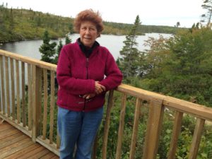 The drive goes close to the coast at many places. Where it does not, there are side roads, but many of these lead to small villages rather than to scenic vistas. However, there is plenty of scenic shoreline. This picture that looks like a boardwalk was taken at a weather beaten old hotel – that was gorgeous inside. We were looking for a snack, but their kitchen was not open for business.
 We stopped at a scenic cove, Shaw’s Landing, for lunch on the restaurant balcony. It was quite chilly, but we try to eat outside when Rumple is with us, so he does not have to stay in the car. The restaurant is right on the cove, with a great view. I enjoyed the blending of colors of the houses, the boats, thebuoys,
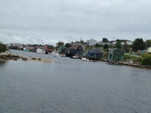 the ropes and the seaweed. I also like the way bolts were placed into these rocks to make what I assume are weights for fishing.
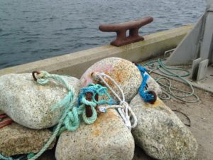
 As we got closer to Peggy’s cove, the scenery changed and began to look very alpine, with large smooth exposed rocks, heathery growth, blueberry bushes (which proved to be laden with over-ripe berries) and mosses. The glaciers of the last ice age scoured this shore down to the bedrock, and soil has been slow to form, creating this barren but beautiful landscape. We stopped for a hike on the barrens and down to the sea.
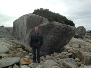
 As we walked, we were joined by Kia, a young woman with a passion for kayaking. She had seen our kayak racks and wondered if we, like she was, were in Nova Scotia for a workshop on ocean kayaking. It turns out that she knows the person who makes the kayak sails and we had fun discussing kayak sailing and surfing.
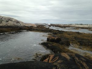 The tidal pools were filled with Irish moss. Rumple still does not understand the concept of dense water plants, and ended up taking an unexpected swim. I am sure he was shocked not only at being in the water, but also at the taste of salt.
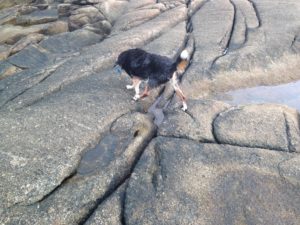
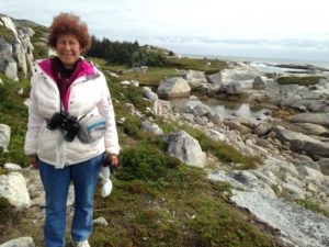
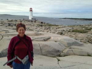 I was last in Peggy’s Cove about 20 years ago, also in the off-season. My friends and I were the only people there. Now, despite the chilly weather, the place was overrun with people, tour buses and just general activity. People come for the scenery and the lighthouse.
 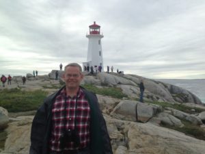 Other than that, there are a few homes (it is still a working lobster fishing village with a year round population of less than 40), art galleries, and restaurants. Peggy’s Cove is a national preservation area, which limits development.
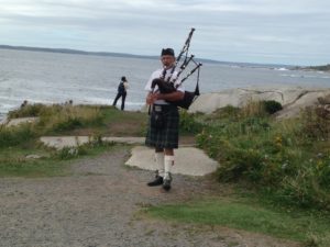 After parking near the famous lighthouse, one is greeted by a bagpiper. This is pretty common at Nova Scotia tourist sites and is a tradition that Chuck and I like.
 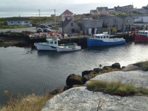 We clambered over the rocks and around the lighthouse and enjoyed the scenery and waves before walking through the town and a few souvenir shops. I am pretty sure the colorful lobster traps and boats at the dock on the right were there during my last visit 20 years ago!
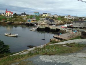
 Downtown Halifax is squeezed between the Halifax Citadel and the tourist harbour. We started our walking tour at the Old Burial Ground, the oldest cemetery in the city, which includes a Crimean War Memorial.
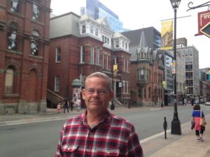 At this point I was reading book 3 of the Anne of Green Gables Series, Anne of the Island. Anne has left PEI to go to university, and is going to a co-ed university in a city. She goes for a walk in an old cemetery – and Montgomery exactly described this burial ground as well as some other sites we saw! So I surmise that Anne went to the local university, Dalhousie, which at that time had most of its campus downtown and was the only co-educational university in Nova Scotia. It can be a great pleasure to read literature while you are visiting the actual setting!
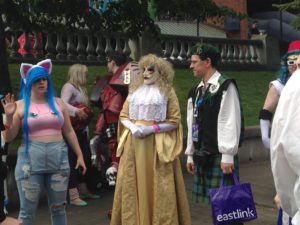 We wandered around the historic district for a while, and then came to The Grand Parade, a paved park between St. Paul’s Church and the City Hall (the original Dalhousie University Building). Hal Con was taking place, with lots of people in costume.
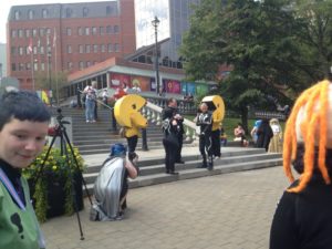 Unlike the previous day, this was a very warm humid day, but one must suffer in the name of art, I guess. Certainly the Star Wars Storm Troopers and many others were encased head to foot. We stopped to watch a very public “renewal of vows” of a couple dressed as characters out of Tron, with a pair of PacMen (or maybe PacWomen?) attendants. For the rest of the weekend, we saw people dressed up and wandering the streets.
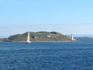 We walked a couple of blocks down to the harbor, and walked along the boardwalk. There is a good view over the harbor to George’s Island (which is also described in Montgomery’s book.) George’s Island was where the Acadians were interred before deportation, and also has a fort and a small lighthouse.
  It is a popular landmark for kayakers to circumnavigate, but no-one is allowed on the island.
 The Halifax boardwalk goes about 2.5 miles along the waterfront from Pier 21, which is the current cruise ship harbour, farmers’ market and immigration museum, through a restaurant and shop district, past the Marine Museum and on towards the office buildings of the non-historic downtown.
 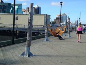 One feature I liked was the set of hammock stands below. Only one hammock was up, but it would be quite feasible to bring your own to have a restful spot on the boardwalk.
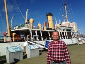
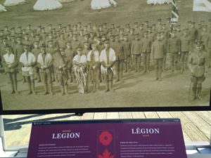 There were also a series of historic plaques commemorating various local people and/or troops. I was taken by this photo of a WWII Jewish legion – particularly as the Maritimes have a very tiny Jewish community.
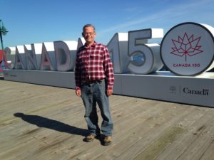
 We walked from near the Marine Museum to Pier 21, and then back to the other end, before returning the restaurant district to look for a place we could eat with Rumple.
 I have no idea where they came up with the name, but they do have this nice sculpture outside.
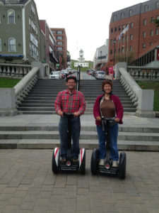
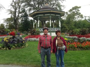 The garden is still in full bloom, or rather Shannon tells us that they change the display about once a week, working at night so that fresh plants are on display.
  and has all the elements of a traditional Victorian Garden, including a pavilion and statuary.
  Shannon also took us to the Halifax Citadel, the old fortress. It was a lot easier climbing up on the Segways than by foot.She explained some things about its design and also the large masts, looking like ships’ masts, that were used to run signal flags – one mast for military flags and one for civilian.
 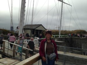 We also saw the schoolroom which was used by children whose families lived at the fort.
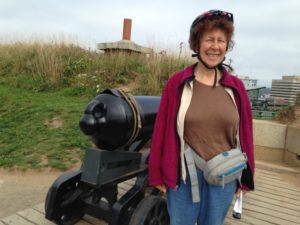
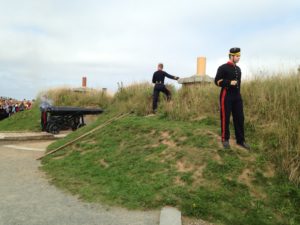 At noon daily, a salute is fired from one of the cannons. The procedure of loading and firing the cannon was explained in detail by one of the Citadel interpreters. One interesting factoid is that they used to fire 2 pounds of gunfire but this was loud enough to trigger car alarms in town between the fort and the harbour (which is the historic tourist section of downtown). So, now, only one pound of powder is used. The fort itself is dug into the hilltop, so the sound is absorbed in the other direction. In fact, the hill absorbed the impact of the great Halifax Explosion of 1914 saving the buildings behind it.
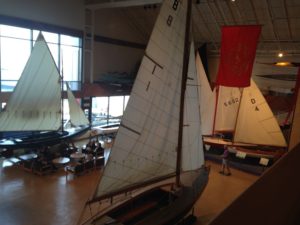 The Museum had the usual collection of boats, models, etc, a magnificent Fresnel lens from a lighthouse, and two special exhibits, one about the Halifax Harbour Explosion and the other about the Titanic, which sank not far off the Labrador coast.
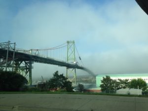 On the way back to the campsite, there were some rather interesting fog effects over Halifax Harbour. I took these photos of one of the bridges, which is closed for repair, and the shipyards, in which an Arctic exploration ship is being built.
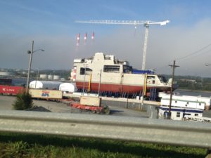
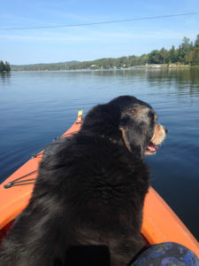
 Rumple stayed fairly calm when we were in the sheltered part of the bay.
 Summerside has about 15000 people, a cute downtown and a boardwalk. One of the features we appreciated downtown was a series of historical plaques giving the family history of some of the town’s founders. We can never pass by a historical marker, and so we read all of them before continuing on to the boardwalk, which also had some reading material.
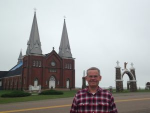
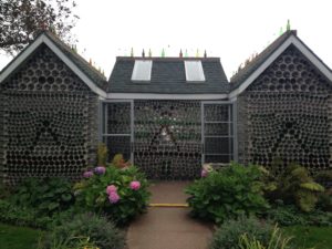
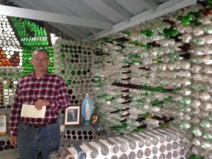 He then proceeded to build a chapel, using votive candle holders for the pews (to the left) and a tavern (below). As far as I know, only the chapel has actually been used as such. He also built a replica of the lighthouse (out of wood) and put in a beautiful garden. The result is an unusual tourist attraction.
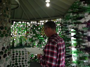
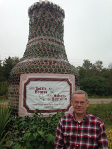 Unfortunately, he used railroad ties for the building foundations, and by 1991 these were beginning to rot. The family decided to preserve the buildings as an attraction, and painstakingly picked all the bottles out of the concrete and rebuilt the buildings on concrete foundations. They also added a huge bottle made of bottles at the roadside (which is good, because otherwise we would have missed it) and a gift shop with lots of feature made from bottles. The whole thing was quirky, but I have to say that the bottle houses have a certain beauty.
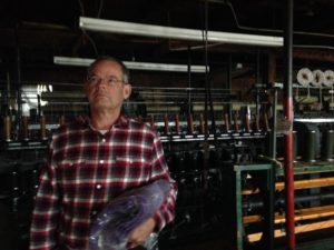 Another interesting stop was the MacAuslander woolen mill at Bloomfield. This factory is the source of the yarns used at the Northern Watter Knitwear Shop and other sweater factories on the island. The machinery is on the ground floor with a small shop in the attic. We were there right before closing, so the machines were not in use, but visitors are welcome to walk around. It looks like what you would imagine a yarn mill might have looked like 100 years ago. The wool comes from local sheep. Washing the wool reduces the weight by 40%, due to the lanolin and dirt in the raw wool. It is then carded, dyed and spun into yarn. The yarn is sold in the shop and other shops on the island. As well, the yarn is woven into blankets, which are now a traditional wedding gift on the island. Both the yarn and the blankets are beautiful but scratchy. I was very tempted to use the yarn for Elisabeth’s poncho, but in the end decided it would be too scratchy for her to wear.
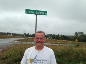
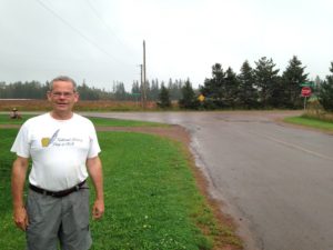 Chuck’s great-great maternal grandfather Gamble grew up in Gambles Corner, PEI. (We do not know if Gambles Corner comes from the family name.) We wanted a photo of the village. Gambles Corner does not appear on any maps of PEI, but Google maps knows where it is.
 In the mid-1700s, France and England were at war and the area changed hands several times. In 1755, when the conquering British expelled the French Acadians from Nova Scotia, some were scattered among other 13 Colonies and some went to Isle St. Jean. In 1758, the British captured Isle St. Jean and Cape Breton and sent most of their Acadian population back to France. Many of the PEI Acadians died in transit as 3 of the ships sank, taking over 800 unfortunates with them. About 2000 Acadians remained in remote parts of PEI, Nova Scotia, New Brunswick and Quebec. Some of the expelled Acadians had, in fact, been working with the French and Mi’kmaqs against British interests, while others maintained neutrality but refused to pledge an oath of loyalty to Britain. The British did not differentiate.
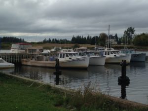 After the Acadian Museum, our next destination was the Shellfish Museum. We were a bit confused about this: according to Google, the original shellfish museum has closed, but another one opened.
 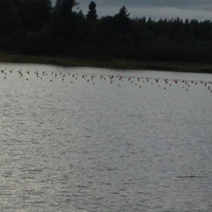 We followed a mix of road signs and Google, getting lost of number of times. We finally came into a small harbor, with lots of small boats and shellfish buoys and a building labelled as Shellfish Museum. However, it was closed – whether permanently or for the season or day was not clear.
 While searching for the Shellfish Museum, we passed a sign for the Parsonage Museum. This turned out to be the parsonage house where L. M. Montgomery lived when she was teaching school. We saw her room, with a fine view of the sea, and toured the house, which is roomy and comfortable. If you recall the incident of the liniment cake in Anne of Green Gables … the incident was inspired by a baking accident that actually occurred in this house.
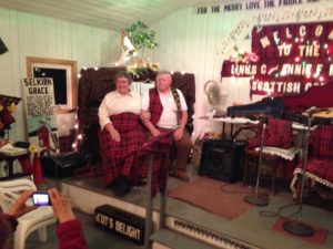
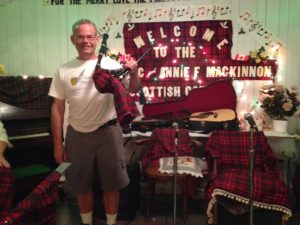 Calling this the McKinnon “Family” ceilidh, is a bit of misnomer now. Cecilia, youngest family member, has been putting on a one-woman show in remembrance of her family since 2007 after her parents passed away and her brother became too ill to perform. She is a wonderful musician and composer, with a lovely singing voice. But it was a bit melancholy with the stage set up for 4 and only her energetic playing to fill it with accordion, bagpipe, fiddle, piano and guitar music, while husband Bill helps out with the practicalities and some jokes.
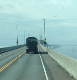 We left PEI on a very calm day. There was no wind, but a slight haze hung over the bridge. Chuck said it reminded him of the song “Bridge to Heaven”.
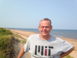 After Anne of Green Gables, PEI is all about beaches, scenery and lighthouses (at least 63). We decided to take the Central Coastal Drive through the beaches and dunes of PEI Island National Park. This is a very pretty drive, although you cannot really see the sea without stopping due to the trees and sand dunes.
 As well, miniature
 For lunch, we stopped at Dalvay by the Sea, a historic inn and ate on their glassed in balcony. Dalvay by the Sea was built by a Scottish American industrialist, Alexander MacDonald in 1896. The grounds and the part of the house that is open to folks using the restaurant are beautiful.
 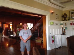 Our waitress, originally from Ontario, moved to PEI 9 years ago for a quieter lifestyle and more affordable housing and loves it.
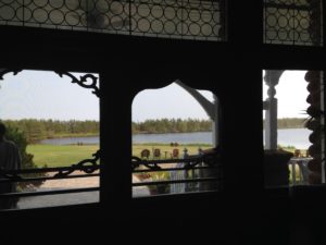
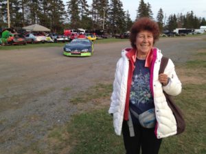
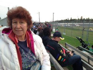 Stock car races are loud – very loud. The cars do not have mufflers, and they might even have devices to increase the noise level. If we ever go again, I shall definitely wear earplugs. We noted that there were many families in the bleachers and usually the youngest children had earplugs or noise-cancelling headphones.
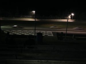 Stock car races are basicly roller derbies in cars. The cars go around a very short, very pitched oval from 10 to 50 times, 8 to 20 cars at a time on a two lane track. Needless to say, collisons and cars going off the track are frequent events. Pieces of fender and even bigger car chunks often go flying, and there is a 12 foot hgh fence between the track and the bleachers.
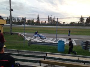 One event had minicars. We assumed that the drivers were kids, despite the relatively high speed of the race, until the very last race, when the category winners emerged from their cars. They were all normal sized men, and the grand winner have a grey beard and could not have been less than 50.
 The campground was basically an open field, but it was right across the road from Rustico Bay, the owners were friendly, and with few campers, much of the field was available for Rumple’s amusement. As in Cape Cod, it was mushroom season, with lots of big mushrooms popping up everywhere.
 While traveling, we have started collecting 2 practical items: grocery store customer loyalty cards and parking apps. I collect the former, which usually involves going to the customer service desk and filling out a form. Chuck handles the latter, which usually requires a download. However, the Charlottetown parking app totally defeated him. After about half an hour, during which I did my banking and wandered around a bit, Chuck finally gave up. I wandered around some more looking for looneys (Canadian $1 coins) to put in the meter. Chuck probably thinks I am crazy for posting this photo, but we download parking apps in just about every city we visit.
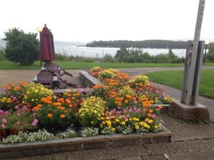
 We found the Charlottetown pleasant, with a lot of older buildings and parks. One thing we liked were the sponsored street corner gardens. Various organizations can adopt street corners where they design and maintain a small garden. A lot of these were very lovely and most downtown intersections have one on each of the possible corners. This really beautifies the downtown.
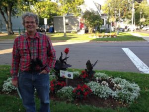
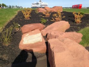 Charlottetown has a touristy harbor. I took this photo to show how red the sandstone is. The white patch is actually a natural greenish rock that occurs when the iron oxidizes in a different form.
 She told us she can make up a sweater in under 2 hours, and offered to make one up for Chuck if he did not like the colors already available.
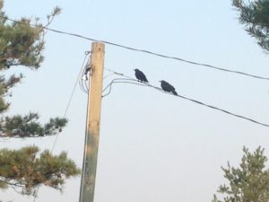 We meandered around town looking for some of the recommended dinner spots. It seemed to us that most of the recommendations had to do with the price of oysters, a delicacy we do not enjoy. Lobster is also popular, but not on our top-choice list. We ended up at a place with street seating right beside the sweater shop. As we sat down, a huge flock of crows appeared overhead — and crows kept coming for about 10 minutes. We already knew that PEI has a lot of crows, but this seemed very extraordinary – even for someone living in State College, where the university fires air guns to keep the flocks out of the main part of campus.
 The next day we took the kayaks down to Rustico Bay. The shores of the bay are a foot or two deep with Irish moss, a type of seaweed (which looks like hay when dry, and is rather fleshy in the water). Irish moss is harvested for carrageen, a food thickener. Those are my feet ankle deep in dry Irish moss.
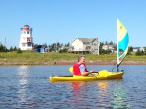
 We took a long paddle along the far shore of the bay, and then crossed over to a spit of land that is part of the Prince Edward Island National Park. We had thought we could pull up on shore and cross the dunes to the Atlantic side. However, although it was fun walking through the springy dry Irish moss, once off the beach the dune vegetation was too thick to make progress. As well, although this put us on the same shore as the campground, the shoreline is very crenellated on that side, making it an even longer paddle back.
 In the end, we went back the way we came and were satisfied with a very nice long paddle and a good view of the mussel farms.
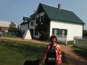 On Wednesday we went to Cavendish to see “Green Gables” which is also a National Park. (All National Parks in Canada are free this year to celebrate the 150th anniversary of Canada’s Confederation.) Love of “Anne of Green Gables” is a major reason why people visit PEI, and we met people from across the US and Canada as well as Britain and Japan.
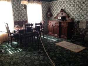 We started off a bit skeptical about Green Gables because, after all, “Anne of Green Gables” is a work of fiction. However, the author, L. M. Montgomery wrote in her diary that Green Gables was modeled after her Aunt and Uncle McNeil’s farm in Cavendish, and that all the places in the book are around the farm. The home and barn are the McNeil buildings, with the furnishings replaced by period pieces in keeping with Montgomery’s description in the book. It was a pleasant hike through “Lovers’ Lane” and the “Haunted Woods” and we enjoyed seeing the house and barn.
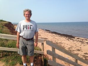
 Following the very strong hints of the woman in the Tourist Information Office, we went into N. Rustico for lunch. We ate at a beachside restaurant, and then walked up the point to the town boardwalk, which was very scenic. We finished off the day by a trip to the local bakery, where we picked up a couple of meat pies, recommended by the same source. (We ended up eating these delicious meat pockets a couple of days later in the RV.)
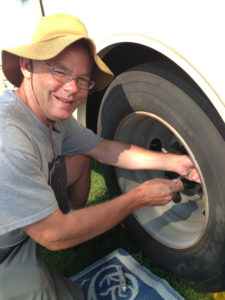 The next day, we spent some time on practical issues around the RV. The first thing was to install our tire pressure monitors on our 6 RV and 4 car tires. Chuck purchased these even before we left, but has been nervous about installng them, in case the installation led to leaks. However, his sister Karen had already successfully installed hers with no problems. After 2 flats on the car, both of which fortunately occurred when we were driving the car, and his parents’ problems getting their RV flat fixed,
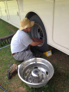 Chuck decided it was time to bite the bullet. The pressure monitors screw into the tire valve and communicate pressure and temperature wirelessly to a monitor. We had a slight leak after installation on one tire, but this was easily fixed by tightening the cap.
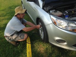
 For some years, Elisabeth’s friend Brianna has been cutting Chuck’s hair. He bought a set of clippers so that she could achieve a more professional look, and brought these along so that I could cut his hair en route. Chuck knows the risks. I have given 2 previous haircuts. My college friend came out looking as if I had put a bowl an top of his head.
 Elisabeth ended up with bangs that were about 1/4 inch long, and vowed never to let me near her again with scissors. However, with the clippers, it is really quite easy to do a short hair cut, and I think it came out OK. Here are the before and after pictures.
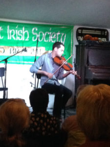
 Undaunted, we headed to the Irish Benevolent Society in Charlotte-town, where we were able to get a seat. The organizers had
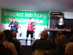 “new” musicians – a group of very young women who played fiddle and keyboards and also did Irish dancing, a young man who played bagpipes, and a young fiddler. All were very good. We had an opportunity to speak with other audience members and the musicians during the lunch break (around 9 p.m.).
 The trip from Ellsworth to Fredericton is very pretty, through wooded countryside. It cannot be denied that winter is coming, as the trees are beginning to turn red. We also had some interesting cloud effects. We kept expecting to see a face in the hole in the clouds in the photo below!
 Signs on the road kept exhorting us to watch out for moose. There is no question that an encounter with a moose would leave both us and the moose the worse for wear, as a male can weigh up to 1500 lb, and even the smaller female can weigh up to 1000 lb. Still, we were disappointed not to see any, despite a lot of promising swampy countryside.
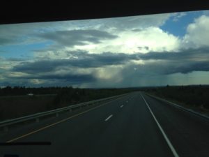 Neither the scenery nor the cloudy sky nor the moose warning signs changed much after we crossed the Canadian border. We now know that Canadian customs does not care about importing food, and care only minimally about alcohol. (You are allowed the equivalent of 2 bottles of wine per person, and that is more than we usually have on hand.) So, so far our crossings have been uneventful.
 As usual, we pulled into the campground in the late afternoon. Hartt Island is a “resort” near Fredericton with a heated pool with water slide and minigolf. The camping area is basically a parking lot, but here is the view from our site. The water is the St. John River, and the scenery was breath-taking in every direction.
 The path next to the water is a biking and hiking trail that is part of the Trans-Canada Trail – 24,000 km of connected trail (mostly RailTrail) stretching from the Alaska border to Vancouver Island to Prince Edward Island and Labrador. It also has lots of side trails, and links up with the Appalachian Trail (although it is much tamer).
 Rumple has been waking me up at about the same time each morning, and our first morning in Fredericton was much the same. However, when we crossed the border, we also changed time zones. So, now it is an hour later, for me at least, which is easier to handle, even if I am still catching a glimpse of sunrise.
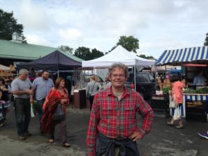
 Saturday is the Farmers’ Market in Fredericton, and the bicycle trail goes directly from the campground into town. (10 km). Once we got to town, it was a bit harder to find the market than we expected, but Google maps did get us there.
 We filled my bicycle basket with veggies and a bottle of blueberry wine, and then headed off to see downtown Fredericton. As is our habit, we read all the historical signs we could find, and meandered around the main street. Note the crosswalk. Although fall is in the air, the gardens were still in good shape.
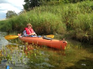 We decided to stay another day to kayak in the St. John River. It turns out that this placid looking river, has a very strong current. It was like paddling in an infinity swimming pool – I paddled as hard as I could just to stay in one place. We did manage to get upstream just enough to be able to cross the river and explore a bit around the islands, although it was a struggle to get back to our original launch site. The photo was taken in a rare spot where a back eddy kept me from being swept away.
 The next day was rainy and windy. Neither of us felt energetic, so we stayed around the campsite until Jake and Rebecca got back from work. Then they came over and we had dinner in our RV.
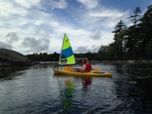 Fortunately, Thursday was a much nicer day. While Jake and Rebecca worked, we kayaked on the lake. (Since Chuck always uses the sail, I will no longer note that he was sailing.)
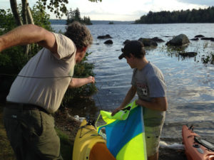
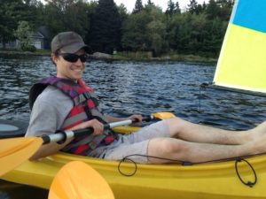 Jake got home in time to try the kayak sail as well. He seemed to enjoy it and is now talking about making his own kayak sail – although it is not clear where he will sail in Arizona!
 We planned to stay near Durham, NH just outside of Portsmouth, where our niece Jill (Karen’s daughter) is studying engineering. However, we ended up staying a bit farther out, a 3 Ponds Campground – named after the 3 spring-fed ponds on the property.
 It is a pretty spot, with both forested and open sites. The largest pond is big enough for a bit of sailing and has a small beach. There is a short dog walk through the woods.
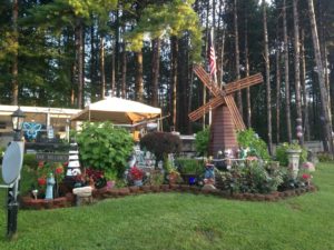
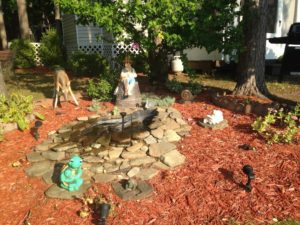 Many of the seasonals have put in quite elaborate gardens and other additions, and undoubtedly will be very sad to need to relocate. (However, we agree that someone who is 88 deserves the chance to retire.)
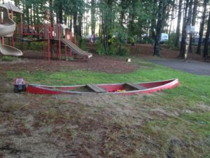
 We had dinner at Libby’s in downtown Durham. They have great nachos, and are now tied with the place at Tybee Island for 2nd place in my nacho taste-off. I will need to visit both places closer in time to make a decision to break the tie. (Sorry to the Pearl – you are now at best in 4th place.) No revisiting until I lose about 20 pounds, though.
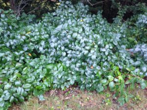 A hazard of our dog walks, and indeed of every activity in New England, is the prevalence of poison ivy, which lines the walkways and climbs the trees and bushes. An oil that is in every part of the plant produces a very itchy rash in most people. And the oil is persistent – it is in dead plants, it is in the smoke if you try to burn the plants,
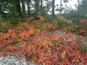 and if your clothing or shoes get any of the oil on them, and then someone touches those clothes, the oil will transfer. I am not sure if dogs get the rash, but if a dog gets the oil on his fur, anyone touching him could get the rash. I am hypervigilant about this and we have not had any problems so far. On the flip side – poison ivy is the harbinger of fall, and often turns beautiful red and gold that is rivaled only by the maple trees.
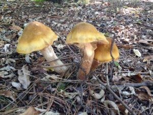 It is mushroom season in Cape Cod and the campground is sprouting a lot of different types of very large mushrooms. Without a mushroom guide, I would not touch them, but it is fun to see how quickly they spring up.
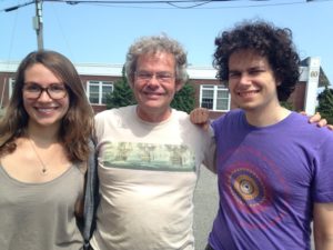
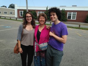 On Saturday morning our new site was vacated early by the previous occupants and we quickly changed campsites. We then headed to Hyannis to pick up Elisabeth from the bus and Jonathan from the airport. Both came in on time. We had a quick lunch and then did some grocery shopping before heading back to the campground to meet up with Chuck’s sister Karen and her significant other, Ed. We have found it expedient to do our grocery shopping after our adult kids arrive, so we don’t stock up on things that they no longer eat.
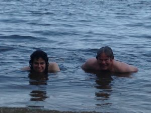 Elisabeth took a lounge chair out on their extensive dock, Jonathan went in for a swim, Chuck had a quick dip and then read. I found it a bit chilly, so I just sat in the shade and blogged.
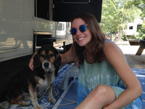 Elisabeth wanted a picture with Rumple after breakfast. Now-a-days he likes to rest under the RV, but she was able to coax him out to pose with her.
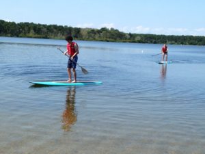
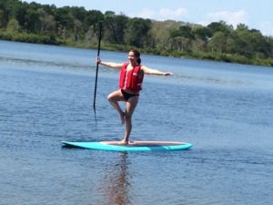
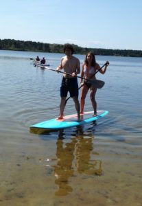
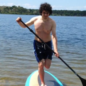
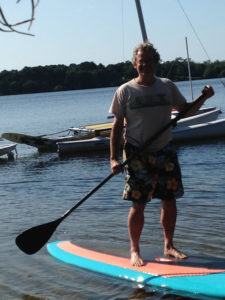
 Once Chuck got back from the bus station, the day really began. A bicycle trip to Chatham was planned. This started, not from the campground, but from a parking lot a few miles down the road. The number of bicycles now matched the number of campers, so we were all able to go. Despite having a number of artificial joints between them, Chuck’s parents are still amazing long-distance bikers. Jonathan has started biking to work in NYC so he is in pretty good shape, too. And of course, Chuck and I have been doing a lot of biking. So the 10 miles into Chatham, on the paved trail, was not too bad. (Again, just because we are not in the picture does not mean that Kathy and I were not on the trip!)
 Unfortunately, when walking around Chatham, Kathy tripped and scraped her knee. While she recovered well (and was fine the next day) she decided it would be expedient to have someone pick her up by car after lunch. We had a nice lunch and wandered around the shops a bit. Then the 6 of us biked the 10 miles back to the cars.
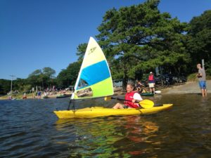 In the late afternoon we headed back to the pond to try out Chuck’s kayak sail. The whole family came for the show, and after Chuck’s maiden voyage, Don and I both tried it out. It is quite fun and easy to sail. Any misjudgment about filling the sail or steering can readily be correct with the paddle. This one is a winner.
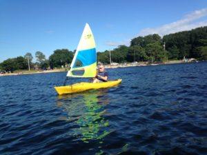
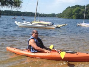
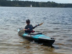
 This did not appeal to the rest of the family, so we headed out on our own by bicycle to the National Seashore. To get there, we got off the CCRT and on regular streets for a few blocks before meeting up with the Seashore Bicycle Trail. This took us through lightly forested dunes before coming to a large salt marsh and then the beach.
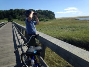 The salt marsh was full of birds, including lots of types of sea gulls. However, we did not linger. We continued on to the beautiful sand beach. With a stiff wind, there was plenty of surf. The lifeguard was enforcing a “no swimming” rule, due to the wave action and currents, although apparently surfing was allowed, as a few hardy souls were trying to ride the waves.
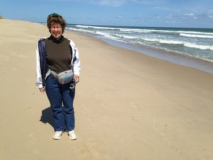
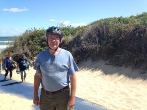
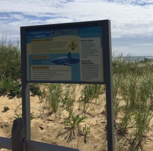
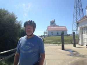 The eastern beach is constantly being eroded and redeposited at the northern and southern tips of the island. The original beach parking lot was swept away in a storm. The new lot is by an old lighthouse. The bike trail takes you to the bicycle parking lot at the same location.
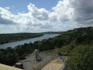 Over 3000 shipwrecks litter the surrounding waters, but shipping became much safer once the Cape Cod Canal (as seen from the bridge) provided access to the inner waters.
 Provincetown is at the northern tip of Cape Cod, amidst sand dunes (undoubtedly brought from the eastern beaches) sculpted by the wind. The residential part of the town looks like an old fishing port with small shingled houses. However, downtown is a classic artsy tourist town.
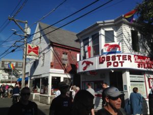 Downtown is right on the coast and centers on the dock for the passenger ferry from Boston. When we were there, the downtown was decorated with the rainbow flags of LGBTQ support.
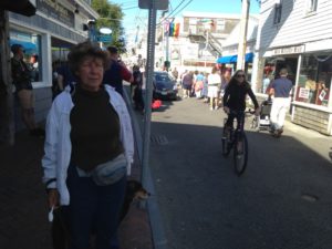 There were hundreds of people on the street, along with bicycles and cars. Although the main street functions as a pedestrian mall, it is open to cars, which move along more slowly than the families with baby strollers. It was very difficult to walk with Rumple, due to the number of dogs. Just off the main street is a dog-friendly beach.
 We started our last day on the Cape with breakfast in Orleans. Since the restaurant was on the CCRT, Chuck and I decided to bike there, while the rest of the family came by car.
 After far too many breakfast calories, we went back to the campsite to collect kayaks, bikes, Chuck’s drone, and Rumple. We took all this to Nickerson State Park, where we set up at Cliff Pond. While Ed and Karen kayaked, and Chuck kayak-sailed, Rumple and I walked around the pond –
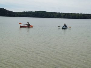

 When everyone reassembled, Chuck wanted to photograph someone sailing the kayak using his drone to get some good photos and videos. Here he is using the storage compartment of the kayak as the take-off pad.
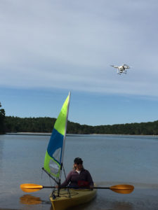 The drone is a bit noisy for a quiet day at the beach, but Chuck did a good job of following Karen in the kayak and keeping the drone away from everyone else. Kathy got this shot of Karen and the drone. A sample of the video will be posted once Chuck edits it.
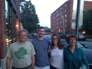 Monday was also the first of Elisabeth’s 2 Ph.D. qualifying exams. After the eclipse, we packed some things we were bringing her into the car and headed into Boston to take her and boyfriend Joey out to dinner.
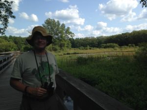 On Thursday we decided to go for a short hike around a cranberry bog. This turned out to be behind the shopping plaza. The hike itself was pleasant, but … short. There were a lot of turtles and small fish in the wild part of the bog, and some interpretive signs about how cranberries are grown. This is probably the best time of year to visit the bog,
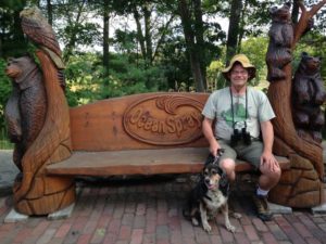 as the berries are almost ripe and can be seen on the bushes. Interesting fact: this particular bog had been a catfish farm before being converted to cranberry cultivation. The nature area and signage were co-sponsored by the shopping center, Bass (a big fishing gear store) and OceanSpray (the big cranberry juice company).
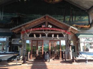 Chuck has started on a quest for a new kayak, and wanted to visit the Bass Pro store after the walk. This is a huge outdoor goods store – with some focus on fishing gear. This store is so elaborate, I was sure it must be the flagship of the chain, but according to the internet, it is not.
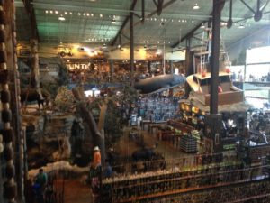 I thought we were going to have to take turns going in, as it was too hot to leave Rumple in the car. However, they welcome dogs in the store and handed me a dog biscuit and a poop bag as I entered. (Thank goodness I did not need the latter.) Inside, they have a mock-ups of hunting lodges, dioramas with real stuffed animals, and even a mock-up of a whale, hanging from the ceiling. It is very over-the-top. What they did not have was a good selection of kayaks.
 Back at Normandy Farms, although our feeders were ignored by most of the local birds, we did manage to attract a hummingbird. (No idea who the passerby is – but this is the best photo I have of the bird.